

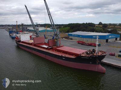
GANNET S
Bulk Carrier

Current Trip
| Time Travelled | 23 h, 57 mins |
|---|---|
| Remaining Time | --- |
| Distance Travelled | 319.70 nm |
| Remaining Distance | --- |
| AVG Speed | 13.2 Knop |
| MAX Speed | 14.3 Knop |
| AVG Wind | 11.4 knots |
| MAX Wind | 18 knots |
| MIN Temp | 17.5°C / 63.5°F |
| MAX Temp | 19.9°C / 67.82°F |
| Djupgående | 5.2 m |
| Position mottagen | Nu |
Current Position
| Longitud | --- |
|---|---|
| Latitude | --- |
| Status | Under way using engine |
| Fart | 13.5 Knop |
| Kurs | 296.8° |
| Område | Mediterranean Sea - Eastern Basin |
| Station | T-AIS |
| Position mottagen | Nu |
Information
The current position of GANNET S is in Mediterranean Sea - Eastern Basin with coordinates 35.18619° / 29.32228° as reported on 2025-03-27 21:16 by AIS to our vessel tracker app. The vessel's current speed is 13.5 Knop and is heading at the port of VARNA. The estimated time of arrival as calculated by MyShipTracking vessel tracking app is 2025-04-01 13:00 LT
The vessel GANNET S (IMO: 9316995, MMSI: 636018923) is a Bulk Carrier that was built in 2007 ( 18 År gammal ). It's sailing under the flag of [LR] Liberia.
In this page you can find informations about the vessels current position, last detected port calls, and current voyage information. If the vessels is not in coverage by AIS you will find the latest position.
The current position of GANNET S is detected by our AIS receivers and we are not responsible for the reliability of the data. The last position was recorded while the vessel was in Coverage by the Ais receivers of our vessel tracking app.
The current draught of GANNET S as reported by AIS is 5.2 meters
Weather
| Temperature | 17.5°C / 63.5°F |
|---|---|
| Wind Speed | 18 knots |
| Direction | 102° ESE |
| Pressure | 1007.1 hPa |
| Humidity | 84.1 % |
| Cloud Coverage | 100 % |


Featured Company
Last Port Calls
| Port | Arrival | Departure | Time In Port |
|---|---|---|---|
| 2025-03-23 22:39 | 2025-03-26 23:19 | 3 d | |
| 2025-02-28 14:53 | 2025-03-03 20:50 | 3 d | |
| 2025-02-18 23:21 | 2025-02-23 12:34 | 4 d | |
| 2025-02-01 10:49 | 2025-02-03 15:59 | 2 d | |
| 2025-01-20 20:14 | 2025-01-24 11:35 | 3 d | |
| 2025-01-14 21:59 | 2025-01-16 22:30 | 2 d | |
| 2025-01-07 00:06 | 2025-01-10 02:30 | 3 d |
Last Trips
| Origin | Departure | Destination | Arrival | Distance | |
|---|---|---|---|---|---|
| 2025-03-03 20:50 | 2025-03-23 22:39 | 4606.11 nm | |||
| 2025-02-23 12:34 | 2025-02-28 14:53 | 1048.15 nm | |||
| 2025-02-03 15:59 | 2025-02-18 23:21 | 3759.51 nm | |||
| 2025-01-24 11:35 | 2025-02-01 10:49 | 950.90 nm | |||
| 2025-01-16 22:30 | 2025-01-20 20:14 | 749.36 nm | |||
| 2025-01-10 02:30 | 2025-01-14 21:59 | 205.41 nm | |||
| 2024-12-27 19:32 | 2025-01-07 00:06 | 2037.10 nm |
Events
| Tid | Event | Detaljer | Position / Dest | Information |
|---|---|---|---|---|
| 2025-03-27 17:49 | Byter havsområde | Greek part of the Mediterranean Sea - Eastern Basin Turkish part of the Mediterranean Sea - Eastern Basin |
34.81960 / 30.16313
Mediterranean Sea - Eastern Basin
BGVAR
|
Fart: 13.2 kn Kurs: 298° |
| 2025-03-27 16:28 | Byter havsområde | Turkish part of the Mediterranean Sea - Eastern Basin Cypriote part of the Mediterranean Sea - Eastern Basin |
34.68317 / 30.47366
Mediterranean Sea - Eastern Basin
BGVAR
|
Fart: 12.7 kn Kurs: 298.8° |
| 2025-03-27 03:58 | Byter havsområde | Cypriote part of the Mediterranean Sea - Eastern Basin Israeli part of the Mediterranean Sea - Eastern Basin |
33.30495 / 33.46775
Mediterranean Sea - Eastern Basin
BGVAR
|
Fart: 13.3 kn Kurs: 299.9° |
| 2025-03-27 02:31 | Status ändrad | Under way using engine Default |
33.14556 / 33.80111
BGVAR
|
Fart: 13.1 kn Kurs: 302° |
| 2025-03-27 02:30 | Status ändrad | Default Under way using engine |
33.14361 / 33.80481
BGVAR
|
Fart: 13.1 kn Kurs: 302.2° |
| 2025-03-27 01:37 | Status ändrad | Under way using engine Default |
33.04584 / 34.00831
BGVAR
|
Fart: 13.6 kn Kurs: 280° |
| 2025-03-27 01:30 | Status ändrad | Default Under way using engine |
33.04141 / 34.03809
BGVAR
|
Fart: 13.6 kn Kurs: 280.4° |
| 2025-03-26 21:34 | Status ändrad | Under way using engine Moored |
32.85846 / 35.00776
BGVAR
|
Fart: 9.2 kn Kurs: 309.2° |
| 2025-03-26 21:19 | AVGÅTT HAMN |
|
32.83253 / 35.02178
BGVAR
|
Fart: 7 kn Kurs: 17° |
| 2025-03-26 21:05 | STARTAR förflyttning |
32.81265 / 35.02900
[IL] HAIFA
|
Fart: 3.2 kn Kurs: 310° |