
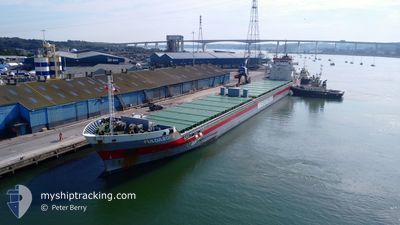
FULDABORG
General Cargo
Current Trip
| Time Travelled | 16 days |
|---|---|
| Remaining Time | --- |
| Distance Travelled | 3339.59 nm |
| Remaining Distance | --- |
| AVG Speed | 8.2 Knop |
| MAX Speed | 12.5 Knop |
| AVG Wind | 23.2 knots |
| MAX Wind | 40 knots |
| MIN Temp | 0.7°C / 33.26°F |
| MAX Temp | 16.4°C / 61.52°F |
| Djupgående | 7.9 m |
| Position mottagen | 2 m sen |
Current Position
| Longitud | --- |
|---|---|
| Latitude | --- |
| Status | At anchor |
| Fart | 0.1 Knop |
| Kurs | 129° |
| Område | Balearic Sea |
| Station | T-AIS |
| Position mottagen | 2 m sen |
Info
Information
The current position of FULDABORG is in Balearic Sea with coordinates 41.09153° / 1.29330° as reported on 2024-12-15 10:55 by AIS to our vessel tracker app. The vessel's current speed is 0.1 Knop
The vessel FULDABORG (IMO: 9559092, MMSI: 245806000) is a General Cargo that was built in 2012 ( 12 År gammal ). It's sailing under the flag of [NL] Netherlands.
In this page you can find informations about the vessels current position, last detected port calls, and current voyage information. If the vessels is not in coverage by AIS you will find the latest position.
The current position of FULDABORG is detected by our AIS receivers and we are not responsible for the reliability of the data. The last position was recorded while the vessel was in Coverage by the Ais receivers of our vessel tracking app.
The current draught of FULDABORG as reported by AIS is 7.9 meters
Weather
| Temperature | 10.8°C / 51.44°F |
|---|---|
| Wind Speed | 6 knots |
| Direction | 312° NW |
| Pressure | 1032.6 hPa |
| Humidity | 65.8 % |
| Cloud Coverage | --- |
Featured Company
Last Port Calls
Most Visited Ports (Last year)
| Port | Arrivals | |
|---|---|---|
| 6 | ||
| 5 | ||
| 5 | ||
| 2 | ||
| 2 | ||
| 2 |
Last Trips
| Origin | Departure | Destination | Arrival | Distance | |
|---|---|---|---|---|---|
| 2024-11-19 23:40 | 2024-11-23 15:56 | 90.16 nm | |||
| 2024-10-31 08:44 | 2024-11-16 16:12 | 3902.53 nm | |||
| 2024-10-27 07:35 | 2024-10-29 10:26 | 351.18 nm | |||
| 2024-10-12 07:53 | 2024-10-25 19:20 | 3061.92 nm | |||
| 2024-10-05 11:33 | 2024-10-06 05:47 | 134.80 nm |
Events
| Tid | Event | Detaljer | Position / Dest | Information |
|---|---|---|---|---|
| 2024-12-15 09:46 | Status ändrad | At anchor Default |
41.09194 / 1.29400
ESTAR
|
Fart: Kurs: 160° |
| 2024-12-15 09:43 | Status ändrad | Default At anchor |
41.09197 / 1.29400
ESTAR
|
Fart: 0.1 kn Kurs: 157° |
| 2024-12-15 08:58 | Status ändrad | At anchor Default |
41.09110 / 1.29314
ESTAR
|
Fart: 0.1 kn Kurs: 106° |
| 2024-12-15 08:55 | Status ändrad | Default At anchor |
41.09103 / 1.29325
ESTAR
|
Fart: 0.2 kn Kurs: 106° |
| 2024-12-15 08:46 | Status ändrad | At anchor Default |
41.09094 / 1.29366
ESTAR
|
Fart: 0.1 kn Kurs: 105° |
| 2024-12-15 08:43 | Status ändrad | Default At anchor |
41.09095 / 1.29364
ESTAR
|
Fart: 0.4 kn Kurs: 114° |
| 2024-12-15 08:22 | Status ändrad | At anchor Under way using engine |
41.09129 / 1.29283
ESTAR
|
Fart: 0.4 kn Kurs: 120° |
| 2024-12-15 08:16 | STOPPAR förflyttning | 3.68 nm, East of TARRAGONA |
41.09060 / 1.29347
ESTAR
|
Fart: 0.3 kn Kurs: 96° |
| 2024-12-15 05:52 | Status ändrad | Under way using engine Default |
40.77466 / 1.16710
ESTAR
|
Fart: 8.1 kn Kurs: 14° |
| 2024-12-15 05:25 | Status ändrad | Default Under way using engine |
40.71162 / 1.14629
ESTAR
|
Fart: 8.1 kn Kurs: 14.8° |