

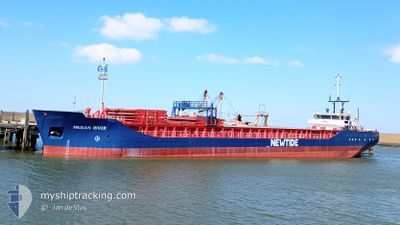
FRISIAN RIVER
General Cargo

Current Trip
| Time Travelled | 23 h, 55 mins |
|---|---|
| Remaining Time | 12 h, 14 mins |
| Distance Travelled | 201.23 nm |
| Remaining Distance | 90.59 nm |
| AVG Speed | 8.6 Knop |
| MAX Speed | 10.3 Knop |
| AVG Wind | 9.8 knots |
| MAX Wind | 17.8 knots |
| MIN Temp | 7.2°C / 44.96°F |
| MAX Temp | 11.3°C / 52.34°F |
| Djupgående | 2.8 m |
| Position mottagen | 1 m sen |
Current Position
| Longitud | --- |
|---|---|
| Latitude | --- |
| Status | Under way using engine |
| Fart | 6.3 Knop |
| Kurs | 185.4° |
| Område | North Sea |
| Station | T-AIS |
| Position mottagen | 1 m sen |
Information
The current position of FRISIAN RIVER is in North Sea with coordinates 52.22156° / 1.80131° as reported on 2025-02-22 19:42 by AIS to our vessel tracker app. The vessel's current speed is 6.3 Knop and is heading at the port of DUNKERQUE. The estimated time of arrival as calculated by MyShipTracking vessel tracking app is 2025-02-23 07:57 LT
The vessel FRISIAN RIVER (IMO: 9421623, MMSI: 245215000) is a General Cargo that was built in 2007 ( 18 År gammal ). It's sailing under the flag of [NL] Netherlands.
In this page you can find informations about the vessels current position, last detected port calls, and current voyage information. If the vessels is not in coverage by AIS you will find the latest position.
The current position of FRISIAN RIVER is detected by our AIS receivers and we are not responsible for the reliability of the data. The last position was recorded while the vessel was in Coverage by the Ais receivers of our vessel tracking app.
The current draught of FRISIAN RIVER as reported by AIS is 2.8 meters
Weather
| Temperature | 8.2°C / 46.76°F |
|---|---|
| Wind Speed | 9 knots |
| Direction | 236° SW |
| Pressure | 1017.8 hPa |
| Humidity | 89.4 % |
| Cloud Coverage | 100 % |


Featured Company
Last Port Calls
| Port | Arrival | Departure | Time In Port |
|---|---|---|---|
| 2025-02-19 17:41 | 2025-02-21 19:48 | 2 d | |
| 2025-02-15 11:33 | 2025-02-18 00:01 | 2 d | |
| 2025-02-09 12:23 | 2025-02-13 15:45 | 4 d | |
| 2025-02-06 03:25 | 2025-02-07 03:42 | 1 d | |
| 2025-02-02 17:31 | 2025-02-04 09:27 | 1 d | |
| 2025-01-29 09:55 | 2025-01-31 22:47 | 2 d | |
| 2025-01-19 11:28 | 2025-01-20 14:55 | 1 d | |
| 2025-01-17 08:49 | 2025-01-17 09:16 | 26 m | |
| 2025-01-09 05:16 | 2025-01-13 15:16 | 4 d | |
| 2025-01-03 05:29 | 2025-01-07 20:33 | 4 d |
Last Trips
| Origin | Departure | Destination | Arrival | Distance | |
|---|---|---|---|---|---|
| 2025-02-18 01:01 | 2025-02-19 17:41 | 374.39 nm | |||
| 2025-02-13 15:45 | 2025-02-15 12:33 | 375.21 nm | |||
| 2025-02-07 04:42 | 2025-02-09 12:23 | 374.24 nm | |||
| 2025-02-04 09:27 | 2025-02-06 04:25 | 373.04 nm | |||
| 2025-01-31 23:47 | 2025-02-02 17:31 | 374.19 nm | |||
| 2025-01-20 15:55 | 2025-01-29 10:55 | 821.03 nm | |||
| 2025-01-17 10:16 | 2025-01-19 12:28 | 67.28 nm | |||
| 2025-01-13 16:16 | 2025-01-17 09:49 | 97.98 nm | |||
| 2025-01-07 20:33 | 2025-01-09 06:16 | 288.40 nm | |||
| 2024-12-31 22:53 | 2025-01-03 05:29 | 375.88 nm |
Events
| Tid | Event | Detaljer | Position / Dest | Information |
|---|---|---|---|---|
| 2025-02-22 12:24 | Status ändrad | Under way using engine Default |
53.08693 / .99711
FRDKK
|
Fart: 9.5 kn Kurs: 132° |
| 2025-02-22 12:21 | I täckningsområde |
53.08693 / .99711
North Sea
FRDKK
|
Fart: 9.6 kn Kurs: 131.5° |
|
| 2025-02-22 11:36 | Status ändrad | Default Under way using engine |
53.17245 / .84311
FRDKK
|
Fart: 9.1 kn Kurs: 131.1° |
| 2025-02-22 11:19 | UTANFÖR täckningsområde |
53.20067 / .78891
North Sea
FRDKK
|
Fart: 9.1 kn Kurs: 131.1° |
|
| 2025-02-22 10:09 | Status ändrad | Under way using engine Default |
53.34805 / .64387
FRDKK
|
Fart: 9.1 kn Kurs: 163° |
| 2025-02-22 10:04 | Status ändrad | Default Under way using engine |
53.35924 / .63800
FRDKK
|
Fart: 8.9 kn Kurs: 162° |
| 2025-02-22 08:57 | Status ändrad | Under way using engine Default |
53.53264 / .55714
FRDKK
|
Fart: 9.4 kn Kurs: 165° |
| 2025-02-22 08:57 | I täckningsområde |
53.53082 / .55798
North Sea
FRDKK
|
Fart: 10.1 kn Kurs: 163.8° |
|
| 2025-02-22 07:17 | Status ändrad | Default Under way using engine |
53.74268 / .37597
FRDKK
|
Fart: 8.1 kn Kurs: 148.7° |
| 2025-02-22 07:09 | UTANFÖR täckningsområde |
53.75857 / .35952
North Sea
FRDKK
|
Fart: 8.1 kn Kurs: 148.7° |