
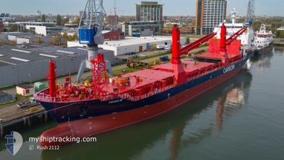
FRIGG W
Cargo
Current Trip
| Time Travelled | 9 days |
|---|---|
| Remaining Time | --- |
| Distance Travelled | 1787.50 nm |
| Remaining Distance | --- |
| AVG Speed | 9.9 Knop |
| MAX Speed | 14.4 Knop |
| AVG Wind | 16.2 knots |
| MAX Wind | 30.8 knots |
| MIN Temp | 1.7°C / 35.06°F |
| MAX Temp | 9.1°C / 48.38°F |
| Djupgående | 7.7 m |
| Position mottagen | 7 d sen |
Current Position
| Longitud | -4.15886° |
|---|---|
| Latitude | 59.19925° |
| Status | Under way using engine |
| Fart | 11.4 Knop |
| Kurs | 320.5° |
| Område | North Atlantic Ocean |
| Station | T-AIS |
| Position mottagen | 7 d sen |
Info
Information
The current position of FRIGG W is in North Atlantic Ocean with coordinates 59.19925° / -4.15886° as reported on 2024-04-19 23:23 by AIS to our vessel tracker app. The vessel's current speed is 11.4 Knop and is heading at the port of REYDARFJORDUR. The estimated time of arrival as calculated by MyShipTracking vessel tracking app is 2024-04-21 15:00 LT
The vessel FRIGG W (IMO: 9754410, MMSI: 209078000) is a Cargo It's sailing under the flag of [CY] Cyprus.
In this page you can find informations about the vessels current position, last detected port calls, and current voyage information. If the vessels is not in coverage by AIS you will find the latest position.
The current position of FRIGG W is detected by our AIS receivers and we are not responsible for the reliability of the data. The last position was recorded while the vessel was in Coverage by the Ais receivers of our vessel tracking app.
The current draught of FRIGG W as reported by AIS is 7.7 meters
Weather
| Temperature | 7.6°C / 45.68°F |
|---|---|
| Wind Speed | 12 knots |
| Direction | 66° ENE |
| Pressure | 1007.4 hPa |
| Humidity | 73.6 % |
| Cloud Coverage | 98 % |
Featured Company
Last Port Calls
| Port | Arrival | Departure | Time In Port |
|---|---|---|---|
| 2024-04-15 18:12 | 2024-04-17 20:04 | 2 d | |
| 2024-04-12 14:40 | 2024-04-12 18:02 | 3 h | |
| 2024-04-07 08:09 | 2024-04-11 16:55 | 4 d | |
| 2024-04-06 07:17 | 2024-04-06 10:30 | 3 h | |
| 2024-04-01 09:10 | 2024-04-03 06:26 | 1 d | |
| 2024-03-21 11:22 | 2024-03-21 18:27 | 7 h | |
| 2024-03-18 18:58 | 2024-03-20 09:42 | 1 d | |
| 2024-03-15 23:48 | 2024-03-16 02:27 | 2 h | |
| 2024-03-10 17:11 | 2024-03-14 19:22 | 4 d | |
| 2024-03-09 16:56 | 2024-03-09 18:14 | 1 h |
Most Visited Ports (Last year)
| Port | Arrivals | |
|---|---|---|
| 31 | ||
| 22 | ||
| 13 | ||
| 8 | ||
| 5 | ||
| 1 |
Last Trips
| Origin | Departure | Destination | Arrival | Distance | |
|---|---|---|---|---|---|
| 2024-04-12 20:02 | 2024-04-15 20:12 | 785.21 nm | |||
| 2024-04-11 18:55 | 2024-04-12 16:40 | 250.78 nm | |||
| 2024-04-06 12:30 | 2024-04-07 10:09 | 253.99 nm | |||
| 2024-04-03 08:26 | 2024-04-06 09:17 | 791.34 nm | |||
| 2024-03-21 18:27 | 2024-04-01 11:10 | 1804.39 nm | |||
| 2024-03-20 10:42 | 2024-03-21 11:22 | 270.19 nm | |||
| 2024-03-16 03:27 | 2024-03-18 19:58 | 794.21 nm | |||
| 2024-03-14 20:22 | 2024-03-16 00:48 | 256.37 nm | |||
| 2024-03-09 19:14 | 2024-03-10 18:11 | 264.20 nm | |||
| 2024-03-09 00:44 | 2024-03-09 17:56 | 221.50 nm |
Events
| Tid | Event | Detaljer | Position / Dest | Information |
|---|---|---|---|---|
| 2024-04-24 20:18 | STARTAR förflyttning | 3.13 nm, South West of ESKIFJORDUR |
65.02500 / -14.07833
ISRFJ
|
Fart: 10 kn Kurs: 93° |
| 2024-04-21 15:09 | STOPPAR förflyttning | 2.77 nm, East of REYDARFJORDUR |
65.02666 / -14.11333
ISRFJ
|
Fart: Kurs: -1° |
| 2024-04-19 23:30 | Status ändrad | Default Under way using engine |
59.21586 / -4.18392
ISRFJ
|
Fart: 11.4 kn Kurs: 320.5° |
| 2024-04-19 23:23 | UTANFÖR täckningsområde |
59.19925 / -4.15886
North Atlantic Ocean
ISRFJ
|
Fart: 11.4 kn Kurs: 320.5° |
|
| 2024-04-19 20:04 | Byter havsområde | United Kingdom part of the North Atlantic Ocean United Kingdom part of the North Sea |
58.76025 / -3.42429
North Atlantic Ocean
ISRFJ
|
Fart: 9.9 kn Kurs: 295.2° |
| 2024-04-19 17:47 | Djupgående ändrat | 7.7 7.8 |
58.57865 / -2.84795
ISRFJ
|
Fart: 9 kn Kurs: 321° |
| 2024-04-19 17:23 | Status ändrad | Under way using engine Default |
58.52950 / -2.76970
ISRFJ
|
Fart: 9.5 kn Kurs: 315° |
| 2024-04-19 17:06 | I täckningsområde |
58.52950 / -2.76970
North Sea
ISRFJ
|
Fart: 9.3 kn Kurs: 319.2° |
|
| 2024-04-19 13:56 | Status ändrad | Default Under way using engine |
58.12614 / -2.12669
ISRFJ
|
Fart: 8.1 kn Kurs: 323.2° |
| 2024-04-19 13:13 | UTANFÖR täckningsområde |
58.04990 / -2.00482
North Sea
ISRFJ
|
Fart: 8.1 kn Kurs: 323.2° |