
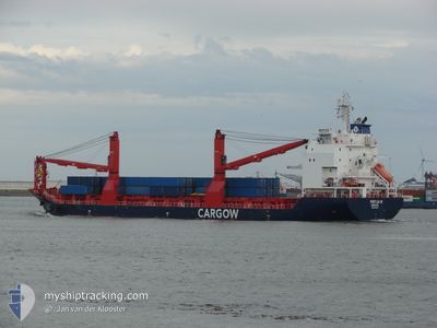
FREYJA W
Cargo
Current Trip
| Time Travelled | 2 days |
|---|---|
| Remaining Time | --- |
| Distance Travelled | 595.94 nm |
| Remaining Distance | --- |
| AVG Speed | 11.9 Knop |
| MAX Speed | 16.3 Knop |
| AVG Wind | 9.6 knots |
| MAX Wind | 16 knots |
| MIN Temp | 12.7°C / 54.86°F |
| MAX Temp | 18°C / 64.4°F |
| Djupgående | 7.4 m |
| Position mottagen | 19 h, 41 m sen |
Current Position
| Longitud | -0.95082° |
|---|---|
| Latitude | 57.69853° |
| Status | Under way using engine |
| Fart | 12.1 Knop |
| Kurs | 341° |
| Område | North Sea |
| Station | T-AIS |
| Position mottagen | 19 h, 41 m sen |
Info
Information
The current position of FREYJA W is in North Sea with coordinates 57.69853° / -0.95082° as reported on 2024-07-26 07:24 by AIS to our vessel tracker app. The vessel's current speed is 12.1 Knop and is heading at the port of REYDARFJORDUR. The estimated time of arrival as calculated by MyShipTracking vessel tracking app is 2024-07-28 15:00 LT
The vessel FREYJA W (IMO: 9754422, MMSI: 212792000) is a Cargo It's sailing under the flag of [CY] Cyprus.
In this page you can find informations about the vessels current position, last detected port calls, and current voyage information. If the vessels is not in coverage by AIS you will find the latest position.
The current position of FREYJA W is detected by our AIS receivers and we are not responsible for the reliability of the data. The last position was recorded while the vessel was in Coverage by the Ais receivers of our vessel tracking app.
The current draught of FREYJA W as reported by AIS is 7.4 meters
Weather
| Temperature | 12.8°C / 55.04°F |
|---|---|
| Wind Speed | 14 knots |
| Direction | 216° SW |
| Pressure | 1005 hPa |
| Humidity | 88.8 % |
| Cloud Coverage | 22 % |
Featured Company
Last Port Calls
| Port | Arrival | Departure | Time In Port |
|---|---|---|---|
| 2024-07-22 09:30 | 2024-07-24 20:24 | 2 d | |
| 2024-07-19 09:36 | 2024-07-19 10:55 | 1 h | |
| 2024-07-15 14:25 | 2024-07-18 15:12 | 3 d | |
| 2024-07-13 07:32 | 2024-07-13 08:38 | 1 h | |
| 2024-07-07 18:19 | 2024-07-10 12:10 | 2 d | |
| 2024-07-07 12:37 | 2024-07-07 16:23 | 3 h | |
| 2024-06-28 15:06 | 2024-06-29 06:31 | 15 h | |
| 2024-06-24 16:43 | 2024-06-26 12:52 | 1 d | |
| 2024-06-21 22:53 | 2024-06-22 00:47 | 1 h | |
| 2024-06-15 21:36 | 2024-06-21 04:14 | 5 d |
Most Visited Ports (Last year)
| Port | Arrivals | |
|---|---|---|
| 35 | ||
| 24 | ||
| 12 | ||
| 9 | ||
| 4 | ||
| 3 |
Last Trips
| Origin | Departure | Destination | Arrival | Distance | |
|---|---|---|---|---|---|
| 2024-07-19 12:55 | 2024-07-22 11:30 | 782.29 nm | |||
| 2024-07-18 17:12 | 2024-07-19 11:36 | 249.61 nm | |||
| 2024-07-13 10:38 | 2024-07-15 16:25 | 252.12 nm | |||
| 2024-07-10 14:10 | 2024-07-13 09:32 | 772.84 nm | |||
| 2024-07-07 18:23 | 2024-07-07 20:19 | 17.09 nm | |||
| 2024-06-29 07:31 | 2024-07-07 14:37 | 1267.04 nm | |||
| 2024-06-26 14:52 | 2024-06-28 16:06 | 732.57 nm | |||
| 2024-06-22 02:47 | 2024-06-24 18:43 | 781.22 nm | |||
| 2024-06-21 06:14 | 2024-06-22 00:53 | 248.69 nm | |||
| 2024-06-14 18:09 | 2024-06-15 23:36 | 251.01 nm |
Events
| Tid | Event | Detaljer | Position / Dest | Information |
|---|---|---|---|---|
| 2024-07-26 07:35 | Status ändrad | Default Under way using engine |
57.73332 / -.97276
ISRFJ
|
Fart: 12.1 kn Kurs: 341° |
| 2024-07-26 07:24 | UTANFÖR täckningsområde |
57.69853 / -.95082
North Sea
ISRFJ
|
Fart: 12.1 kn Kurs: 341° |
|
| 2024-07-26 07:08 | Status ändrad | Under way using engine Default |
57.64994 / -.91865
ISRFJ
|
Fart: 11.5 kn Kurs: 340° |
| 2024-07-26 06:49 | I täckningsområde |
57.64994 / -.91865
North Sea
ISRFJ
|
Fart: 11.8 kn Kurs: 339.6° |
|
| 2024-07-26 06:06 | Status ändrad | Default Under way using engine |
57.46598 / -.79735
ISRFJ
|
Fart: 11.1 kn Kurs: 343.2° |
| 2024-07-26 06:00 | UTANFÖR täckningsområde |
57.44653 / -.78580
North Sea
ISRFJ
|
Fart: 11.1 kn Kurs: 343.2° |
|
| 2024-07-26 05:00 | Status ändrad | Under way using engine Default |
57.27749 / -.68332
ISRFJ
|
Fart: 10.3 kn Kurs: 341° |
| 2024-07-26 05:00 | I täckningsområde |
57.27749 / -.68332
North Sea
ISRFJ
|
Fart: 10.4 kn Kurs: 342.5° |
|
| 2024-07-25 13:11 | Status ändrad | Default Under way using engine |
54.44103 / 1.07496
ISRFJ
|
Fart: 13 kn Kurs: 340.7° |
| 2024-07-25 12:20 | UTANFÖR täckningsområde |
54.25919 / 1.18188
North Sea
ISRFJ
|
Fart: 13 kn Kurs: 340.7° |