

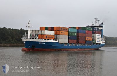
FREYA
Container Ship

Current Trip
| Time Travelled | 8 h, 47 mins |
|---|---|
| Remaining Time | 5 h, 14 mins |
| Distance Travelled | 128.97 nm |
| Remaining Distance | 70.27 nm |
| AVG Speed | 15.2 Knop |
| MAX Speed | 16.7 Knop |
| AVG Wind | 15.6 knots |
| MAX Wind | 17.8 knots |
| MIN Temp | 7.4°C / 45.32°F |
| MAX Temp | 14.2°C / 57.56°F |
| Djupgående | 6.7 m |
| Position mottagen | 6 m sen |
Current Position
| Longitud | --- |
|---|---|
| Latitude | --- |
| Status | Under way using engine |
| Fart | 13.7 Knop |
| Kurs | 293° |
| Område | North Sea |
| Station | T-AIS |
| Position mottagen | 6 m sen |
Information
The current position of FREYA is in North Sea with coordinates 53.02188° / 1.18224° as reported on 2025-02-22 02:47 by AIS to our vessel tracker app. The vessel's current speed is 13.7 Knop and is heading at the port of HULL. The estimated time of arrival as calculated by MyShipTracking vessel tracking app is 2025-02-22 08:07 LT
The vessel FREYA (IMO: 9219874, MMSI: 244180000) is a Container Ship that was built in 2000 ( 25 År gammal ). It's sailing under the flag of [NL] Netherlands.
In this page you can find informations about the vessels current position, last detected port calls, and current voyage information. If the vessels is not in coverage by AIS you will find the latest position.
The current position of FREYA is detected by our AIS receivers and we are not responsible for the reliability of the data. The last position was recorded while the vessel was in Coverage by the Ais receivers of our vessel tracking app.
The current draught of FREYA as reported by AIS is 6.7 meters
Weather
| Temperature | 8.8°C / 47.84°F |
|---|---|
| Wind Speed | 7 knots |
| Direction | 206° SSW |
| Pressure | 1006.1 hPa |
| Humidity | 97.8 % |
| Cloud Coverage | 100 % |


Featured Company
Last Port Calls
| Port | Arrival | Departure | Time In Port |
|---|---|---|---|
| 2025-02-21 07:48 | 2025-02-21 18:06 | 10 h | |
| 2025-02-20 07:53 | 2025-02-20 17:41 | 9 h | |
| 2025-02-18 07:46 | 2025-02-19 16:43 | 1 d | |
| 2025-02-16 07:59 | 2025-02-17 17:11 | 1 d | |
| 2025-02-15 07:43 | 2025-02-15 16:54 | 9 h | |
| 2025-02-14 07:44 | 2025-02-14 17:53 | 10 h | |
| 2025-02-13 07:55 | 2025-02-13 16:47 | 8 h | |
| 2025-02-12 06:30 | 2025-02-12 18:26 | 11 h | |
| 2025-02-10 07:36 | 2025-02-11 16:16 | 1 d | |
| 2025-02-09 06:24 | 2025-02-09 16:41 | 10 h |
Last Trips
| Origin | Departure | Destination | Arrival | Distance | |
|---|---|---|---|---|---|
| 2025-02-20 17:41 | 2025-02-21 08:48 | 201.84 nm | |||
| 2025-02-19 17:43 | 2025-02-20 07:53 | 200.12 nm | |||
| 2025-02-17 17:11 | 2025-02-18 08:46 | 202.01 nm | |||
| 2025-02-15 17:54 | 2025-02-16 07:59 | 200.47 nm | |||
| 2025-02-14 17:53 | 2025-02-15 08:43 | 201.91 nm | |||
| 2025-02-13 17:47 | 2025-02-14 07:44 | 199.53 nm | |||
| 2025-02-12 18:26 | 2025-02-13 08:55 | 203.76 nm | |||
| 2025-02-11 17:16 | 2025-02-12 06:30 | 200.27 nm | |||
| 2025-02-09 16:41 | 2025-02-10 08:36 | 202.33 nm | |||
| 2025-02-08 17:47 | 2025-02-09 06:24 | 199.72 nm |
Events
| Tid | Event | Detaljer | Position / Dest | Information |
|---|---|---|---|---|
| 2025-02-21 22:58 | Status ändrad | Under way using engine Default |
52.44683 / 2.14170
BEZEE <> GBHUL
|
Fart: 15.8 kn Kurs: 329° |
| 2025-02-21 22:45 | Status ändrad | Default Under way using engine |
52.39870 / 2.18390
BEZEE <> GBHUL
|
Fart: 15.7 kn Kurs: 338° |
| 2025-02-21 22:20 | Status ändrad | Under way using engine Default |
52.29707 / 2.25288
BEZEE <> GBHUL
|
Fart: 16 kn Kurs: 337° |
| 2025-02-21 21:30 | Status ändrad | Default Under way using engine |
52.08609 / 2.38896
BEZEE <> GBHUL
|
Fart: 16.1 kn Kurs: 328° |
| 2025-02-21 21:20 | Status ändrad | Under way using engine Default |
52.04836 / 2.41981
BEZEE <> GBHUL
|
Fart: 16 kn Kurs: 326° |
| 2025-02-21 20:49 | Status ändrad | Default Under way using engine |
51.92672 / 2.52728
BEZEE <> GBHUL
|
Fart: 16.3 kn Kurs: 333° |
| 2025-02-21 20:43 | Byter havsområde | United Kingdom part of the North Sea Dutch part of the North Sea |
51.90210 / 2.54768
North Sea
BEZEE <> GBHUL
|
Fart: 16.3 kn Kurs: 333° |
| 2025-02-21 20:31 | Byter havsområde | Dutch part of the North Sea Belgian part of the North Sea |
51.85368 / 2.57953
North Sea
BEZEE <> GBHUL
|
Fart: 16.5 kn Kurs: 350° |
| 2025-02-21 18:06 | AVGÅTT HAMN |
|
51.36590 / 3.18852
BEZEE <> GBHUL
|
Fart: 15.5 kn Kurs: 318° |
| 2025-02-21 17:57 | STARTAR förflyttning |
51.33743 / 3.19604
[BE] ZEEBRUGGE
|
Fart: 7 kn Kurs: 38° |