
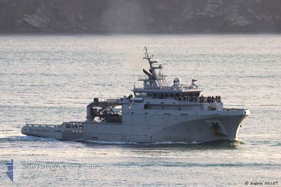
FRENCH WARSHIP
Military ops
Current Trip
Unknown
| Time Travelled | 1 day |
|---|---|
| Remaining Time | --- |
| Distance Travelled | 101.52 nm |
| Remaining Distance | --- |
| AVG Speed | 8.4 Knop |
| MAX Speed | 17.1 Knop |
| AVG Wind | 8 knots |
| MAX Wind | 18 knots |
| MIN Temp | 15.7°C / 60.26°F |
| MAX Temp | 19.3°C / 66.74°F |
| Djupgående | 4.7 m |
| Position mottagen | 14 h, 6 m sen |
Current Position
| Longitud | -4.79085° |
|---|---|
| Latitude | 48.12659° |
| Status | Under way using engine |
| Fart | 14.4 Knop |
| Kurs | 254.4° |
| Område | Celtic Sea |
| Station | T-AIS |
| Position mottagen | 14 h, 6 m sen |
Info
Information
The current position of FRENCH WARSHIP is in Celtic Sea with coordinates 48.12659° / -4.79085° as reported on 2024-06-25 15:04 by AIS to our vessel tracker app. The vessel's current speed is 14.4 Knop
The vessel FRENCH WARSHIP (MMSI: 399999999) is a Military ops It's sailing under the flag of [00] Unknown.
In this page you can find informations about the vessels current position, last detected port calls, and current voyage information. If the vessels is not in coverage by AIS you will find the latest position.
The current position of FRENCH WARSHIP is detected by our AIS receivers and we are not responsible for the reliability of the data. The last position was recorded while the vessel was in Coverage by the Ais receivers of our vessel tracking app.
The current draught of FRENCH WARSHIP as reported by AIS is 4.7 meters
Weather
| Temperature | 19.2°C / 66.56°F |
|---|---|
| Wind Speed | 15 knots |
| Direction | 22° NNE |
| Pressure | 1013.7 hPa |
| Humidity | 76.4 % |
| Cloud Coverage | 3 % |
Featured Company
Last Port Calls
| Port | Arrival | Departure | Time In Port |
|---|---|---|---|
| 2024-06-19 16:41 | 2024-06-24 07:19 | 4 d | |
| 2024-04-15 09:29 | 2024-06-19 07:51 | ||
| 2024-04-15 05:44 | 2024-04-15 08:03 | 2 h | |
| 2024-04-11 13:55 | 2024-04-13 18:55 | 2 d | |
| 2024-04-10 07:10 | 2024-04-10 08:28 | 1 h | |
| 2024-04-05 06:53 | 2024-04-07 15:43 | 2 d | |
| 2024-04-02 09:19 | 2024-04-04 07:36 | 1 d |
Last Trips
| Origin | Departure | Destination | Arrival | Distance | |
|---|---|---|---|---|---|
| 2024-06-19 09:51 | 2024-06-19 18:41 | 83.12 nm | |||
| 2024-04-15 10:03 | 2024-04-15 11:29 | 15.55 nm | |||
| 2024-04-13 20:55 | 2024-04-15 07:44 | 209.69 nm | |||
| 2024-04-10 10:28 | 2024-04-11 15:55 | 279.43 nm | |||
| 2024-04-07 17:43 | 2024-04-10 09:10 | 459.28 nm | |||
| 2024-04-04 09:36 | 2024-04-05 08:53 | 107.61 nm | |||
| 2024-03-29 10:15 | 2024-04-02 11:19 | 484.92 nm |
Events
| Tid | Event | Detaljer | Position / Dest | Information |
|---|---|---|---|---|
| 2024-06-25 15:04 | UTANFÖR täckningsområde |
48.12659 / -4.79085
Celtic Sea
|
Fart: 14.4 kn Kurs: 254.4° |
|
| 2024-06-25 14:16 | Status ändrad | Under way using engine Restricted manoeuverability |
48.25831 / -4.89585
|
Fart: 14.2 kn Kurs: 58° |
| 2024-06-25 14:02 | STARTAR förflyttning | 8.99 nm, South of MOLENE |
48.25158 / -4.92419
|
Fart: 3.2 kn Kurs: 118° |
| 2024-06-25 12:08 | STOPPAR förflyttning | 8.04 nm, South of MOLENE |
48.26952 / -4.90926
|
Fart: 0.3 kn Kurs: 161° |
| 2024-06-25 11:59 | STARTAR förflyttning | 8.4 nm, South of MOLENE |
48.26396 / -4.90653
|
Fart: 6.7 kn Kurs: 65.5° |
| 2024-06-25 11:56 | Status ändrad | Restricted manoeuverability Under way using engine |
48.26402 / -4.90959
|
Fart: 0.5 kn Kurs: 351° |
| 2024-06-25 11:56 | I täckningsområde |
48.26370 / -4.90803
Celtic Sea
|
Fart: 3.5 kn Kurs: 85.1° |
|
| 2024-06-25 09:06 | UTANFÖR täckningsområde |
48.27822 / -4.75672
Celtic Sea
|
Fart: 10.3 kn Kurs: 247.4° |
|
| 2024-06-25 08:52 | I täckningsområde |
48.28091 / -4.74707
Celtic Sea
|
Fart: 2.9 kn Kurs: 97.3° |
|
| 2024-06-25 06:02 | UTANFÖR täckningsområde |
48.32788 / -4.52180
Celtic Sea
|
Fart: 0.2 kn Kurs: 212.6° |