

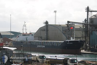
FOKKO UKENA
General Cargo

Current Trip
| Time Travelled | 20 h, 57 mins |
|---|---|
| Remaining Time | 16 h, 50 mins |
| Distance Travelled | 185.51 nm |
| Remaining Distance | 175.69 nm |
| AVG Speed | 8.5 Knop |
| MAX Speed | 11.4 Knop |
| AVG Wind | 9.4 knots |
| MAX Wind | 18.7 knots |
| MIN Temp | 6.3°C / 43.34°F |
| MAX Temp | 10.3°C / 50.54°F |
| Djupgående | 4.7 m |
| Position mottagen | 1 m sen |
Current Position
| Longitud | --- |
|---|---|
| Latitude | --- |
| Status | Under way using engine |
| Fart | 10.8 Knop |
| Kurs | 234.1° |
| Område | English Channel |
| Station | T-AIS |
| Position mottagen | 1 m sen |
Information
The current position of FOKKO UKENA is in English Channel with coordinates 50.80413° / 0.92173° as reported on 2025-03-29 17:56 by AIS to our vessel tracker app. The vessel's current speed is 10.8 Knop and is heading at the port of TEIGNMOUTH. The estimated time of arrival as calculated by MyShipTracking vessel tracking app is 2025-03-30 11:48 LT
The vessel FOKKO UKENA (IMO: 9375812, MMSI: 304089000) is a General Cargo that was built in 2007 ( 18 År gammal ). It's sailing under the flag of [AG] Antigua Barbuda.
In this page you can find informations about the vessels current position, last detected port calls, and current voyage information. If the vessels is not in coverage by AIS you will find the latest position.
The current position of FOKKO UKENA is detected by our AIS receivers and we are not responsible for the reliability of the data. The last position was recorded while the vessel was in Coverage by the Ais receivers of our vessel tracking app.
The current draught of FOKKO UKENA as reported by AIS is 4.7 meters
Weather
| Temperature | 8.6°C / 47.48°F |
|---|---|
| Wind Speed | 16 knots |
| Direction | 250° WSW |
| Pressure | 1022.7 hPa |
| Humidity | 79.5 % |
| Cloud Coverage | 35 % |


Featured Company
Last Port Calls
| Port | Arrival | Departure | Time In Port |
|---|---|---|---|
| 2025-03-28 11:47 | 2025-03-28 22:01 | 10 h | |
| 2025-03-24 12:01 | 2025-03-26 19:47 | 2 d | |
| 2025-03-21 16:47 | 2025-03-22 13:57 | 21 h | |
| 2025-03-21 16:15 | 2025-03-21 16:28 | 12 m | |
| 2025-03-19 21:18 | 2025-03-20 20:24 | 23 h | |
| 2025-03-07 08:37 | 2025-03-11 15:25 | 4 d | |
| 2025-02-23 07:57 | 2025-02-26 11:35 | 3 d | |
| 2025-02-11 18:33 | 2025-02-14 14:52 | 2 d | |
| 2025-01-31 09:56 | 2025-01-31 14:52 | 4 h | |
| 2025-01-21 17:28 | 2025-01-23 16:45 | 1 d |
Last Trips
| Origin | Departure | Destination | Arrival | Distance | |
|---|---|---|---|---|---|
| 2025-03-26 19:47 | 2025-03-28 11:47 | 384.63 nm | |||
| 2025-03-22 13:57 | 2025-03-24 12:01 | 403.79 nm | |||
| 2025-03-21 16:28 | 2025-03-21 16:47 | 1.45 nm | |||
| 2025-03-20 20:24 | 2025-03-21 16:15 | 131.10 nm | |||
| 2025-03-11 15:25 | 2025-03-19 21:18 | 1440.84 nm | |||
| 2025-02-26 11:35 | 2025-03-07 08:37 | 140.73 nm | |||
| 2025-02-14 14:52 | 2025-02-23 07:57 | 1303.95 nm | |||
| 2025-01-31 14:52 | 2025-02-11 18:33 | 1289.06 nm | |||
| 2025-01-23 16:45 | 2025-01-31 09:56 | 1130.43 nm | |||
| 2025-01-20 11:13 | 2025-01-21 17:28 | 251.54 nm |
Events
| Tid | Event | Detaljer | Position / Dest | Information |
|---|---|---|---|---|
| 2025-03-29 17:23 | Status ändrad | Under way using engine Default |
50.86277 / 1.04735
GBTNM
|
Fart: 11 kn Kurs: 230° |
| 2025-03-29 17:22 | Status ändrad | Default Under way using engine |
50.86535 / 1.05230
GBTNM
|
Fart: 10.8 kn Kurs: 229.9° |
| 2025-03-29 17:17 | Status ändrad | Under way using engine Default |
50.87512 / 1.07071
GBTNM
|
Fart: 10.8 kn Kurs: 230° |
| 2025-03-29 16:54 | Status ändrad | Default Under way using engine |
50.91874 / 1.15479
GBTNM
|
Fart: 10.5 kn Kurs: 237.7° |
| 2025-03-29 16:46 | Status ändrad | Under way using engine Default |
50.93173 / 1.18422
GBTNM
|
Fart: 10.4 kn Kurs: 238° |
| 2025-03-29 16:34 | Status ändrad | Default Under way using engine |
50.95006 / 1.23055
GBTNM
|
Fart: 10.3 kn Kurs: 237.9° |
| 2025-03-29 16:14 | Status ändrad | Under way using engine Default |
50.98242 / 1.30235
GBTNM
|
Fart: 9.9 kn Kurs: 230° |
| 2025-03-29 15:30 | Status ändrad | Default Under way using engine |
51.05599 / 1.44863
GBTNM
|
Fart: 6.5 kn Kurs: 232.9° |
| 2025-03-29 15:18 | Upptäckt i hav | United Kingdom part of the English Channel |
51.07094 / 1.47859
English Channel
GBTNM
|
Fart: 8.6 kn Kurs: 228.2° |
| 2025-03-29 08:28 | Upptäckt i hav | United Kingdom part of the North Sea |
51.82192 / 2.49324
North Sea
GBTNM
|
Fart: 11.4 kn Kurs: 221.5° |