
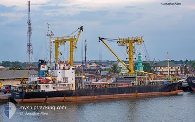
FLORA 8
General Cargo
Current Trip
MY PORTKLANG
| Time Travelled | 1 day |
|---|---|
| Remaining Time | --- |
| Distance Travelled | 195.13 nm |
| Remaining Distance | --- |
| AVG Speed | 6.9 Knop |
| MAX Speed | 9.3 Knop |
| AVG Wind | 4.3 knots |
| MAX Wind | 9.5 knots |
| MIN Temp | 27.1°C / 80.78°F |
| MAX Temp | 28.8°C / 83.84°F |
| Djupgående | 5.4 m |
| Position mottagen | 13 h, 31 m sen |
Current Position
| Longitud | --- |
|---|---|
| Latitude | --- |
| Status | Under way using engine |
| Fart | 7.6 Knop |
| Kurs | 161.6° |
| Område | Malacca Strait |
| Station | T-AIS |
| Position mottagen | 13 h, 31 m sen |
Info
Information
The current position of FLORA 8 is in Malacca Strait with coordinates 4.09376° / 100.40986° as reported on 2025-03-01 04:23 by AIS to our vessel tracker app. The vessel's current speed is 7.6 Knop
The vessel FLORA 8 (IMO: 9277151, MMSI: 525005283) is a General Cargo that was built in 2002 ( 23 År gammal ). It's sailing under the flag of [ID] Indonesia.
In this page you can find informations about the vessels current position, last detected port calls, and current voyage information. If the vessels is not in coverage by AIS you will find the latest position.
The current position of FLORA 8 is detected by our AIS receivers and we are not responsible for the reliability of the data. The last position was recorded while the vessel was in Coverage by the Ais receivers of our vessel tracking app.
The current draught of FLORA 8 as reported by AIS is 5.4 meters
Weather
| Temperature | 28.5°C / 83.3°F |
|---|---|
| Wind Speed | 1 knots |
| Direction | 174° S |
| Pressure | 1009.6 hPa |
| Humidity | 72.8 % |
| Cloud Coverage | 11 % |
Featured Company
Last Port Calls
| Port | Arrival | Departure | Time In Port |
|---|---|---|---|
| 2025-02-25 05:41 | 2025-02-28 13:05 | 3 d | |
| 2025-02-20 13:08 | 2025-02-21 14:29 | 1 d | |
| 2025-02-18 12:25 | 2025-02-19 07:13 | 18 h | |
| 2025-02-14 23:44 | 2025-02-15 15:55 | 16 h | |
| 2025-01-16 09:37 | 2025-01-21 03:48 | 4 d | |
| 2025-01-02 17:33 | 2025-01-05 13:05 | 2 d |
Most Visited Ports (Last year)
| Port | Arrivals | |
|---|---|---|
| 10 | ||
| 5 | ||
| 4 | ||
| 3 | ||
| 3 | ||
| 3 |
Last Trips
| Origin | Departure | Destination | Arrival | Distance | |
|---|---|---|---|---|---|
| 2025-02-21 21:29 | 2025-02-25 13:41 | 160.48 nm | |||
| 2025-02-19 15:13 | 2025-02-20 20:08 | 176.81 nm | |||
| 2025-02-15 23:55 | 2025-02-18 20:25 | 192.86 nm | |||
| 2025-01-21 11:48 | 2025-02-15 07:44 | 1566.34 nm | |||
| 2025-01-05 21:05 | 2025-01-16 17:37 | 1055.06 nm | |||
| 2025-01-01 03:15 | 2025-01-03 01:33 | 391.31 nm |
Events
| Tid | Event | Detaljer | Position / Dest | Information |
|---|---|---|---|---|
| 2025-03-01 04:27 | Status ändrad | Default Under way using engine |
4.08501 / 100.41262
MY PORTKLANG
|
Fart: 7.6 kn Kurs: 161.6° |
| 2025-03-01 04:23 | UTANFÖR täckningsområde |
4.09376 / 100.40986
Malacca Strait
|
Fart: 7.6 kn Kurs: 161.6° |
|
| 2025-03-01 04:09 | Status ändrad | Under way using engine Default |
4.12171 / 100.40174
MY PORTKLANG
|
Fart: 7.2 kn Kurs: 167° |
| 2025-03-01 04:09 | I täckningsområde |
4.12171 / 100.40174
Malacca Strait
|
Fart: 7.3 kn Kurs: 167.1° |
|
| 2025-02-28 13:05 | AVGÅTT HAMN |
|
5.44951 / 100.34660
MY PORTKLANG
|
Fart: 10.4 kn Kurs: -1° |
| 2025-02-28 12:42 | STARTAR förflyttning |
5.39032 / 100.36189
[MY] PENANG
|
Fart: 4.6 kn Kurs: -1° |
|
| 2025-02-25 05:42 | STOPPAR förflyttning |
5.38890 / 100.36456
[MY] PENANG
|
Fart: 0.3 kn Kurs: -1° |
|
| 2025-02-25 05:41 | ANLÄNDER HAMN |
|
5.38890 / 100.36456
[MY] PENANG
|
Fart: 0.8 kn Kurs: -1° |
| 2025-02-24 09:37 | STARTAR förflyttning | 8.29 nm, North East of BELAWAN |
3.91269 / 98.78082
MY PORTKLANG
|
Fart: 4.5 kn Kurs: -1° |
| 2025-02-21 15:41 | STOPPAR förflyttning | 8.16 nm, North East of BELAWAN |
3.91246 / 98.77690
MY PORTKLANG
|
Fart: 0.1 kn Kurs: -1° |