

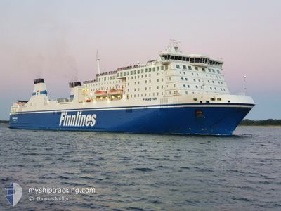
FINNSTAR
Ro-Ro/Passenger Ship

Current Trip
| Time Travelled | 19 h, 53 mins |
|---|---|
| Remaining Time | 10 h, 5 mins |
| Distance Travelled | 409.36 nm |
| Remaining Distance | 213.67 nm |
| AVG Speed | 20.8 Knop |
| MAX Speed | 21.9 Knop |
| AVG Wind | 15.3 knots |
| MAX Wind | 24 knots |
| MIN Temp | 0.9°C / 33.62°F |
| MAX Temp | 4.5°C / 40.1°F |
| Djupgående | 6.8 m |
| Position mottagen | 1 m sen |
Current Position
| Longitud | --- |
|---|---|
| Latitude | --- |
| Status | Under way using engine |
| Fart | 20.7 Knop |
| Kurs | 241.3° |
| Område | Baltic Sea |
| Station | T-AIS |
| Position mottagen | 1 m sen |
Information
The current position of FINNSTAR is in Baltic Sea with coordinates 55.80307° / 15.82338° as reported on 2025-02-25 08:50 by AIS to our vessel tracker app. The vessel's current speed is 20.7 Knop and is heading at the port of TRAVEMUNDE. The estimated time of arrival as calculated by MyShipTracking vessel tracking app is 2025-02-25 18:56 LT
The vessel FINNSTAR (IMO: 9319442, MMSI: 230981000) is a Ro-Ro/Passenger Ship that was built in 2006 ( 19 År gammal ). It's sailing under the flag of [FI] Finland.
In this page you can find informations about the vessels current position, last detected port calls, and current voyage information. If the vessels is not in coverage by AIS you will find the latest position.
The current position of FINNSTAR is detected by our AIS receivers and we are not responsible for the reliability of the data. The last position was recorded while the vessel was in Coverage by the Ais receivers of our vessel tracking app.
The current draught of FINNSTAR as reported by AIS is 6.8 meters
Weather
| Temperature | 3.8°C / 38.84°F |
|---|---|
| Wind Speed | 13 knots |
| Direction | 220° SW |
| Pressure | 1012.4 hPa |
| Humidity | 99.3 % |
| Cloud Coverage | 100 % |


Featured Company
Last Port Calls
| Port | Arrival | Departure | Time In Port |
|---|---|---|---|
| 2025-02-24 07:39 | 2025-02-24 12:58 | 5 h | |
| 2025-02-22 19:18 | 2025-02-23 01:17 | 5 h | |
| 2025-02-21 07:35 | 2025-02-21 13:06 | 5 h | |
| 2025-02-19 20:32 | 2025-02-20 01:57 | 5 h | |
| 2025-02-18 07:41 | 2025-02-18 13:09 | 5 h | |
| 2025-02-16 19:22 | 2025-02-17 01:09 | 5 h | |
| 2025-02-15 07:45 | 2025-02-15 13:19 | 5 h | |
| 2025-02-13 19:24 | 2025-02-14 01:17 | 5 h | |
| 2025-02-12 07:54 | 2025-02-12 13:10 | 5 h | |
| 2025-02-10 19:21 | 2025-02-11 01:25 | 6 h |
Most Visited Ports (Last year)
| Port | Arrivals | |
|---|---|---|
| 120 | ||
| 120 |
Last Trips
| Origin | Departure | Destination | Arrival | Distance | |
|---|---|---|---|---|---|
| 2025-02-23 02:17 | 2025-02-24 09:39 | 618.29 nm | |||
| 2025-02-21 15:06 | 2025-02-22 20:18 | 618.76 nm | |||
| 2025-02-20 02:57 | 2025-02-21 09:35 | 617.88 nm | |||
| 2025-02-18 15:09 | 2025-02-19 21:32 | 683.71 nm | |||
| 2025-02-17 02:09 | 2025-02-18 09:41 | 617.98 nm | |||
| 2025-02-15 15:19 | 2025-02-16 20:22 | 619.06 nm | |||
| 2025-02-14 02:17 | 2025-02-15 09:45 | 618.52 nm | |||
| 2025-02-12 15:10 | 2025-02-13 20:24 | 620.35 nm | |||
| 2025-02-11 02:25 | 2025-02-12 09:54 | 617.90 nm | |||
| 2025-02-09 14:36 | 2025-02-10 20:21 | 619.68 nm |
Events
| Tid | Event | Detaljer | Position / Dest | Information |
|---|---|---|---|---|
| 2025-02-25 06:43 | Status ändrad | Under way using engine Default |
56.21822 / 16.88937
DETRV
|
Fart: 20.4 kn Kurs: 233° |
| 2025-02-25 06:38 | I täckningsområde |
56.21124 / 16.87314
Baltic Sea
DETRV
|
Fart: 20.5 kn Kurs: 232.1° |
|
| 2025-02-25 02:41 | Status ändrad | Default Under way using engine |
57.10116 / 18.83047
DETRV
|
Fart: 20.3 kn Kurs: 228.8° |
| 2025-02-25 02:33 | UTANFÖR täckningsområde |
57.13278 / 18.89411
Baltic Sea
DETRV
|
Fart: 20.3 kn Kurs: 228.8° |
|
| 2025-02-25 02:32 | Status ändrad | Under way using engine Default |
57.13612 / 18.90117
DETRV
|
Fart: 20.3 kn Kurs: 229° |
| 2025-02-25 02:29 | Status ändrad | Default Under way using engine |
57.14653 / 18.92314
DETRV
|
Fart: 20.4 kn Kurs: 222.9° |
| 2025-02-25 02:24 | Status ändrad | Under way using engine Default |
57.16701 / 18.96484
DETRV
|
Fart: 20.2 kn Kurs: 216° |
| 2025-02-25 02:22 | Status ändrad | Default Under way using engine |
57.17808 / 18.98085
DETRV
|
Fart: 20.3 kn Kurs: 215.7° |
| 2025-02-25 00:38 | Status ändrad | Under way using engine Default |
57.65176 / 19.61856
DETRV
|
Fart: 19.7 kn Kurs: 216° |
| 2025-02-25 00:37 | Status ändrad | Default Under way using engine |
57.65531 / 19.62334
DETRV
|
Fart: 19.8 kn Kurs: 215.7° |