

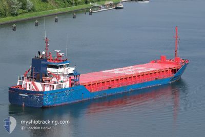
FERROMAR
General Cargo

Current Trip
| Time Travelled | 2 days |
|---|---|
| Remaining Time | 1 day |
| Distance Travelled | 484.63 nm |
| Remaining Distance | 289.67 nm |
| AVG Speed | 9.1 Knop |
| MAX Speed | 11.6 Knop |
| AVG Wind | 14.7 knots |
| MAX Wind | 22 knots |
| MIN Temp | 7.6°C / 45.68°F |
| MAX Temp | 15.5°C / 59.9°F |
| Djupgående | 6.4 m |
| Position mottagen | 1 h, 56 m sen |
Current Position
| Longitud | --- |
|---|---|
| Latitude | --- |
| Status | Under way using engine |
| Fart | 7.4 Knop |
| Kurs | 72.5° |
| Område | English Channel |
| Station | T-AIS |
| Position mottagen | 1 h, 56 m sen |
Information
The current position of FERROMAR is in English Channel with coordinates 49.92968° / -2.17038° as reported on 2025-02-15 18:22 by AIS to our vessel tracker app. The vessel's current speed is 7.4 Knop and is heading at the port of DORDRECHT. The estimated time of arrival as calculated by MyShipTracking vessel tracking app is 2025-02-17 07:49 LT
The vessel FERROMAR (IMO: 9313785, MMSI: 209710000) is a General Cargo that was built in 2004 ( 21 År gammal ). It's sailing under the flag of [CY] Cyprus.
In this page you can find informations about the vessels current position, last detected port calls, and current voyage information. If the vessels is not in coverage by AIS you will find the latest position.
The current position of FERROMAR is detected by our AIS receivers and we are not responsible for the reliability of the data. The last position was recorded while the vessel was in Coverage by the Ais receivers of our vessel tracking app.
The current draught of FERROMAR as reported by AIS is 6.4 meters
Weather
| Temperature | 8.1°C / 46.58°F |
|---|---|
| Wind Speed | 15 knots |
| Direction | 117° ESE |
| Pressure | 1016 hPa |
| Humidity | 64.6 % |
| Cloud Coverage | 16 % |


Featured Company
Last Port Calls
| Port | Arrival | Departure | Time In Port |
|---|---|---|---|
| 2025-02-12 23:02 | 2025-02-13 16:44 | 17 h | |
| 2025-02-06 23:24 | 2025-02-09 13:57 | 2 d | |
| 2025-01-29 08:32 | 2025-02-01 08:30 | 2 d | |
| 2025-01-25 11:05 | 2025-01-28 10:35 | 2 d | |
| 2025-01-18 22:10 | 2025-01-22 23:09 | 4 d | |
| 2025-01-18 07:26 |
Last Trips
| Origin | Departure | Destination | Arrival | Distance | |
|---|---|---|---|---|---|
| 2025-02-09 13:57 | 2025-02-13 00:02 | 604.66 nm | |||
| 2025-02-01 09:30 | 2025-02-06 23:24 | 486.72 nm | |||
| 2025-01-28 10:35 | 2025-01-29 09:32 | 215.39 nm | |||
| 2025-01-23 00:09 | 2025-01-25 11:05 | 426.67 nm | |||
| 2025-01-18 08:26 | 2025-01-18 23:10 | 156.24 nm |
Events
| Tid | Event | Detaljer | Position / Dest | Information |
|---|---|---|---|---|
| 2025-02-15 18:27 | Status ändrad | Default Under way using engine |
49.93314 / -2.15556
DORDRECHT
|
Fart: 7.4 kn Kurs: 72.5° |
| 2025-02-15 18:22 | UTANFÖR täckningsområde |
49.92968 / -2.17038
English Channel
DORDRECHT
|
Fart: 7.4 kn Kurs: 72.5° |
|
| 2025-02-15 16:41 | Status ändrad | Under way using engine Default |
49.87369 / -2.43245
DORDRECHT
|
Fart: 4.7 kn Kurs: 68° |
| 2025-02-15 16:35 | Status ändrad | Default Under way using engine |
49.87094 / -2.44493
DORDRECHT
|
Fart: 5.6 kn Kurs: 71° |
| 2025-02-15 16:29 | Status ändrad | Under way using engine Default |
49.86796 / -2.45898
DORDRECHT
|
Fart: 5.5 kn Kurs: 70° |
| 2025-02-15 16:27 | Status ändrad | Default Under way using engine |
49.86712 / -2.46281
DORDRECHT
|
Fart: 5.9 kn Kurs: 71.9° |
| 2025-02-15 16:27 | Status ändrad | Under way using engine Default |
49.86679 / -2.46428
DORDRECHT
|
Fart: 5 kn Kurs: 69° |
| 2025-02-15 16:03 | Status ändrad | Default Under way using engine |
49.85566 / -2.51672
DORDRECHT
|
Fart: 5.3 kn Kurs: 76.5° |
| 2025-02-15 15:50 | Status ändrad | Under way using engine Default |
49.84992 / -2.54544
DORDRECHT
|
Fart: 5.3 kn Kurs: 70° |
| 2025-02-15 15:43 | Status ändrad | Default Under way using engine |
49.84676 / -2.56146
DORDRECHT
|
Fart: 5.2 kn Kurs: 75.4° |