
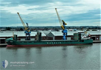
FEMBRIA
General Cargo
Current Trip
| Time Travelled | 18 h, 58 mins |
|---|---|
| Remaining Time | --- |
| Distance Travelled | 214.33 nm |
| Remaining Distance | --- |
| AVG Speed | 12.2 Knop |
| MAX Speed | 12.8 Knop |
| AVG Wind | 8.3 knots |
| MAX Wind | 12 knots |
| MIN Temp | 9.4°C / 48.92°F |
| MAX Temp | 12.7°C / 54.86°F |
| Djupgående | 4 m |
| Position mottagen | 1 h, 12 m sen |
Current Position
| Longitud | --- |
|---|---|
| Latitude | --- |
| Status | Under way using engine |
| Fart | 12.3 Knop |
| Kurs | 168.9° |
| Område | Gulf of Riga |
| Station | T-AIS |
| Position mottagen | 1 h, 12 m sen |
Info
Information
The current position of FEMBRIA is in Gulf of Riga with coordinates 58.09377° / 23.59736° as reported on 2024-10-05 04:57 by AIS to our vessel tracker app. The vessel's current speed is 12.3 Knop and is heading at the port of RIGA. The estimated time of arrival as calculated by MyShipTracking vessel tracking app is 2024-10-05 10:00 LT
The vessel FEMBRIA (IMO: 9350771, MMSI: 255802840) is a General Cargo that was built in 2006 ( 18 År gammal ). It's sailing under the flag of [PT] Portugal.
In this page you can find informations about the vessels current position, last detected port calls, and current voyage information. If the vessels is not in coverage by AIS you will find the latest position.
The current position of FEMBRIA is detected by our AIS receivers and we are not responsible for the reliability of the data. The last position was recorded while the vessel was in Coverage by the Ais receivers of our vessel tracking app.
The current draught of FEMBRIA as reported by AIS is 4 meters
Weather
| Temperature | 11.5°C / 52.7°F |
|---|---|
| Wind Speed | 5 knots |
| Direction | 272° W |
| Pressure | 1019.6 hPa |
| Humidity | 75.5 % |
| Cloud Coverage | 6 % |
Featured Company
Last Port Calls
| Port | Arrival | Departure | Time In Port |
|---|---|---|---|
| 2024-10-02 17:54 | 2024-10-04 11:11 | 1 d | |
| 2024-09-29 14:24 | 2024-09-30 15:14 | 1 d | |
| 2024-09-27 08:56 | 2024-09-29 14:10 | 2 d | |
| 2024-09-20 23:20 | 2024-09-22 15:09 | 1 d | |
| 2024-09-17 13:37 | 2024-09-19 08:14 | 1 d | |
| 2024-09-07 03:08 | 2024-09-11 17:54 | 4 d | |
| 2024-09-01 18:13 | 2024-09-03 21:01 | 2 d | |
| 2024-08-23 05:58 | 2024-08-24 22:51 | 1 d | |
| 2024-08-20 03:35 | 2024-08-22 10:13 | 2 d | |
| 2024-08-15 22:01 | 2024-08-16 22:52 | 1 d |
Most Visited Ports (Last year)
| Port | Arrivals | |
|---|---|---|
| 6 | ||
| 5 | ||
| 5 | ||
| 4 | ||
| 4 | ||
| 3 |
Last Trips
| Origin | Departure | Destination | Arrival | Distance | |
|---|---|---|---|---|---|
| 2024-09-30 17:14 | 2024-10-02 20:54 | 485.91 nm | |||
| 2024-09-29 16:10 | 2024-09-29 16:24 | 0.41 nm | |||
| 2024-09-22 18:09 | 2024-09-27 10:56 | 873.78 nm | |||
| 2024-09-19 11:14 | 2024-09-21 02:20 | 393.61 nm | |||
| 2024-09-11 19:54 | 2024-09-17 16:37 | 949.49 nm | |||
| 2024-09-03 23:01 | 2024-09-07 05:08 | 720.01 nm | |||
| 2024-08-25 00:51 | 2024-09-01 20:13 | 1328.32 nm | |||
| 2024-08-22 12:13 | 2024-08-23 07:58 | 203.14 nm | |||
| 2024-08-17 00:52 | 2024-08-20 05:35 | 719.73 nm | |||
| 2024-08-13 03:57 | 2024-08-16 00:01 | 482.83 nm |
Events
| Tid | Event | Detaljer | Position / Dest | Information |
|---|---|---|---|---|
| 2024-10-05 04:57 | UTANFÖR täckningsområde |
58.09377 / 23.59736
Gulf of Riga
RIGA
|
Fart: 12.3 kn Kurs: 168.9° |
|
| 2024-10-05 02:15 | Byter havsområde | Estonian part of the Gulf of Riga Estonian part of the Gulf of Finland |
58.62544 / 23.39920
Gulf of Riga
RIGA
|
Fart: 12.2 kn Kurs: 139.1° |
| 2024-10-05 02:15 | I täckningsområde |
58.62544 / 23.39920
Gulf of Riga
RIGA
|
Fart: 12.2 kn Kurs: 139.1° |
|
| 2024-10-04 22:03 | Status ändrad | Default Under way using engine |
59.34264 / 23.34089
RIGA
|
Fart: 12.5 kn Kurs: 230.3° |
| 2024-10-04 21:44 | UTANFÖR täckningsområde |
59.38358 / 23.44070
Gulf of Finland
RIGA
|
Fart: 12.5 kn Kurs: 230.3° |
|
| 2024-10-04 19:57 | Upptäckt i hav | Estonian part of the Gulf of Finland |
59.63065 / 23.97550
Gulf of Finland
RIGA
|
Fart: 12.3 kn Kurs: 223.1° |
| 2024-10-04 19:26 | Status ändrad | Under way using engine Default |
59.70912 / 24.11956
RIGA
|
Fart: 12.3 kn Kurs: 220° |
| 2024-10-04 19:19 | Status ändrad | Default Under way using engine |
59.72570 / 24.14877
RIGA
|
Fart: 11.9 kn Kurs: 250.3° |
| 2024-10-04 19:15 | Status ändrad | Under way using engine Default |
59.73689 / 24.17255
RIGA
|
Fart: 11.9 kn Kurs: 251° |
| 2024-10-04 19:01 | Byter havsområde | Finnish part of the Gulf of Finland Estonian part of the Gulf of Finland |
59.75234 / 24.25882
Gulf of Finland
RIGA
|
Fart: 11.8 kn Kurs: 251.1° |