
EXTASE
Other Type
Current Trip
| Time Travelled | 2 days |
|---|---|
| Remaining Time | --- |
| Distance Travelled | 30.54 nm |
| Remaining Distance | --- |
| AVG Speed | 6.7 Knop |
| MAX Speed | 7.3 Knop |
| AVG Wind | 1.4 knots |
| MAX Wind | 2.1 knots |
| MIN Temp | -3.3°C / 26.06°F |
| MAX Temp | 0.1°C / 32.18°F |
| Djupgående | 0 m |
| Position mottagen | 1 d sen |
Current Position
| Longitud | --- |
|---|---|
| Latitude | --- |
| Status | Under way using engine |
| Fart | |
| Kurs | --- |
| Område | North Sea |
| Station | T-AIS |
| Position mottagen | 1 d sen |
Info
Information
The current position of EXTASE is in North Sea with coordinates 52.40777° / 9.73940° as reported on 2025-02-15 10:36 by AIS to our vessel tracker app. The vessel's current speed is 0 Knop and is heading at the port of LINGEN.
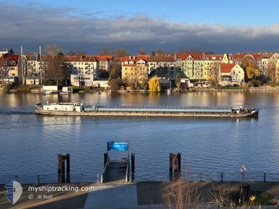
The vessel EXTASE (MMSI: 270262000) is a Other Type It's sailing under the flag of [CZ] Czech Republic.
In this page you can find informations about the vessels current position, last detected port calls, and current voyage information. If the vessels is not in coverage by AIS you will find the latest position.
The current position of EXTASE is detected by our AIS receivers and we are not responsible for the reliability of the data. The last position was recorded while the vessel was in Coverage by the Ais receivers of our vessel tracking app.
Weather
| Temperature | -0.1°C / 31.82°F |
|---|---|
| Wind Speed | 2 knots |
| Direction | 246° WSW |
| Pressure | 1025.8 hPa |
| Humidity | 82 % |
| Cloud Coverage | 96 % |
Featured Company
Last Port Calls
| Port | Arrival | Departure | Time In Port |
|---|---|---|---|
| 2025-02-14 15:13 | 2025-02-14 17:14 | 2 h | |
| 2025-02-11 05:38 | 2025-02-11 07:08 | 1 h | |
| 2025-02-09 13:59 | 2025-02-10 14:59 | 1 d | |
| 2025-02-06 09:13 | 2025-02-09 10:53 | 3 d | |
| 2025-02-05 12:42 | |||
| 2025-01-31 13:43 | 2025-01-31 14:57 | 1 h | |
| 2025-01-21 19:01 | 2025-01-22 05:51 | 10 h | |
| 2024-12-03 12:25 | 2024-12-05 18:25 | 2 d | |
| 2024-12-02 19:21 | 2024-12-02 19:32 | 11 m |
Last Trips
| Origin | Departure | Destination | Arrival | Distance | |
|---|---|---|---|---|---|
| 2025-02-11 08:08 | 2025-02-14 16:13 | 3.06 nm | |||
| 2025-02-10 15:59 | 2025-02-11 06:38 | 21.13 nm | |||
| 2025-02-09 11:53 | 2025-02-09 14:59 | 19.78 nm | |||
| 2025-02-05 13:42 | 2025-02-06 10:13 | 38.67 nm | |||
| 2025-01-22 06:51 | 2025-01-31 14:43 | 433.83 nm | |||
| 2024-12-05 19:25 | 2025-01-21 20:01 | 339.55 nm | |||
| 2024-12-02 20:32 | 2024-12-03 13:25 | 28.87 nm | |||
| 2024-11-27 12:19 | 2024-12-02 20:21 | 265.40 nm |
Events
| Tid | Event | Detaljer | Position / Dest | Information |
|---|---|---|---|---|
| 2025-02-15 10:36 | UTANFÖR täckningsområde |
52.40777 / 9.73940
North Sea
|
Fart: Kurs: 117.1° |
|
| 2025-02-15 10:36 | STOPPAR förflyttning | 0.31 nm, North West of YACHTHAFEN HANNOVER |
52.40777 / 9.73940
LINGEN
|
Fart: Kurs: 511° |
| 2025-02-15 10:35 | STARTAR förflyttning | 0.4 nm, North West of YACHTHAFEN HANNOVER |
52.40851 / 9.73709
LINGEN
|
Fart: 6.2 kn Kurs: 119.8° |
| 2025-02-15 10:34 | STOPPAR förflyttning | 0.51 nm, North West of YACHTHAFEN HANNOVER |
52.40936 / 9.73442
LINGEN
|
Fart: Kurs: 511° |
| 2025-02-15 10:20 | I täckningsområde |
52.42223 / 9.69764
North Sea
|
Fart: 6.1 kn Kurs: 112.3° |
|
| 2025-02-15 06:11 | UTANFÖR täckningsområde |
52.40565 / 9.51669
North Sea
|
Fart: 6.9 kn Kurs: 110.7° |
|
| 2025-02-15 05:03 | I täckningsområde |
52.38736 / 9.31095
North Sea
|
Fart: 7.1 kn Kurs: 85.3° |
|
| 2025-02-14 19:11 | UTANFÖR täckningsområde |
52.38218 / 9.25915
North Sea
|
Fart: 5.1 kn Kurs: 79.2° |
|
| 2025-02-14 19:11 | I täckningsområde |
52.38218 / 9.25915
North Sea
|
Fart: 5.1 kn Kurs: 79.2° |
|
| 2025-02-14 17:43 | UTANFÖR täckningsområde |
52.30510 / 9.03972
North Sea
|
Fart: 6.6 kn Kurs: 54.5° |