
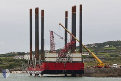
EXCALIBUR
Crane Jack Up
Current Trip
| Time Travelled | 13 days |
|---|---|
| Remaining Time | --- |
| Distance Travelled | 568.39 nm |
| Remaining Distance | --- |
| AVG Speed | 4.5 Knop |
| MAX Speed | 7.8 Knop |
| AVG Wind | 15.8 knots |
| MAX Wind | 29.8 knots |
| MIN Temp | 6.5°C / 43.7°F |
| MAX Temp | 14.7°C / 58.46°F |
| Djupgående | 4.3 m |
| Position mottagen | Nu |
Current Position
| Longitud | 7.67539° |
|---|---|
| Latitude | 55.83408° |
| Status | Restricted manoeuverability |
| Fart | |
| Kurs | --- |
| Område | North Sea |
| Station | T-AIS |
| Position mottagen | Nu |
Info
Information
The current position of EXCALIBUR is in North Sea with coordinates 55.83408° / 7.67539° as reported on 2024-05-06 06:36 by AIS to our vessel tracker app. The vessel's current speed is 0 Knop
The vessel EXCALIBUR (IMO: 8763282, MMSI: 576152000) is a Crane Jack Up that was built in 1978 ( 46 År gammal ). It's sailing under the flag of [VU] Vanuatu.
In this page you can find informations about the vessels current position, last detected port calls, and current voyage information. If the vessels is not in coverage by AIS you will find the latest position.
The current position of EXCALIBUR is detected by our AIS receivers and we are not responsible for the reliability of the data. The last position was recorded while the vessel was in Coverage by the Ais receivers of our vessel tracking app.
The current draught of EXCALIBUR as reported by AIS is 4.3 meters
Weather
| Temperature | 10.1°C / 50.18°F |
|---|---|
| Wind Speed | 11 knots |
| Direction | 294° WNW |
| Pressure | 1007.2 hPa |
| Humidity | 85 % |
| Cloud Coverage | 100 % |
Featured Company
Last Port Calls
| Port | Arrival | Departure | Time In Port |
|---|---|---|---|
| 2024-04-20 18:14 | 2024-04-22 18:58 | 2 d | |
| 2024-04-17 15:26 |
Most Visited Ports (Last year)
| Port | Arrivals | |
|---|---|---|
| 2 | ||
| 1 |
Last Trips
| Origin | Departure | Destination | Arrival | Distance | |
|---|---|---|---|---|---|
| 2024-04-17 16:26 | 2024-04-20 19:14 | 310.09 nm |
Events
| Tid | Event | Detaljer | Position / Dest | Information |
|---|---|---|---|---|
| 2024-05-04 05:54 | STOPPAR förflyttning | 19.92 nm, South West of HVIDE SANDE |
55.81894 / 7.63295
ESBJERG
|
Fart: 0.3 kn Kurs: 511° |
| 2024-05-04 05:37 | STARTAR förflyttning | 19.82 nm, South West of HVIDE SANDE |
55.81632 / 7.63967
ESBJERG
|
Fart: 3.1 kn Kurs: 289.1° |
| 2024-05-01 16:34 | STOPPAR förflyttning | 19.85 nm, South West of HVIDE SANDE |
55.80335 / 7.65518
ESBJERG
|
Fart: 0.2 kn Kurs: 511° |
| 2024-05-01 16:33 | STARTAR förflyttning | 19.86 nm, South West of HVIDE SANDE |
55.80313 / 7.65516
ESBJERG
|
Fart: 3.2 kn Kurs: 228.4° |
| 2024-05-01 00:03 | ETA ändrat | 2025/04/28 06:00 2024/04/28 06:00 |
55.80330 / 7.65523
ESBJERG
|
Fart: Kurs: 511° |
| 2024-04-28 03:27 | STOPPAR förflyttning | 20.23 nm, South West of HVIDE SANDE |
55.80875 / 7.63431
ESBJERG
|
Fart: 0.3 kn Kurs: 511° |
| 2024-04-27 19:22 | ETA ändrat | 2024/04/28 06:00 2024/04/27 12:00 |
55.42005 / 7.11855
ESBJERG
|
Fart: 4.3 kn Kurs: 15.9° |
| 2024-04-27 18:55 | Byter havsområde | Danish part of the North Sea Dutch part of the North Sea |
55.39120 / 7.10238
North Sea
|
Fart: 4.1 kn Kurs: 14.9° |
| 2024-04-27 18:55 | I täckningsområde |
55.39120 / 7.10238
North Sea
|
Fart: 4.1 kn Kurs: 14.9° |
|
| 2024-04-26 12:39 | UTANFÖR täckningsområde |
53.47212 / 4.75007
North Sea
ESBJERG
|
Fart: 4.5 kn Kurs: 25.4° |