
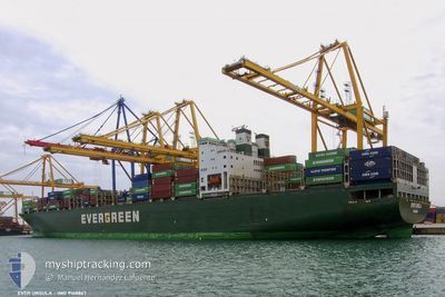
EVER URSULA
Container Ship
Current Trip
| Time Travelled | 14 h, 4 mins |
|---|---|
| Remaining Time | 1 h, 47 mins |
| Distance Travelled | 196.82 nm |
| Remaining Distance | 42.62 nm |
| AVG Speed | 14.3 Knop |
| MAX Speed | 18.8 Knop |
| AVG Wind | 12.3 knots |
| MAX Wind | 17.8 knots |
| MIN Temp | 12.8°C / 55.04°F |
| MAX Temp | 17.6°C / 63.68°F |
| Djupgående | 10.3 m |
| Position mottagen | 10 h, 13 m sen |
Current Position
| Longitud | 118.79945° |
|---|---|
| Latitude | 38.77215° |
| Status | Under way using engine |
| Fart | 11.5 Knop |
| Kurs | 105° |
| Område | Yellow Sea |
| Station | T-AIS |
| Position mottagen | 10 h, 13 m sen |
Info
Information
The current position of EVER URSULA is in Yellow Sea with coordinates 38.77215° / 118.79945° as reported on 2024-05-17 23:50 by AIS to our vessel tracker app. The vessel's current speed is 11.5 Knop and is heading at the port of DALIAN. The estimated time of arrival as calculated by MyShipTracking vessel tracking app is 2024-05-18 19:51 LT
The vessel EVER URSULA (IMO: 9168867, MMSI: 357737000) is a Container Ship that was built in 1999 ( 25 År gammal ). It's sailing under the flag of [PA] Panama.
In this page you can find informations about the vessels current position, last detected port calls, and current voyage information. If the vessels is not in coverage by AIS you will find the latest position.
The current position of EVER URSULA is detected by our AIS receivers and we are not responsible for the reliability of the data. The last position was recorded while the vessel was in Coverage by the Ais receivers of our vessel tracking app.
The current draught of EVER URSULA as reported by AIS is 10.3 meters
Weather
| Temperature | 16.7°C / 62.06°F |
|---|---|
| Wind Speed | 16 knots |
| Direction | 158° SSE |
| Pressure | 1010.1 hPa |
| Humidity | 82.5 % |
| Cloud Coverage | 71 % |
Featured Company
Last Port Calls
| Port | Arrival | Departure | Time In Port |
|---|---|---|---|
| 2024-05-17 06:28 | 2024-05-18 04:00 | 21 h | |
| 2024-05-06 22:28 | 2024-05-08 00:00 | 1 d | |
| 2024-04-04 21:05 | 2024-04-07 06:54 | 2 d | |
| 2024-03-27 08:38 | 2024-03-28 00:13 | 15 h | |
| 2024-03-24 20:40 | 2024-03-26 08:27 | 1 d | |
| 2024-03-18 18:57 | 2024-03-20 08:24 | 1 d |
Last Trips
| Origin | Departure | Destination | Arrival | Distance | |
|---|---|---|---|---|---|
| 2024-05-08 00:00 | 2024-05-17 06:28 | 3105.00 nm | |||
| 2024-04-07 06:54 | 2024-05-06 22:28 | 12158.82 nm | |||
| 2024-03-28 00:13 | 2024-04-04 21:05 | 2964.70 nm | |||
| 2024-03-26 08:27 | 2024-03-27 08:38 | 114.26 nm | |||
| 2024-03-20 08:24 | 2024-03-24 20:40 | 365.59 nm | |||
| 2024-02-13 22:39 | 2024-03-18 18:57 | 12137.13 nm |
Events
| Tid | Event | Detaljer | Position / Dest | Information |
|---|---|---|---|---|
| 2024-05-17 23:56 | Status ändrad | Default Under way using engine |
38.76697 / 118.82476
MYPKG > CNDLC
|
Fart: 11.5 kn Kurs: 105° |
| 2024-05-17 23:50 | UTANFÖR täckningsområde |
38.77215 / 118.79945
Yellow Sea
|
Fart: 11.5 kn Kurs: 105° |
|
| 2024-05-17 22:59 | Byter havsområde | Chinese part of the Yellow Sea South Korean part of the Yellow Sea |
38.79847 / 118.59110
Yellow Sea
|
Fart: 11.5 kn Kurs: 98° |
| 2024-05-17 22:57 | I täckningsområde |
38.79847 / 118.59110
Yellow Sea
|
Fart: 11.5 kn Kurs: 98° |
|
| 2024-05-17 22:56 | Status ändrad | Under way using engine Default |
38.79963 / 118.58164
MYPKG > CNDLC
|
Fart: 11.5 kn Kurs: 98° |
| 2024-05-17 20:00 | AVGÅTT HAMN |
|
38.95468 / 117.88796
MYPKG > CNDLC
|
Fart: 12 kn Kurs: -1° |
| 2024-05-17 19:28 | STARTAR förflyttning |
38.99189 / 117.78243
[CN] TIANJIN
|
Fart: 5.6 kn Kurs: -1° |
|
| 2024-05-16 22:37 | STOPPAR förflyttning |
38.99487 / 117.77704
[CN] TIANJIN
|
Fart: 0.1 kn Kurs: -1° |
|
| 2024-05-16 22:28 | ANLÄNDER HAMN |
|
38.99484 / 117.77779
[CN] TIANJIN
|
Fart: 0.8 kn Kurs: -1° |
| 2024-05-16 04:09 | STARTAR förflyttning | 8.89 nm, North East of DALIAN |
39.01897 / 121.86220
MYPKG > CNDLC
|
Fart: 4.4 kn Kurs: -1° |