
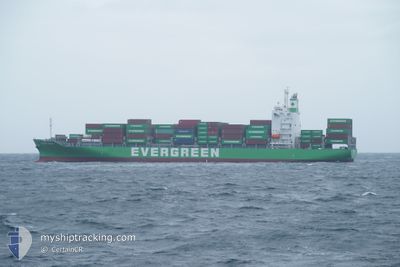
EVER OMNI
Cargo
Current Trip
| Trip Time | 1 day |
|---|---|
| Trip Distance | 394.48 nm |
| AVG Speed | 13.7 Knop |
| MAX Speed | 13.7 Knop |
| Djupgående | 8.3 m |
| AVG Wind | 7.6 knots |
| MAX Wind | 22.5 knots |
| MIN Temp | 23.8°C / 74.84°F |
| MAX Temp | 29.2°C / 84.56°F |
| Position mottagen | 1 d sen |
Current Position
| Longitud | --- |
|---|---|
| Latitude | --- |
| Status | Under way using engine |
| Fart | 16 Knop |
| Kurs | 347° |
| Område | Malacca Strait |
| Station | T-AIS |
| Position mottagen | 1 d sen |
Info
Information
The current position of EVER OMNI is in Malacca Strait with coordinates 4.44169° / 100.27561° as reported on 2024-11-27 01:44 by AIS to our vessel tracker app. The vessel's current speed is 16 Knop and is currently inside the port of PENANG.
The vessel EVER OMNI (IMO: 9919498, MMSI: 636022523) is a Cargo It's sailing under the flag of [LR] Liberia.
In this page you can find informations about the vessels current position, last detected port calls, and current voyage information. If the vessels is not in coverage by AIS you will find the latest position.
The current position of EVER OMNI is detected by our AIS receivers and we are not responsible for the reliability of the data. The last position was recorded while the vessel was in Coverage by the Ais receivers of our vessel tracking app.
The current draught of EVER OMNI as reported by AIS is 8.3 meters
Weather
| Temperature | 24.2°C / 75.56°F |
|---|---|
| Wind Speed | 4 knots |
| Direction | 75° ENE |
| Pressure | 1009.8 hPa |
| Humidity | 90.9 % |
| Cloud Coverage | 100 % |
Featured Company
Last Port Calls
| Port | Arrival | Departure | Time In Port |
|---|---|---|---|
| 2024-11-27 20:04 | |||
| 2024-11-25 19:08 | 2024-11-26 15:27 | 20 h | |
| 2024-11-25 00:40 | 2024-11-25 12:43 | 12 h | |
| 2024-11-18 10:58 | 2024-11-18 18:09 | 7 h | |
| 2024-11-17 11:30 | 2024-11-17 20:59 | 9 h | |
| 2024-11-15 19:04 | 2024-11-16 13:28 | 18 h | |
| 2024-11-14 08:24 | 2024-11-15 04:24 | 20 h | |
| 2024-11-12 10:31 | 2024-11-13 04:06 | 17 h | |
| 2024-11-11 10:27 | 2024-11-11 19:38 | 9 h | |
| 2024-11-03 15:32 | 2024-11-04 00:35 | 9 h |
Most Visited Ports (Last year)
| Port | Arrivals | |
|---|---|---|
| 16 | ||
| 15 | ||
| 11 | ||
| 11 | ||
| 9 | ||
| 8 |
Last Trips
| Origin | Departure | Destination | Arrival | Distance | |
|---|---|---|---|---|---|
| 2024-11-26 15:27 | 2024-11-27 20:04 | 394.48 nm | |||
| 2024-11-25 12:43 | 2024-11-25 19:08 | 55.00 nm | |||
| 2024-11-18 18:09 | 2024-11-25 00:40 | 1368.80 nm | |||
| 2024-11-17 20:59 | 2024-11-18 10:58 | 24.61 nm | |||
| 2024-11-16 13:28 | 2024-11-17 11:30 | 197.73 nm | |||
| 2024-11-15 04:24 | 2024-11-15 19:04 | 224.36 nm | |||
| 2024-11-13 04:06 | 2024-11-14 08:24 | 392.91 nm | |||
| 2024-11-11 19:38 | 2024-11-12 10:31 | 137.73 nm | |||
| 2024-11-04 00:35 | 2024-11-11 10:27 | 1399.02 nm | |||
| 2024-11-03 09:32 | 2024-11-03 15:32 | 56.12 nm |
Events
| Tid | Event | Detaljer | Position / Dest | Information |
|---|---|---|---|---|
| 2024-11-27 12:43 | STOPPAR förflyttning |
5.41946 / 100.36031
[MY] PENANG
|
Fart: 0.1 kn Kurs: 4° |
|
| 2024-11-27 12:04 | ANLÄNDER HAMN |
|
5.43659 / 100.35211
[MY] PENANG
|
Fart: 11.3 kn Kurs: 164° |
| 2024-11-27 01:49 | Status ändrad | Default Under way using engine |
4.46397 / 100.27046
SGSGP>>MYPEN
|
Fart: 16 kn Kurs: 347° |
| 2024-11-27 01:44 | UTANFÖR täckningsområde |
4.44169 / 100.27561
Malacca Strait
SGSGP>>MYPEN
|
Fart: 16 kn Kurs: 347° |
|
| 2024-11-26 23:13 | Status ändrad | Under way using engine Default |
3.75962 / 100.47929
SGSGP>>MYPEN
|
Fart: 16.9 kn Kurs: 340° |
| 2024-11-26 22:56 | Status ändrad | Default Under way using engine |
3.68485 / 100.50639
SGSGP>>MYPEN
|
Fart: 16.8 kn Kurs: 340.4° |
| 2024-11-26 22:38 | Status ändrad | Under way using engine Default |
3.60514 / 100.53500
SGSGP>>MYPEN
|
Fart: 17.5 kn Kurs: 336° |
| 2024-11-26 22:38 | I täckningsområde |
3.60558 / 100.53481
Malacca Strait
SGSGP>>MYPEN
|
Fart: 16.9 kn Kurs: 337.3° |
|
| 2024-11-26 16:35 | Status ändrad | Default Under way using engine |
2.45896 / 101.62442
SGSGP>>MYPEN
|
Fart: 17.1 kn Kurs: 308.1° |
| 2024-11-26 16:27 | UTANFÖR täckningsområde |
2.43297 / 101.65671
Malacca Strait
SGSGP>>MYPEN
|
Fart: 17.1 kn Kurs: 308.1° |