
EVER FRONT
Cargo D
Current Trip
| Time Travelled | 11 days |
|---|---|
| Remaining Time | 3 days |
| Distance Travelled | 4177.93 nm |
| Remaining Distance | 1380.00 nm |
| AVG Speed | 15.1 Knop |
| MAX Speed | 20.4 Knop |
| AVG Wind | 12.3 knots |
| MAX Wind | 31 knots |
| MIN Temp | 1°C / 33.8°F |
| MAX Temp | 12.8°C / 55.04°F |
| Djupgående | 13.9 m |
| Position mottagen | 9 h, 11 m sen |
Current Position
| Longitud | 139.98346° |
|---|---|
| Latitude | 41.17912° |
| Status | Under way using engine |
| Fart | 16.6 Knop |
| Kurs | 229.9° |
| Område | Japan Sea |
| Station | T-AIS |
| Position mottagen | 9 h, 11 m sen |
Info
Information
The current position of EVER FRONT is in Japan Sea with coordinates 41.17912° / 139.98346° as reported on 2024-05-09 06:46 by AIS to our vessel tracker app. The vessel's current speed is 16.6 Knop and is heading at the port of KAOHSIUNG. The estimated time of arrival as calculated by MyShipTracking vessel tracking app is 2024-05-13 03:50 LT
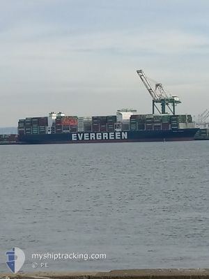
The vessel EVER FRONT (IMO: 9850549, MMSI: 373285000) is a Cargo D It's sailing under the flag of [PA] Panama.
In this page you can find informations about the vessels current position, last detected port calls, and current voyage information. If the vessels is not in coverage by AIS you will find the latest position.
The current position of EVER FRONT is detected by our AIS receivers and we are not responsible for the reliability of the data. The last position was recorded while the vessel was in Coverage by the Ais receivers of our vessel tracking app.
The current draught of EVER FRONT as reported by AIS is 13.9 meters
Weather
| Temperature | 12.8°C / 55.04°F |
|---|---|
| Wind Speed | 20 knots |
| Direction | 225° SW |
| Pressure | 1017 hPa |
| Humidity | 78.6 % |
| Cloud Coverage | 100 % |
Featured Company
Last Port Calls
| Port | Arrival | Departure | Time In Port |
|---|---|---|---|
| 2024-04-26 11:18 | 2024-04-28 04:44 | 1 d | |
| 2024-04-22 12:28 | 2024-04-24 02:20 | 1 d | |
| 2024-04-17 21:25 | 2024-04-21 00:48 | 3 d | |
| 2024-04-02 09:36 | 2024-04-03 17:29 | 1 d | |
| 2024-03-31 03:24 | 2024-04-01 14:37 | 1 d | |
| 2024-03-29 23:16 | 2024-03-30 11:57 | 12 h | |
| 2024-03-23 01:16 | 2024-03-24 03:37 | 1 d | |
| 2024-03-12 16:27 | 2024-03-14 13:22 | 1 d |
Last Trips
| Origin | Departure | Destination | Arrival | Distance | |
|---|---|---|---|---|---|
| 2024-04-23 19:20 | 2024-04-26 04:18 | 857.73 nm | |||
| 2024-04-20 17:48 | 2024-04-22 05:28 | 410.93 nm | |||
| 2024-04-04 01:29 | 2024-04-17 14:25 | 6441.35 nm | |||
| 2024-04-01 22:37 | 2024-04-02 17:36 | 343.96 nm | |||
| 2024-03-30 19:57 | 2024-03-31 11:24 | 215.86 nm | |||
| 2024-03-24 11:37 | 2024-03-30 07:16 | 2179.37 nm | |||
| 2024-03-14 21:22 | 2024-03-23 09:16 | 1812.74 nm | |||
| 2024-02-26 06:24 | 2024-03-13 00:27 | 5729.39 nm |
Events
| Tid | Event | Detaljer | Position / Dest | Information |
|---|---|---|---|---|
| 2024-05-09 07:00 | Status ändrad | Default Under way using engine |
41.13534 / 139.91428
USTIW > TWKHH
|
Fart: 16.6 kn Kurs: 229.9° |
| 2024-05-09 06:46 | UTANFÖR täckningsområde |
41.17912 / 139.98346
Japan Sea
USTIW > TWKHH
|
Fart: 16.6 kn Kurs: 229.9° |
|
| 2024-05-09 06:45 | Status ändrad | Under way using engine Default |
41.18057 / 139.98575
USTIW > TWKHH
|
Fart: 16.6 kn Kurs: 230° |
| 2024-05-09 06:44 | I täckningsområde |
41.17912 / 139.98346
Japan Sea
USTIW > TWKHH
|
Fart: 16.6 kn Kurs: 229.9° |
|
| 2024-05-09 05:28 | Status ändrad | Default Under way using engine |
41.35100 / 140.33406
USTIW > TWKHH
|
Fart: 12.6 kn Kurs: 234.9° |
| 2024-05-09 05:21 | UTANFÖR täckningsområde |
41.36699 / 140.36385
Japan Sea
USTIW > TWKHH
|
Fart: 12.6 kn Kurs: 234.9° |
|
| 2024-05-09 02:11 | Byter havsområde | Japanese part of the Japan Sea Japanese part of the North Pacific Ocean |
41.64057 / 141.26837
Japan Sea
USTIW > TWKHH
|
Fart: 16.8 kn Kurs: 269.3° |
| 2024-05-09 00:54 | Destination ändrad | USTIW > TWKHH USTIW > TWTPE |
41.63823 / 141.74310
USTIW > TWKHH
|
Fart: 17.8 kn Kurs: 268.2° |
| 2024-05-09 00:54 | ETA ändrat | 2024/05/13 04:00 2024/05/15 14:00 |
41.63823 / 141.74310
USTIW > TWKHH
|
Fart: 17.8 kn Kurs: 268.2° |
| 2024-05-09 00:06 | Status ändrad | Under way using engine Default |
41.64048 / 142.06080
USTIW > TWTPE
|
Fart: 18.2 kn Kurs: 272° |