
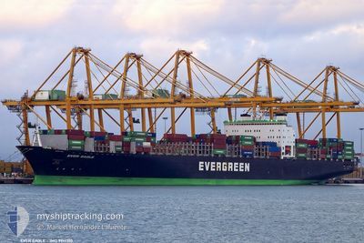
EVER EAGLE
Container Ship
Current Trip
| Time Travelled | 4 days |
|---|---|
| Remaining Time | --- |
| Distance Travelled | 184.78 nm |
| Remaining Distance | 2.85 nm |
| AVG Speed | 15.8 Knop |
| MAX Speed | 22 Knop |
| AVG Wind | 6.3 knots |
| MAX Wind | 16.8 knots |
| MIN Temp | 5.1°C / 41.18°F |
| MAX Temp | 15.6°C / 60.08°F |
| Djupgående | 12 m |
| Position mottagen | 1 m sen |
Current Position
| Longitud | -123.19797° |
|---|---|
| Latitude | 49.30703° |
| Status | Under way using engine |
| Fart | 5.6 Knop |
| Kurs | 50.8° |
| Område | The Coastal Waters of Southeast Alaska and British Columbia |
| Station | T-AIS |
| Position mottagen | 1 m sen |
Info
Information
The current position of EVER EAGLE is in The Coastal Waters of Southeast Alaska and British Columbia with coordinates 49.30703° / -123.19797° as reported on 2024-05-08 09:51 by AIS to our vessel tracker app. The vessel's current speed is 5.6 Knop and is heading at the port of VANCOUVER. The estimated time of arrival as calculated by MyShipTracking vessel tracking app is 2024-05-03 17:00 LT
The vessel EVER EAGLE (IMO: 9241310, MMSI: 235335000) is a Container Ship that was built in 2001 ( 23 År gammal ). It's sailing under the flag of [GB] United Kingdom.
In this page you can find informations about the vessels current position, last detected port calls, and current voyage information. If the vessels is not in coverage by AIS you will find the latest position.
The current position of EVER EAGLE is detected by our AIS receivers and we are not responsible for the reliability of the data. The last position was recorded while the vessel was in Coverage by the Ais receivers of our vessel tracking app.
The current draught of EVER EAGLE as reported by AIS is 12 meters
Weather
| Temperature | 8.4°C / 47.12°F |
|---|---|
| Wind Speed | 6 knots |
| Direction | 96° E |
| Pressure | 1027.2 hPa |
| Humidity | 67.9 % |
| Cloud Coverage | 8 % |
Featured Company
Last Port Calls
| Port | Arrival | Departure | Time In Port |
|---|---|---|---|
| 2024-04-30 21:34 | 2024-05-03 10:57 | 2 d | |
| 2024-04-14 01:07 | 2024-04-14 17:05 | 15 h | |
| 2024-04-12 11:06 | 2024-04-13 02:22 | 15 h | |
| 2024-04-10 04:45 | 2024-04-10 16:37 | 11 h | |
| 2024-04-05 11:33 | 2024-04-06 03:09 | 15 h | |
| 2024-04-02 11:09 | 2024-04-03 00:33 | 13 h | |
| 2024-03-27 10:22 | 2024-03-28 06:55 | 20 h | |
| 2024-03-21 11:03 | 2024-03-22 05:04 | 18 h | |
| 2024-03-19 14:56 | 2024-03-20 08:40 | 17 h |
Last Trips
| Origin | Departure | Destination | Arrival | Distance | |
|---|---|---|---|---|---|
| 2024-04-15 01:05 | 2024-04-30 14:34 | 5973.55 nm | |||
| 2024-04-13 10:22 | 2024-04-14 09:07 | 345.16 nm | |||
| 2024-04-11 00:37 | 2024-04-12 19:06 | 689.39 nm | |||
| 2024-04-06 11:09 | 2024-04-10 12:45 | 1001.11 nm | |||
| 2024-04-03 08:33 | 2024-04-05 19:33 | 434.93 nm | |||
| 2024-03-28 14:55 | 2024-04-02 19:09 | 1568.63 nm | |||
| 2024-03-22 13:04 | 2024-03-27 18:22 | 1537.57 nm | |||
| 2024-03-20 16:40 | 2024-03-21 19:03 | 427.77 nm | |||
| 2024-02-14 00:40 | 2024-03-19 22:56 | 1631.15 nm |
Events
| Tid | Event | Detaljer | Position / Dest | Information |
|---|---|---|---|---|
| 2024-05-08 09:50 | STARTAR förflyttning | 4.14 nm, West of VANCOUVER |
49.30643 / -123.19916
USTIW>>CAVAN
|
Fart: 4.8 kn Kurs: 51° |
| 2024-05-08 09:30 | Status ändrad | Under way using engine At anchor |
49.30484 / -123.20164
USTIW>>CAVAN
|
Fart: 0.4 kn Kurs: 83° |
| 2024-05-03 22:20 | Status ändrad | At anchor Under way using engine |
49.30467 / -123.20101
USTIW>>CAVAN
|
Fart: 0.1 kn Kurs: 86° |
| 2024-05-03 22:12 | STOPPAR förflyttning | 4.19 nm, West of VANCOUVER |
49.30498 / -123.20086
USTIW>>CAVAN
|
Fart: 0.3 kn Kurs: 93° |
| 2024-05-03 20:11 | Byter havsområde | Canadian part of the The Coastal Waters of Southeast Alaska and British Columbia United States part of the The Coastal Waters of Southeast Alaska and British Columbia |
49.00742 / -123.25164
The Coastal Waters of Southeast Alaska and British Columbia
USTIW>>CAVAN
|
Fart: 17.7 kn Kurs: 314° |
| 2024-05-03 19:26 | Byter havsområde | United States part of the The Coastal Waters of Southeast Alaska and British Columbia Canadian part of the The Coastal Waters of Southeast Alaska and British Columbia |
48.84349 / -123.02364
The Coastal Waters of Southeast Alaska and British Columbia
USTIW>>CAVAN
|
Fart: 17.9 kn Kurs: 330.3° |
| 2024-05-03 19:23 | Byter havsområde | Canadian part of the The Coastal Waters of Southeast Alaska and British Columbia United States part of the The Coastal Waters of Southeast Alaska and British Columbia |
48.83069 / -123.01237
The Coastal Waters of Southeast Alaska and British Columbia
USTIW>>CAVAN
|
Fart: 17.6 kn Kurs: 330.2° |
| 2024-05-03 19:17 | Byter havsområde | United States part of the The Coastal Waters of Southeast Alaska and British Columbia Canadian part of the The Coastal Waters of Southeast Alaska and British Columbia |
48.80332 / -123.00140
The Coastal Waters of Southeast Alaska and British Columbia
USTIW>>CAVAN
|
Fart: 17.9 kn Kurs: 9.1° |
| 2024-05-03 18:53 | Byter havsområde | Canadian part of the The Coastal Waters of Southeast Alaska and British Columbia United States part of the The Coastal Waters of Southeast Alaska and British Columbia |
48.72897 / -123.14087
The Coastal Waters of Southeast Alaska and British Columbia
USTIW>>CAVAN
|
Fart: 18 kn Kurs: 62.7° |
| 2024-05-03 17:47 | Byter havsområde | United States part of the The Coastal Waters of Southeast Alaska and British Columbia Canadian part of the The Coastal Waters of Southeast Alaska and British Columbia |
48.45956 / -123.16436
The Coastal Waters of Southeast Alaska and British Columbia
USTIW>>CAVAN
|
Fart: 16.4 kn Kurs: 1° |