
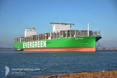
EVER ATOP
Cargo D
Current Trip
| Time Travelled | 12 days |
|---|---|
| Remaining Time | --- |
| Distance Travelled | 5445.82 nm |
| Remaining Distance | --- |
| AVG Speed | 15.6 Knop |
| MAX Speed | 21.7 Knop |
| AVG Wind | 18.8 knots |
| MAX Wind | 36.3 knots |
| MIN Temp | 3.7°C / 38.66°F |
| MAX Temp | 28.2°C / 82.76°F |
| Djupgående | 12.2 m |
| Position mottagen | 6 d sen |
Current Position
| Longitud | --- |
|---|---|
| Latitude | --- |
| Status | Under way using engine |
| Fart | 20.3 Knop |
| Kurs | 200.2° |
| Område | North Atlantic Ocean |
| Station | T-AIS |
| Position mottagen | 6 d sen |
Info
Information
The current position of EVER ATOP is in North Atlantic Ocean with coordinates 27.37315° / -15.32147° as reported on 2024-12-26 16:08 by AIS to our vessel tracker app. The vessel's current speed is 20.3 Knop and is heading at the port of TANJUNG PELEPAS. The estimated time of arrival as calculated by MyShipTracking vessel tracking app is 2025-01-17 12:00 LT
The vessel EVER ATOP (IMO: 9893993, MMSI: 563166100) is a Cargo D It's sailing under the flag of [SG] Singapore.
In this page you can find informations about the vessels current position, last detected port calls, and current voyage information. If the vessels is not in coverage by AIS you will find the latest position.
The current position of EVER ATOP is detected by our AIS receivers and we are not responsible for the reliability of the data. The last position was recorded while the vessel was in Coverage by the Ais receivers of our vessel tracking app.
The current draught of EVER ATOP as reported by AIS is 12.2 meters
Weather
| Temperature | 20.4°C / 68.72°F |
|---|---|
| Wind Speed | 12 knots |
| Direction | 149° SSE |
| Pressure | 1014.4 hPa |
| Humidity | 71.1 % |
| Cloud Coverage | 100 % |
Featured Company
Last Port Calls
| Port | Arrival | Departure | Time In Port |
|---|---|---|---|
| 2024-12-17 18:52 | 2024-12-20 18:55 | 3 d | |
| 2024-12-05 16:26 | 2024-12-10 12:32 | 4 d | |
| 2024-11-07 05:27 | 2024-11-08 05:07 | 23 h | |
| 2024-11-02 05:36 | 2024-11-03 16:32 | 1 d |
Last Trips
| Origin | Departure | Destination | Arrival | Distance | |
|---|---|---|---|---|---|
| 2024-12-10 12:32 | 2024-12-17 18:52 | 527.65 nm | |||
| 2024-11-08 05:07 | 2024-12-05 16:26 | 11915.93 nm | |||
| 2024-11-03 16:32 | 2024-11-07 05:27 | 1483.93 nm | |||
| 2024-10-30 02:50 | 2024-11-02 05:36 | 478.00 nm |
Events
| Tid | Event | Detaljer | Position / Dest | Information |
|---|---|---|---|---|
| 2024-12-26 16:15 | Status ändrad | Default Under way using engine |
27.33444 / -15.33745
DE HAM > MY TPP
|
Fart: 20.3 kn Kurs: 200.2° |
| 2024-12-26 16:08 | UTANFÖR täckningsområde |
27.37315 / -15.32147
North Atlantic Ocean
DE HAM > MY TPP
|
Fart: 20.3 kn Kurs: 200.2° |
|
| 2024-12-26 16:07 | Status ändrad | Under way using engine Default |
27.37537 / -15.32055
DE HAM > MY TPP
|
Fart: 20.3 kn Kurs: 200° |
| 2024-12-26 15:39 | Status ändrad | Default Under way using engine |
27.52535 / -15.25928
DE HAM > MY TPP
|
Fart: 20.2 kn Kurs: 201.1° |
| 2024-12-26 12:14 | ETA ändrat | 2025/01/17 04:00 2025/01/16 18:00 |
28.64878 / -14.84379
DE HAM > MY TPP
|
Fart: 20.6 kn Kurs: 199.8° |
| 2024-12-26 10:52 | Status ändrad | Under way using engine Default |
29.08189 / -14.69396
DE HAM > MY TPP
|
Fart: 20.3 kn Kurs: 194° |
| 2024-12-26 10:47 | Status ändrad | Default Under way using engine |
29.11255 / -14.68482
DE HAM > MY TPP
|
Fart: 20.2 kn Kurs: 194.6° |
| 2024-12-26 10:46 | Status ändrad | Under way using engine Default |
29.11520 / -14.68401
DE HAM > MY TPP
|
Fart: 20.2 kn Kurs: 195° |
| 2024-12-26 10:31 | Status ändrad | Default Under way using engine |
29.20107 / -14.65737
DE HAM > MY TPP
|
Fart: 20.1 kn Kurs: 195.4° |
| 2024-12-26 10:25 | Status ändrad | Under way using engine Default |
29.22926 / -14.64848
DE HAM > MY TPP
|
Fart: 20.2 kn Kurs: 196° |