

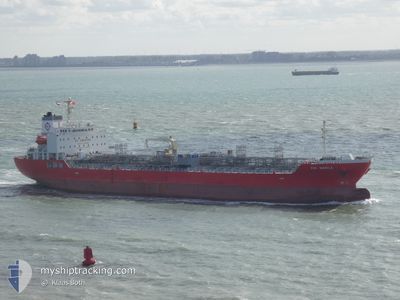
EVA MANILA
Other Type B

Current Trip
| Time Travelled | 14 h, 34 mins |
|---|---|
| Remaining Time | 3 days |
| Distance Travelled | 191.18 nm |
| Remaining Distance | 1212.72 nm |
| AVG Speed | 13.3 Knop |
| MAX Speed | 14.2 Knop |
| AVG Wind | 8.3 knots |
| MAX Wind | 14.7 knots |
| MIN Temp | 18.7°C / 65.66°F |
| MAX Temp | 22.7°C / 72.86°F |
| Djupgående | 8.9 m |
| Position mottagen | Nu |
Current Position
| Longitud | --- |
|---|---|
| Latitude | --- |
| Status | Under way using engine |
| Fart | 12.8 Knop |
| Kurs | 146.5° |
| Område | Persian Gulf |
| Station | T-AIS |
| Position mottagen | Nu |
Information
The current position of EVA MANILA is in Persian Gulf with coordinates 26.51846° / 52.97414° as reported on 2025-02-13 02:54 by AIS to our vessel tracker app. The vessel's current speed is 12.8 Knop and is heading at the port of DAHEJ. The estimated time of arrival as calculated by MyShipTracking vessel tracking app is 2025-02-16 22:39 LT
The vessel EVA MANILA (IMO: 9918602, MMSI: 548705000) is a Other Type B It's sailing under the flag of [PH] Philippines.
In this page you can find informations about the vessels current position, last detected port calls, and current voyage information. If the vessels is not in coverage by AIS you will find the latest position.
The current position of EVA MANILA is detected by our AIS receivers and we are not responsible for the reliability of the data. The last position was recorded while the vessel was in Coverage by the Ais receivers of our vessel tracking app.
The current draught of EVA MANILA as reported by AIS is 8.9 meters
Weather
| Temperature | 22.2°C / 71.96°F |
|---|---|
| Wind Speed | 13 knots |
| Direction | 128° SE |
| Pressure | 1015.1 hPa |
| Humidity | 72.7 % |
| Cloud Coverage | 100 % |


Featured Company
Last Port Calls
| Port | Arrival | Departure | Time In Port |
|---|---|---|---|
| 2025-02-10 20:35 | 2025-02-12 12:21 | 1 d | |
| 2025-01-22 14:11 | 2025-01-25 01:56 | 2 d | |
| 2024-12-14 21:35 | 2024-12-15 16:27 | 18 h | |
| 2024-12-03 05:07 | 2024-12-05 01:25 | 1 d |
Last Trips
| Origin | Departure | Destination | Arrival | Distance | |
|---|---|---|---|---|---|
| 2025-01-25 06:56 | 2025-02-10 23:35 | 1209.56 nm | |||
| 2024-12-15 21:57 | 2025-01-22 19:11 | 5122.58 nm | |||
| 2024-12-05 04:25 | 2024-12-15 03:05 | 3100.31 nm | |||
| 2024-11-18 11:39 | 2024-12-03 08:07 | 573.39 nm |
Events
| Tid | Event | Detaljer | Position / Dest | Information |
|---|---|---|---|---|
| 2025-02-12 23:02 | Status ändrad | Under way using engine Default |
27.05770 / 52.31329
INDAH
|
Fart: 13.3 kn Kurs: 102° |
| 2025-02-12 22:54 | Status ändrad | Default Under way using engine |
27.06390 / 52.28382
INDAH
|
Fart: 13.3 kn Kurs: 101.6° |
| 2025-02-12 20:55 | ETA ändrat | 2025/02/17 09:00 2026/01/17 08:00 |
27.17975 / 51.78872
INDAH
|
Fart: 14.1 kn Kurs: 101.5° |
| 2025-02-12 20:06 | Status ändrad | Under way using engine Default |
27.20312 / 51.57337
INDAH
|
Fart: 14.1 kn Kurs: 92° |
| 2025-02-12 19:57 | Status ändrad | Default Under way using engine |
27.20460 / 51.53127
INDAH
|
Fart: 14.1 kn Kurs: 91.8° |
| 2025-02-12 19:50 | Status ändrad | Under way using engine Default |
27.20550 / 51.50457
INDAH
|
Fart: 14 kn Kurs: 83° |
| 2025-02-12 19:43 | Status ändrad | Default Under way using engine |
27.20363 / 51.47383
INDAH
|
Fart: 14 kn Kurs: 83.3° |
| 2025-02-12 19:38 | Status ändrad | Under way using engine Default |
27.20141 / 51.45214
INDAH
|
Fart: 14 kn Kurs: 84° |
| 2025-02-12 19:29 | Status ändrad | Default Under way using engine |
27.19632 / 51.40986
INDAH
|
Fart: 14 kn Kurs: 105.1° |
| 2025-02-12 17:08 | Byter havsområde | Iranian part of the Persian Gulf Saudi Arabian part of the Persian Gulf |
27.24951 / 50.81797
Persian Gulf
|
Fart: 13.2 kn Kurs: 90° |