
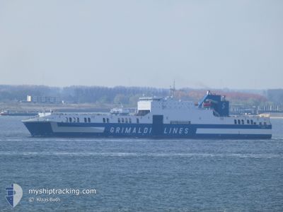
EUROCARGO BARI
Ro-Ro Cargo
Current Trip
| Time Travelled | 22 h, 23 mins |
|---|---|
| Remaining Time | --- |
| Distance Travelled | 399.93 nm |
| Remaining Distance | --- |
| AVG Speed | 17.3 Knop |
| MAX Speed | 21.5 Knop |
| AVG Wind | 11.2 knots |
| MAX Wind | 19 knots |
| MIN Temp | 12.5°C / 54.5°F |
| MAX Temp | 23°C / 73.4°F |
| Djupgående | 6.5 m |
| Position mottagen | 15 h, 45 m sen |
Current Position
| Longitud | -74.00938° |
|---|---|
| Latitude | 38.93420° |
| Status | Under way using engine |
| Fart | 20.4 Knop |
| Kurs | 189.3° |
| Område | North Atlantic Ocean |
| Station | T-AIS |
| Position mottagen | 15 h, 45 m sen |
Info
Information
The current position of EUROCARGO BARI is in North Atlantic Ocean with coordinates 38.93420° / -74.00938° as reported on 2024-04-29 10:20 by AIS to our vessel tracker app. The vessel's current speed is 20.4 Knop and is heading at the port of ALTAMIRA. The estimated time of arrival as calculated by MyShipTracking vessel tracking app is 2024-05-03 04:00 LT
The vessel EUROCARGO BARI (IMO: 9471082, MMSI: 247320400) is a Ro-Ro Cargo that was built in 2012 ( 12 År gammal ). It's sailing under the flag of [IT] Italy.
In this page you can find informations about the vessels current position, last detected port calls, and current voyage information. If the vessels is not in coverage by AIS you will find the latest position.
The current position of EUROCARGO BARI is detected by our AIS receivers and we are not responsible for the reliability of the data. The last position was recorded while the vessel was in Coverage by the Ais receivers of our vessel tracking app.
The current draught of EUROCARGO BARI as reported by AIS is 6.5 meters
Weather
| Temperature | 22.9°C / 73.22°F |
|---|---|
| Wind Speed | 14 knots |
| Direction | 223° SW |
| Pressure | 1020.5 hPa |
| Humidity | 69 % |
| Cloud Coverage | 7 % |
Featured Company
Last Port Calls
| Port | Arrival | Departure | Time In Port |
|---|---|---|---|
| 2024-04-28 15:14 | 2024-04-29 03:42 | 12 h | |
| 2024-04-27 09:33 | 2024-04-27 18:04 | 8 h | |
| 2024-04-20 02:30 | 2024-04-20 12:58 | 10 h | |
| 2024-04-13 15:53 | 2024-04-13 23:29 | 7 h | |
| 2024-04-12 01:22 | 2024-04-12 23:09 | 21 h | |
| 2024-04-05 23:35 | 2024-04-06 10:42 | 11 h | |
| 2024-03-27 14:21 | 2024-03-28 12:20 | 21 h | |
| 2024-03-26 10:33 | 2024-03-26 19:16 | 8 h | |
| 2024-03-21 00:12 | 2024-03-21 10:46 | 10 h | |
| 2024-03-15 11:12 | 2024-03-15 19:38 | 8 h |
Most Visited Ports (Last year)
| Port | Arrivals | |
|---|---|---|
| 21 | ||
| 20 | ||
| 20 | ||
| 1 | ||
| 1 |
Last Trips
| Origin | Departure | Destination | Arrival | Distance | |
|---|---|---|---|---|---|
| 2024-04-27 14:04 | 2024-04-28 11:14 | 184.53 nm | |||
| 2024-04-20 07:58 | 2024-04-27 05:33 | 2194.33 nm | |||
| 2024-04-13 19:29 | 2024-04-19 21:30 | 2010.64 nm | |||
| 2024-04-12 19:09 | 2024-04-13 11:53 | 162.59 nm | |||
| 2024-04-06 04:42 | 2024-04-11 21:22 | 2107.68 nm | |||
| 2024-03-28 08:20 | 2024-04-05 17:35 | 2025.04 nm | |||
| 2024-03-26 15:16 | 2024-03-27 10:21 | 163.45 nm | |||
| 2024-03-21 04:46 | 2024-03-26 06:33 | 2166.80 nm | |||
| 2024-03-15 15:38 | 2024-03-20 18:12 | 1997.37 nm | |||
| 2024-03-14 18:00 | 2024-03-15 07:12 | 162.23 nm |
Events
| Tid | Event | Detaljer | Position / Dest | Information |
|---|---|---|---|---|
| 2024-04-29 10:25 | Status ändrad | Default Under way using engine |
38.90333 / -74.01500
US NYC > MX ATM
|
Fart: 20.4 kn Kurs: 189.3° |
| 2024-04-29 10:20 | UTANFÖR täckningsområde |
38.93420 / -74.00938
North Atlantic Ocean
US NYC > MX ATM
|
Fart: 20.4 kn Kurs: 189.3° |
|
| 2024-04-29 10:16 | Status ändrad | Under way using engine Default |
38.95165 / -74.00610
US NYC > MX ATM
|
Fart: 20 kn Kurs: 188° |
| 2024-04-29 10:10 | Status ändrad | Default Under way using engine |
38.98667 / -73.99834
US NYC > MX ATM
|
Fart: 20.7 kn Kurs: 187.6° |
| 2024-04-29 10:01 | Status ändrad | Under way using engine Default |
39.03833 / -73.99000
US NYC > MX ATM
|
Fart: 20 kn Kurs: 189° |
| 2024-04-29 09:58 | Status ändrad | Default Under way using engine |
39.05500 / -73.98500
US NYC > MX ATM
|
Fart: 20.7 kn Kurs: 188° |
| 2024-04-29 09:51 | Status ändrad | Under way using engine Default |
39.09901 / -73.97875
US NYC > MX ATM
|
Fart: 20 kn Kurs: 187° |
| 2024-04-29 09:51 | I täckningsområde |
39.09786 / -73.97896
North Atlantic Ocean
US NYC > MX ATM
|
Fart: 20.7 kn Kurs: 188° |
|
| 2024-04-29 08:58 | Status ändrad | Default Under way using engine |
39.39667 / -73.92167
US NYC > MX ATM
|
Fart: 20.5 kn Kurs: 189.1° |
| 2024-04-29 08:44 | UTANFÖR täckningsområde |
39.49204 / -73.90560
North Atlantic Ocean
US NYC > MX ATM
|
Fart: 20.5 kn Kurs: 189.1° |