
ETAGAS
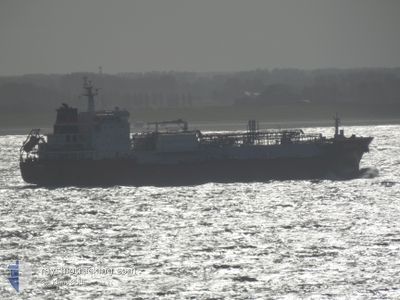
Tanker
Current Trip
| Time Travelled | 7 days |
|---|---|
| Remaining Time | 6 days |
| Distance Travelled | 2054.10 nm |
| Remaining Distance | 3318.55 nm |
| AVG Speed | 12.5 Knop |
| MAX Speed | 15.6 Knop |
| AVG Wind | 11.4 knots |
| MAX Wind | 33.9 knots |
| MIN Temp | 27.5°C / 81.5°F |
| MAX Temp | 35.4°C / 95.72°F |
| Djupgående | 8.5 m |
| Position mottagen | 5 d sen |
Current Position
| Longitud | 57.26698° |
|---|---|
| Latitude | 25.42821° |
| Status | Under way using engine |
| Fart | 11.2 Knop |
| Kurs | 138.8° |
| Område | Gulf of Oman |
| Station | T-AIS |
| Position mottagen | 5 d sen |
Info
Information
The current position of ETAGAS is in Gulf of Oman with coordinates 25.42821° / 57.26698° as reported on 2024-06-24 12:39 by AIS to our vessel tracker app. The vessel's current speed is 11.2 Knop and is heading at the port of PASIR GUDANG. The estimated time of arrival as calculated by MyShipTracking vessel tracking app is 2024-07-07 02:37 LT
The vessel ETAGAS (IMO: 9553634, MMSI: 305369000) is a Tanker It's sailing under the flag of [AG] Antigua Barbuda.
In this page you can find informations about the vessels current position, last detected port calls, and current voyage information. If the vessels is not in coverage by AIS you will find the latest position.
The current position of ETAGAS is detected by our AIS receivers and we are not responsible for the reliability of the data. The last position was recorded while the vessel was in Coverage by the Ais receivers of our vessel tracking app.
The current draught of ETAGAS as reported by AIS is 8.5 meters
Weather
| Temperature | 28.4°C / 83.12°F |
|---|---|
| Wind Speed | 13 knots |
| Direction | 234° SW |
| Pressure | 1008.2 hPa |
| Humidity | 77 % |
| Cloud Coverage | 60 % |
Featured Company
Last Port Calls
| Port | Arrival | Departure | Time In Port |
|---|---|---|---|
| 2024-06-21 16:54 | 2024-06-23 01:48 | 1 d | |
| 2024-06-17 18:39 | 2024-06-18 16:44 | 22 h | |
| 2024-05-25 11:26 | 2024-05-28 16:30 | 3 d | |
| 2024-04-16 17:16 | 2024-04-17 19:46 | 1 d | |
| 2024-04-14 00:28 | 2024-04-14 03:52 | 3 h | |
| 2024-04-12 13:56 | 2024-04-14 00:20 | 1 d | |
| 2024-04-12 09:27 | 2024-04-12 13:28 | 4 h | |
| 2024-04-09 16:19 | 2024-04-10 13:04 | 20 h | |
| 2024-04-06 07:27 | 2024-04-07 07:29 | 1 d | |
| 2024-04-02 16:12 | 2024-04-04 12:38 | 1 d |
Last Trips
| Origin | Departure | Destination | Arrival | Distance | |
|---|---|---|---|---|---|
| 2024-06-18 19:44 | 2024-06-21 19:54 | 29.47 nm | |||
| 2024-05-29 01:30 | 2024-06-17 21:39 | 6349.66 nm | |||
| 2024-04-17 14:46 | 2024-05-25 20:26 | 9768.87 nm | |||
| 2024-04-13 22:52 | 2024-04-16 12:16 | 438.21 nm | |||
| 2024-04-13 19:20 | 2024-04-13 19:28 | 1.93 nm | |||
| 2024-04-12 08:28 | 2024-04-12 08:56 | 2.39 nm | |||
| 2024-04-10 08:04 | 2024-04-12 04:27 | 521.51 nm | |||
| 2024-04-07 01:29 | 2024-04-09 11:19 | 415.44 nm | |||
| 2024-04-04 06:38 | 2024-04-06 01:27 | 14.00 nm |
Events
| Tid | Event | Detaljer | Position / Dest | Information |
|---|---|---|---|---|
| 2024-06-24 12:46 | Status ändrad | Default Under way using engine |
25.41305 / 57.28179
MY PGU
|
Fart: 11.2 kn Kurs: 138.8° |
| 2024-06-24 12:39 | UTANFÖR täckningsområde |
25.42821 / 57.26698
Gulf of Oman
MY PGU
|
Fart: 11.2 kn Kurs: 138.8° |
|
| 2024-06-24 09:47 | Byter havsområde | Iranian part of the Gulf of Oman Omani part of the Persian Gulf |
25.87320 / 56.95053
Gulf of Oman
MY PGU
|
Fart: 10.9 kn Kurs: 152.7° |
| 2024-06-24 09:46 | Status ändrad | Under way using engine Default |
25.87540 / 56.94927
MY PGU
|
Fart: 10.9 kn Kurs: 153° |
| 2024-06-24 09:38 | I täckningsområde |
25.87320 / 56.95053
Gulf of Oman
MY PGU
|
Fart: 10.9 kn Kurs: 152.7° |
|
| 2024-06-24 04:22 | Status ändrad | Default Under way using engine |
26.39251 / 56.10867
MY PGU
|
Fart: 14.9 kn Kurs: 66° |
| 2024-06-24 04:15 | UTANFÖR täckningsområde |
26.38117 / 56.08337
Persian Gulf
MY PGU
|
Fart: 14.9 kn Kurs: 66° |
|
| 2024-06-24 04:14 | Status ändrad | Under way using engine Default |
26.37811 / 56.07582
MY PGU
|
Fart: 14.6 kn Kurs: 69° |
| 2024-06-24 04:05 | Status ändrad | Default Under way using engine |
26.36553 / 56.04156
MY PGU
|
Fart: 14.3 kn Kurs: 66.4° |
| 2024-06-24 03:54 | Status ändrad | Under way using engine Default |
26.34765 / 55.99427
MY PGU
|
Fart: 14.2 kn Kurs: 67° |