
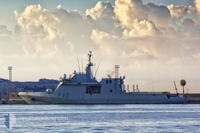
ESP RAYO P42
Military ops
Current Trip
| Trip Time | 11 days |
|---|---|
| Trip Distance | 1088.47 nm |
| AVG Speed | 10.5 Knop |
| MAX Speed | 16.9 Knop |
| Djupgående | 0 m |
| AVG Wind | 13.5 knots |
| MAX Wind | 22.3 knots |
| MIN Temp | 21.6°C / 70.88°F |
| MAX Temp | 28.3°C / 82.94°F |
| Position mottagen | 7 d sen |
Current Position
| Longitud | --- |
|---|---|
| Latitude | --- |
| Status | Under way using engine |
| Fart | 8.2 Knop |
| Kurs | 121° |
| Område | North Atlantic Ocean |
| Station | T-AIS |
| Position mottagen | 7 d sen |
Info
Information
The current position of ESP RAYO P42 is in North Atlantic Ocean with coordinates 16.71790° / -24.96202° as reported on 2025-12-02 12:21 by AIS to our vessel tracker app. The vessel's current speed is 8.2 Knop and is currently inside the port of NOUAKCHOTT.
The vessel ESP RAYO P42 (MMSI: 224139770) is a Military ops It's sailing under the flag of [ES] Spain.
In this page you can find informations about the vessels current position, last detected port calls, and current voyage information. If the vessels is not in coverage by AIS you will find the latest position.
The current position of ESP RAYO P42 is detected by our AIS receivers and we are not responsible for the reliability of the data. The last position was recorded while the vessel was in Coverage by the Ais receivers of our vessel tracking app.
Weather
| Temperature | 21.8°C / 71.24°F |
|---|---|
| Wind Speed | 11 knots |
| Direction | 22° NNE |
| Pressure | 1016.5 hPa |
| Humidity | 42.5 % |
| Cloud Coverage | 100 % |
Featured Company
Most Visited Ports (Last year)
| Port | Arrivals | |
|---|---|---|
| 2 | ||
| 1 | ||
| 1 | ||
| 1 | ||
| 1 | ||
| 1 |
Last Trips
| Origin | Departure | Destination | Arrival | Distance | |
|---|---|---|---|---|---|
| 2025-11-24 09:56 | 2025-12-06 09:17 | 1088.47 nm | |||
| 2025-11-05 09:55 | 2025-11-18 09:36 | 2786.09 nm | |||
| 2025-10-25 12:19 | 2025-10-30 08:19 | 840.99 nm | |||
| 2025-10-13 09:32 | 2025-10-20 08:39 | 730.34 nm | |||
| 2025-09-30 11:00 | 2025-10-07 08:44 | 357.47 nm |
Events
| Tid | Event | Detaljer | Position / Dest | Information |
|---|---|---|---|---|
| 2025-12-06 09:22 | STOPPAR förflyttning |
17.98603 / -16.02837
[MR] NOUAKCHOTT
|
Fart: Kurs: 78° |
|
| 2025-12-06 09:17 | ANLÄNDER HAMN |
|
17.98600 / -16.02878
[MR] NOUAKCHOTT
|
Fart: 5.3 kn Kurs: 92° |
| 2025-12-02 12:29 | Status ändrad | Default Under way using engine |
16.70510 / -24.93907
|
Fart: 8.2 kn Kurs: 121° |
| 2025-12-02 12:21 | UTANFÖR täckningsområde |
16.71790 / -24.96202
North Atlantic Ocean
|
Fart: 8.2 kn Kurs: 121° |
|
| 2025-12-02 12:15 | Status ändrad | Under way using engine Default |
16.72575 / -24.97630
|
Fart: 10.7 kn Kurs: 120° |
| 2025-12-02 12:07 | Status ändrad | Default Under way using engine |
16.73793 / -24.99828
|
Fart: 10.9 kn Kurs: 122.7° |
| 2025-12-02 12:04 | Status ändrad | Under way using engine Default |
16.74365 / -25.00825
|
Fart: 11 kn Kurs: 123° |
| 2025-12-02 12:01 | Status ändrad | Default Under way using engine |
16.74767 / -25.01493
|
Fart: 10.9 kn Kurs: 119.3° |
| 2025-12-02 11:56 | Status ändrad | Under way using engine Default |
16.75643 / -25.03015
|
Fart: 11.6 kn Kurs: 119° |
| 2025-12-02 11:53 | Status ändrad | Default Under way using engine |
16.75987 / -25.03633
|
Fart: 11.4 kn Kurs: 121.1° |