
ERRIKOS
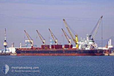
Bulk Carrier
Current Trip
TW TXG
| Time Travelled | 12 h, 48 mins |
|---|---|
| Remaining Time | --- |
| Distance Travelled | 136.19 nm |
| Remaining Distance | --- |
| AVG Speed | 11.8 Knop |
| MAX Speed | 13.6 Knop |
| AVG Wind | 14.9 knots |
| MAX Wind | 22 knots |
| MIN Temp | 23.6°C / 74.48°F |
| MAX Temp | 25.4°C / 77.72°F |
| Djupgående | 7.5 m |
| Position mottagen | 4 d sen |
Current Position
| Longitud | 119.88981° |
|---|---|
| Latitude | 23.66558° |
| Status | Under way using engine |
| Fart | 16.3 Knop |
| Kurs | 5.1° |
| Område | South China Sea |
| Station | T-AIS |
| Position mottagen | 4 d sen |
Info
Information
The current position of ERRIKOS is in South China Sea with coordinates 23.66558° / 119.88981° as reported on 2024-04-29 18:04 by AIS to our vessel tracker app. The vessel's current speed is 16.3 Knop
The vessel ERRIKOS (IMO: 9624500, MMSI: 538005376) is a Bulk Carrier that was built in 2014 ( 10 År gammal ). It's sailing under the flag of [MH] Marshall Is.
In this page you can find informations about the vessels current position, last detected port calls, and current voyage information. If the vessels is not in coverage by AIS you will find the latest position.
The current position of ERRIKOS is detected by our AIS receivers and we are not responsible for the reliability of the data. The last position was recorded while the vessel was in Coverage by the Ais receivers of our vessel tracking app.
The current draught of ERRIKOS as reported by AIS is 7.5 meters
Weather
| Temperature | 25.7°C / 78.26°F |
|---|---|
| Wind Speed | 9 knots |
| Direction | 30° NNE |
| Pressure | 1012.2 hPa |
| Humidity | 83.6 % |
| Cloud Coverage | 95 % |
Featured Company
Events
| Tid | Event | Detaljer | Position / Dest | Information |
|---|---|---|---|---|
| 2024-05-03 12:12 | AVGÅTT HAMN |
|
24.29473 / 120.49321
TW TXG
|
Fart: 8.5 kn Kurs: 296° |
| 2024-05-03 11:44 | STARTAR förflyttning |
24.23869 / 120.48882
[TW] TAICHUNG
|
Fart: 6.2 kn Kurs: 28° |
|
| 2024-04-30 01:12 | STOPPAR förflyttning |
24.23453 / 120.48890
[TW] TAICHUNG
|
Fart: 0.3 kn Kurs: 200° |
|
| 2024-04-30 00:18 | ANLÄNDER HAMN |
|
24.29194 / 120.50165
[TW] TAICHUNG
|
Fart: 6.3 kn Kurs: 76° |
| 2024-04-29 18:12 | Status ändrad | Default Under way using engine |
23.70230 / 119.89317
TW TXG
|
Fart: 16.3 kn Kurs: 5.1° |
| 2024-04-29 18:04 | UTANFÖR täckningsområde |
23.66558 / 119.88981
South China Sea
TW TXG
|
Fart: 16.3 kn Kurs: 5.1° |
|
| 2024-04-29 17:51 | Status ändrad | Under way using engine Default |
23.60608 / 119.88627
TW TXG
|
Fart: 16.2 kn Kurs: 3° |
| 2024-04-29 17:48 | Status ändrad | Default Under way using engine |
23.59329 / 119.88561
TW TXG
|
Fart: 16.1 kn Kurs: 353.9° |
| 2024-04-29 16:52 | Status ändrad | Under way using engine Default |
23.34778 / 119.91953
TW TXG
|
Fart: 15.8 kn Kurs: 352° |
| 2024-04-29 16:47 | Status ändrad | Default Under way using engine |
23.32281 / 119.92396
TW TXG
|
Fart: 15.7 kn Kurs: 352.3° |