

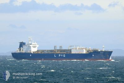
EMPERY
Tanker

Current Trip
| Time Travelled | 9 days |
|---|---|
| Remaining Time | --- |
| Distance Travelled | 2398.51 nm |
| Remaining Distance | --- |
| AVG Speed | 11 Knop |
| MAX Speed | 17.4 Knop |
| AVG Wind | 18.2 knots |
| MAX Wind | 39.7 knots |
| MIN Temp | 1.4°C / 34.52°F |
| MAX Temp | 16.3°C / 61.34°F |
| Djupgående | 7.2 m |
| Position mottagen | 5 d sen |
Current Position
| Longitud | --- |
|---|---|
| Latitude | --- |
| Status | Under way using engine |
| Fart | 11.9 Knop |
| Kurs | 229.8° |
| Område | Celtic Sea |
| Station | T-AIS |
| Position mottagen | 5 d sen |
Information
The current position of EMPERY is in Celtic Sea with coordinates 49.66485° / -5.52365° as reported on 2025-03-20 04:38 by AIS to our vessel tracker app. The vessel's current speed is 11.9 Knop and is heading at the port of MARCUS HOOK. The estimated time of arrival as calculated by MyShipTracking vessel tracking app is 2025-03-30 08:00 LT
The vessel EMPERY (IMO: 9744910, MMSI: 564011000) is a Tanker It's sailing under the flag of [SG] Singapore.
In this page you can find informations about the vessels current position, last detected port calls, and current voyage information. If the vessels is not in coverage by AIS you will find the latest position.
The current position of EMPERY is detected by our AIS receivers and we are not responsible for the reliability of the data. The last position was recorded while the vessel was in Coverage by the Ais receivers of our vessel tracking app.
The current draught of EMPERY as reported by AIS is 7.2 meters
Weather
| Temperature | 12.4°C / 54.32°F |
|---|---|
| Wind Speed | 28 knots |
| Direction | 297° WNW |
| Pressure | 1024.9 hPa |
| Humidity | 64.3 % |
| Cloud Coverage | 100 % |


Featured Company
Last Port Calls
| Port | Arrival | Departure | Time In Port |
|---|---|---|---|
| 2025-03-14 14:11 | 2025-03-16 01:27 | 1 d | |
| 2025-03-01 08:51 | 2025-03-02 19:02 | 1 d | |
| 2025-02-09 11:43 | 2025-02-11 12:19 | 2 d | |
| 2025-01-24 04:24 | 2025-01-25 16:08 | 1 d | |
| 2025-01-07 11:38 | 2025-01-08 13:01 | 1 d |
Most Visited Ports (Last year)
| Port | Arrivals | |
|---|---|---|
| 11 | ||
| 9 | ||
| 5 | ||
| 2 |
Last Trips
| Origin | Departure | Destination | Arrival | Distance | |
|---|---|---|---|---|---|
| 2025-03-02 19:02 | 2025-03-14 14:11 | 3674.01 nm | |||
| 2025-02-11 12:19 | 2025-03-01 08:51 | 5575.31 nm | |||
| 2025-01-25 16:08 | 2025-02-09 11:43 | 4453.80 nm | |||
| 2025-01-08 13:01 | 2025-01-24 04:24 | 4833.97 nm | |||
| 2024-12-25 19:23 | 2025-01-07 11:38 | 3780.02 nm |
Events
| Tid | Event | Detaljer | Position / Dest | Information |
|---|---|---|---|---|
| 2025-03-20 04:44 | Status ändrad | Default Under way using engine |
49.65296 / -5.54460
USMAH
|
Fart: 11.9 kn Kurs: 229.8° |
| 2025-03-20 04:38 | UTANFÖR täckningsområde |
49.66485 / -5.52365
Celtic Sea
USMAH
|
Fart: 11.9 kn Kurs: 229.8° |
|
| 2025-03-20 04:13 | Byter havsområde | United Kingdom part of the Celtic Sea United Kingdom part of the English Channel |
49.71773 / -5.43250
Celtic Sea
USMAH
|
Fart: 11.5 kn Kurs: 229.2° |
| 2025-03-20 01:22 | STARTAR förflyttning | 0.79 nm, South East of MYLOR |
50.16719 / -5.04089
USMAH
|
Fart: 3.5 kn Kurs: 156° |
| 2025-03-20 00:33 | Djupgående ändrat | 7.2 6.9 |
50.16874 / -5.04075
USMAH
|
Fart: 0.1 kn Kurs: 56° |
| 2025-03-20 00:33 | ETA ändrat | 2025/03/30 12:00 2025/03/18 12:00 |
50.16874 / -5.04075
USMAH
|
Fart: 0.1 kn Kurs: 56° |
| 2025-03-20 00:31 | Status ändrad | Under way using engine At anchor |
50.16873 / -5.04070
USMAH
|
Fart: 0.1 kn Kurs: 63° |
| 2025-03-20 00:31 | Destination ändrad | USMAH GBFAL |
50.16890 / -5.04045
USMAH
|
Fart: 0.1 kn Kurs: 63° |
| 2025-03-19 22:47 | Status ändrad | At anchor Default |
50.16857 / -5.04042
GBFAL
|
Fart: Kurs: 45° |
| 2025-03-19 22:41 | Status ändrad | Default At anchor |
50.16858 / -5.04043
GBFAL
|
Fart: Kurs: 45° |