

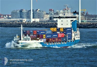
ELISABETH
Container Ship

Current Trip
| Time Travelled | 1 day |
|---|---|
| Remaining Time | 6 h, 59 mins |
| Distance Travelled | 376.18 nm |
| Remaining Distance | 290.27 nm |
| AVG Speed | 12.2 Knop |
| MAX Speed | 14.4 Knop |
| AVG Wind | 11.6 knots |
| MAX Wind | 28 knots |
| MIN Temp | -5.9°C / 21.38°F |
| MAX Temp | 4.3°C / 39.74°F |
| Djupgående | 6.8 m |
| Position mottagen | 18 h, 0 m sen |
Current Position
| Longitud | --- |
|---|---|
| Latitude | --- |
| Status | Under way using engine |
| Fart | 11.7 Knop |
| Kurs | 209.1° |
| Område | North Sea |
| Station | T-AIS |
| Position mottagen | 18 h, 0 m sen |
Information
The current position of ELISABETH is in North Sea with coordinates 56.08123° / 6.98426° as reported on 2025-02-19 14:56 by AIS to our vessel tracker app. The vessel's current speed is 11.7 Knop and is heading at the port of ROTTERDAM. The estimated time of arrival as calculated by MyShipTracking vessel tracking app is 2025-02-20 15:55 LT
The vessel ELISABETH (IMO: 9219862, MMSI: 246497000) is a Container Ship that was built in 2000 ( 25 År gammal ). It's sailing under the flag of [NL] Netherlands.
In this page you can find informations about the vessels current position, last detected port calls, and current voyage information. If the vessels is not in coverage by AIS you will find the latest position.
The current position of ELISABETH is detected by our AIS receivers and we are not responsible for the reliability of the data. The last position was recorded while the vessel was in Coverage by the Ais receivers of our vessel tracking app.
The current draught of ELISABETH as reported by AIS is 6.8 meters
Weather
| Temperature | 5.2°C / 41.36°F |
|---|---|
| Wind Speed | 18 knots |
| Direction | 173° S |
| Pressure | 1016.9 hPa |
| Humidity | 94.2 % |
| Cloud Coverage | 100 % |


Featured Company
Last Port Calls
| Port | Arrival | Departure | Time In Port |
|---|---|---|---|
| 2025-02-18 07:53 | 2025-02-18 20:18 | 12 h | |
| 2025-02-16 23:50 | 2025-02-18 01:30 | 1 d | |
| 2025-02-14 19:44 | 2025-02-15 09:40 | 13 h | |
| 2025-02-13 13:03 | 2025-02-14 17:53 | 1 d | |
| 2025-02-11 16:42 | 2025-02-13 11:29 | 1 d | |
| 2025-02-07 20:31 | 2025-02-08 20:47 | 1 d | |
| 2025-02-05 06:49 | 2025-02-06 07:38 | 1 d | |
| 2025-02-04 00:03 | 2025-02-05 06:45 | 1 d | |
| 2025-02-03 15:51 | 2025-02-03 22:52 | 7 h | |
| 2025-02-01 16:58 | 2025-02-02 01:45 | 8 h |
Most Visited Ports (Last year)
| Port | Arrivals | |
|---|---|---|
| 37 | ||
| 25 | ||
| 24 | ||
| 24 | ||
| 18 | ||
| 15 |
Last Trips
| Origin | Departure | Destination | Arrival | Distance | |
|---|---|---|---|---|---|
| 2025-02-18 02:30 | 2025-02-18 08:53 | 54.45 nm | |||
| 2025-02-15 10:40 | 2025-02-17 00:50 | 485.75 nm | |||
| 2025-02-14 18:53 | 2025-02-14 20:44 | 15.99 nm | |||
| 2025-02-13 12:29 | 2025-02-13 14:03 | 16.25 nm | |||
| 2025-02-08 20:47 | 2025-02-11 17:42 | 410.23 nm | |||
| 2025-02-06 08:38 | 2025-02-07 20:31 | 396.58 nm | |||
| 2025-02-05 07:45 | 2025-02-05 07:49 | 0.59 nm | |||
| 2025-02-03 23:52 | 2025-02-04 01:03 | 15.40 nm | |||
| 2025-02-02 02:45 | 2025-02-03 16:51 | 505.08 nm | |||
| 2025-02-01 03:16 | 2025-02-01 17:58 | 202.89 nm |
Events
| Tid | Event | Detaljer | Position / Dest | Information |
|---|---|---|---|---|
| 2025-02-19 15:00 | Status ändrad | Default Under way using engine |
56.06741 / 6.96975
NLRTM
|
Fart: 11.7 kn Kurs: 209.1° |
| 2025-02-19 14:56 | Status ändrad | Under way using engine Default |
56.08123 / 6.98426
NLRTM
|
Fart: 11.5 kn Kurs: 210° |
| 2025-02-19 14:56 | UTANFÖR täckningsområde |
56.08123 / 6.98426
North Sea
NLRTM
|
Fart: 11.7 kn Kurs: 209.1° |
|
| 2025-02-19 14:46 | Status ändrad | Default Under way using engine |
56.10845 / 7.01318
NLRTM
|
Fart: 11.6 kn Kurs: 210.5° |
| 2025-02-19 14:32 | Status ändrad | Under way using engine Default |
56.14798 / 7.05369
NLRTM
|
Fart: 11.7 kn Kurs: 210° |
| 2025-02-19 14:11 | Status ändrad | Default Under way using engine |
56.20628 / 7.11062
NLRTM
|
Fart: 11.7 kn Kurs: 211° |
| 2025-02-19 14:08 | Status ändrad | Under way using engine Default |
56.21375 / 7.11851
NLRTM
|
Fart: 11.8 kn Kurs: 210° |
| 2025-02-19 14:08 | I täckningsområde |
56.21375 / 7.11851
North Sea
NLRTM
|
Fart: 11.7 kn Kurs: 211° |
|
| 2025-02-19 12:25 | Status ändrad | Default Under way using engine |
56.49925 / 7.42693
NLRTM
|
Fart: 11.7 kn Kurs: 209.8° |
| 2025-02-19 12:22 | UTANFÖR täckningsområde |
56.50797 / 7.43617
North Sea
NLRTM
|
Fart: 11.7 kn Kurs: 209.8° |