

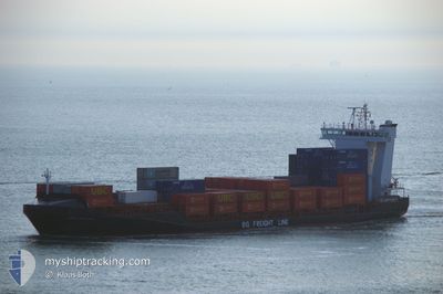
ELBSTROM
Container Ship

Current Trip
| Trip Time | 1 day |
|---|---|
| Trip Distance | 213.31 nm |
| AVG Speed | 10.2 Knop |
| MAX Speed | 15.8 Knop |
| Djupgående | 5.9 m |
| AVG Wind | 5 knots |
| MAX Wind | 8 knots |
| MIN Temp | 4.8°C / 40.64°F |
| MAX Temp | 8.2°C / 46.76°F |
| Position mottagen | 2 m sen |
Current Position
| Longitud | --- |
|---|---|
| Latitude | --- |
| Status | Moored |
| Fart | |
| Kurs | 263° |
| Område | North Sea |
| Station | T-AIS |
| Position mottagen | 2 m sen |
Information
The current position of ELBSTROM is in North Sea with coordinates 51.88143° / 4.40144° as reported on 2025-03-27 15:40 by AIS to our vessel tracker app. The vessel's current speed is 0 Knop and is currently inside the port of ROTTERDAM PERNIS.
The vessel ELBSTROM (IMO: 9369007, MMSI: 255805577) is a Container Ship that was built in 2008 ( 17 År gammal ). It's sailing under the flag of [PT] Portugal.
In this page you can find informations about the vessels current position, last detected port calls, and current voyage information. If the vessels is not in coverage by AIS you will find the latest position.
The current position of ELBSTROM is detected by our AIS receivers and we are not responsible for the reliability of the data. The last position was recorded while the vessel was in Coverage by the Ais receivers of our vessel tracking app.
The current draught of ELBSTROM as reported by AIS is 5.9 meters
Weather
| Temperature | 14.9°C / 58.82°F |
|---|---|
| Wind Speed | 6 knots |
| Direction | 256° WSW |
| Pressure | 1018.7 hPa |
| Humidity | 41.3 % |
| Cloud Coverage | 6 % |


Featured Company
Last Port Calls
| Port | Arrival | Departure | Time In Port |
|---|---|---|---|
| 2025-03-27 05:21 | |||
| 2025-03-25 06:02 | 2025-03-25 23:11 | 17 h | |
| 2025-03-21 11:25 | 2025-03-21 21:06 | 9 h | |
| 2025-03-19 20:06 | 2025-03-20 12:01 | 15 h | |
| 2025-03-18 05:09 | 2025-03-18 22:23 | 17 h | |
| 2025-03-14 10:11 | 2025-03-14 10:22 | 11 m | |
| 2025-03-13 12:44 | |||
| 2025-03-12 02:24 | 2025-03-12 19:50 | 17 h | |
| 2025-03-07 14:58 | 2025-03-08 01:01 | 10 h | |
| 2025-03-05 20:57 | 2025-03-06 16:41 | 19 h |
Most Visited Ports (Last year)
| Port | Arrivals | |
|---|---|---|
| 33 | ||
| 19 | ||
| 19 | ||
| 19 | ||
| 18 | ||
| 8 |
Last Trips
| Origin | Departure | Destination | Arrival | Distance | |
|---|---|---|---|---|---|
| 2025-03-25 23:11 | 2025-03-27 05:21 | 213.31 nm | |||
| 2025-03-21 21:06 | 2025-03-25 06:02 | 945.78 nm | |||
| 2025-03-20 12:01 | 2025-03-21 11:25 | 247.84 nm | |||
| 2025-03-18 22:23 | 2025-03-19 20:06 | 325.05 nm | |||
| 2025-03-14 10:22 | 2025-03-18 05:09 | 1177.29 nm | |||
| 2025-03-12 19:50 | 2025-03-14 10:11 | 204.01 nm | |||
| 2025-03-12 19:50 | 2025-03-13 12:44 | 203.64 nm | |||
| 2025-03-08 01:01 | 2025-03-12 02:24 | 951.56 nm | |||
| 2025-03-06 16:41 | 2025-03-07 14:58 | 243.85 nm | |||
| 2025-03-05 00:05 | 2025-03-05 20:57 | 314.01 nm |
Events
| Tid | Event | Detaljer | Position / Dest | Information |
|---|---|---|---|---|
| 2025-03-27 04:33 | Status ändrad | Moored Under way using engine |
51.88143 / 4.40143
[NL] ROTTERDAM PERNIS
|
Fart: Kurs: 263° |
| 2025-03-27 04:21 | STOPPAR förflyttning |
51.88131 / 4.40147
[NL] ROTTERDAM PERNIS
|
Fart: 0.3 kn Kurs: 264° |
|
| 2025-03-27 04:21 | ANLÄNDER HAMN |
|
51.88133 / 4.40146
[NL] ROTTERDAM PERNIS
|
Fart: 0.7 kn Kurs: 261° |
| 2025-03-27 00:41 | STARTAR förflyttning | 16.95 nm, North West of BROUWERSDAM |
51.90311 / 3.44856
NLRTM
|
Fart: 5.8 kn Kurs: 347.6° |
| 2025-03-27 00:35 | Status ändrad | Under way using engine At anchor |
51.90098 / 3.45044
NLRTM
|
Fart: 0.6 kn Kurs: 227° |
| 2025-03-27 00:27 | Status ändrad | At anchor Default |
51.90142 / 3.45091
NLRTM
|
Fart: 0.1 kn Kurs: 228° |
| 2025-03-27 00:21 | Status ändrad | Default At anchor |
51.90186 / 3.45136
NLRTM
|
Fart: 0.1 kn Kurs: 229° |
| 2025-03-26 23:57 | Status ändrad | At anchor Default |
51.90185 / 3.45137
NLRTM
|
Fart: 0.1 kn Kurs: 231° |
| 2025-03-26 23:45 | Status ändrad | Default At anchor |
51.90179 / 3.45149
NLRTM
|
Fart: 0.1 kn Kurs: 234° |
| 2025-03-26 23:36 | Status ändrad | At anchor Default |
51.90174 / 3.45157
NLRTM
|
Fart: Kurs: 234° |