
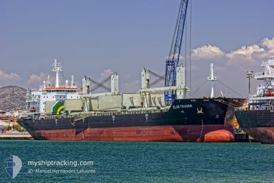
ELAR TRADER
Bulk Carrier
Current Trip
MRNKC
| Time Travelled | 1 day |
|---|---|
| Remaining Time | --- |
| Distance Travelled | 5.99 nm |
| Remaining Distance | --- |
| AVG Speed | 5 Knop |
| MAX Speed | 6.9 Knop |
| AVG Wind | 11.8 knots |
| MAX Wind | 15.8 knots |
| MIN Temp | 21.4°C / 70.52°F |
| MAX Temp | 30.8°C / 87.44°F |
| Djupgående | 10.6 m |
| Position mottagen | 8 d sen |
Current Position
| Longitud | --- |
|---|---|
| Latitude | --- |
| Status | At anchor |
| Fart | |
| Kurs | --- |
| Område | North Atlantic Ocean |
| Station | T-AIS |
| Position mottagen | 8 d sen |
Info
Information
The current position of ELAR TRADER is in North Atlantic Ocean with coordinates 17.95618° / -16.14616° as reported on 2024-11-23 07:48 by AIS to our vessel tracker app. The vessel's current speed is 0 Knop
The vessel ELAR TRADER (IMO: 9409534, MMSI: 311037100) is a Bulk Carrier that was built in 2010 ( 14 År gammal ). It's sailing under the flag of [BS] Bahamas.
In this page you can find informations about the vessels current position, last detected port calls, and current voyage information. If the vessels is not in coverage by AIS you will find the latest position.
The current position of ELAR TRADER is detected by our AIS receivers and we are not responsible for the reliability of the data. The last position was recorded while the vessel was in Coverage by the Ais receivers of our vessel tracking app.
The current draught of ELAR TRADER as reported by AIS is 10.6 meters
Weather
| Temperature | 23.9°C / 75.02°F |
|---|---|
| Wind Speed | 15 knots |
| Direction | 73° ENE |
| Pressure | 1017.3 hPa |
| Humidity | 28.4 % |
| Cloud Coverage | 100 % |
Featured Company
Last Port Calls
| Port | Arrival | Departure | Time In Port |
|---|---|---|---|
| 2024-11-24 20:17 | 2024-11-29 10:52 | 4 d | |
| 2024-11-03 13:54 | 2024-11-15 17:51 | 12 d | |
| 2024-10-23 18:38 | 2024-10-26 10:34 | 2 d | |
| 2024-10-16 01:17 | 2024-10-20 03:54 | 4 d | |
| 2024-10-08 03:57 | 2024-10-10 23:29 | 2 d | |
| 2024-10-04 15:03 |
Most Visited Ports (Last year)
| Port | Arrivals | |
|---|---|---|
| 5 | ||
| 4 | ||
| 3 | ||
| 2 | ||
| 2 | ||
| 1 |
Last Trips
| Origin | Departure | Destination | Arrival | Distance | |
|---|---|---|---|---|---|
| 2024-11-15 18:51 | 2024-11-24 20:17 | 1694.79 nm | |||
| 2024-10-26 12:34 | 2024-11-03 14:54 | 304.03 nm | |||
| 2024-10-20 04:54 | 2024-10-23 20:38 | 902.69 nm | |||
| 2024-10-11 01:29 | 2024-10-16 02:17 | 939.52 nm | |||
| 2024-10-04 16:03 | 2024-10-08 05:57 | 906.63 nm |
Events
| Tid | Event | Detaljer | Position / Dest | Information |
|---|---|---|---|---|
| 2024-11-29 11:58 | STOPPAR förflyttning | 5.39 nm, West of NOUAKCHOTT |
17.97693 / -16.12339
MRNKC
|
Fart: 0.2 kn Kurs: 71° |
| 2024-11-29 10:52 | AVGÅTT HAMN |
|
17.98463 / -16.05377
MRNKC
|
Fart: 3.6 kn Kurs: 262° |
| 2024-11-29 10:38 | STARTAR förflyttning |
17.98706 / -16.03600
[MR] NOUAKCHOTT
|
Fart: 3.2 kn Kurs: 249° |
|
| 2024-11-24 20:37 | STOPPAR förflyttning |
17.98695 / -16.02838
[MR] NOUAKCHOTT
|
Fart: Kurs: 94° |
|
| 2024-11-24 20:17 | ANLÄNDER HAMN |
|
17.98672 / -16.03569
[MR] NOUAKCHOTT
|
Fart: 4.2 kn Kurs: 80° |
| 2024-11-24 19:39 | STARTAR förflyttning | 3.61 nm, West of NOUAKCHOTT |
17.97883 / -16.09234
MRNKC
|
Fart: 4.4 kn Kurs: 69° |
| 2024-11-24 18:24 | STOPPAR förflyttning | 4.82 nm, West of NOUAKCHOTT |
17.96583 / -16.11082
MRNKC
|
Fart: 0.3 kn Kurs: 17° |
| 2024-11-24 18:04 | STARTAR förflyttning | 5.21 nm, West of NOUAKCHOTT |
17.95721 / -16.11502
MRNKC
|
Fart: 3.3 kn Kurs: 20° |
| 2024-11-23 14:23 | STOPPAR förflyttning | 6.01 nm, West of NOUAKCHOTT |
17.95767 / -16.12996
MRNKC
|
Fart: 0.1 kn Kurs: 331° |
| 2024-11-23 12:01 | STARTAR förflyttning | 6.37 nm, West of NOUAKCHOTT |
17.96234 / -16.13792
MRNKC
|
Fart: 3.9 kn Kurs: 75° |