
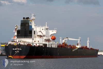
ELAN VITAL
Crude Oil Tanker
Current Trip
| Time Travelled | 1 day |
|---|---|
| Remaining Time | --- |
| Distance Travelled | 505.61 nm |
| Remaining Distance | --- |
| AVG Speed | 11.8 Knop |
| MAX Speed | 13.4 Knop |
| AVG Wind | 8.4 knots |
| MAX Wind | 14 knots |
| MIN Temp | 2.4°C / 36.32°F |
| MAX Temp | 7.8°C / 46.04°F |
| Djupgående | 13.9 m |
| Position mottagen | Nu |
Current Position
| Longitud | 16.83137° |
|---|---|
| Latitude | 55.86039° |
| Status | Under way using engine |
| Fart | 12 Knop |
| Kurs | 258.7° |
| Område | Baltic Sea |
| Station | T-AIS |
| Position mottagen | Nu |
Info
Information
The current position of ELAN VITAL is in Baltic Sea with coordinates 55.86039° / 16.83137° as reported on 2024-04-28 05:20 by AIS to our vessel tracker app. The vessel's current speed is 12 Knop and is heading at the port of EREGLI. The estimated time of arrival as calculated by MyShipTracking vessel tracking app is 2024-05-12 12:00 LT
The vessel ELAN VITAL (IMO: 9252943, MMSI: 538001893) is a Crude Oil Tanker that was built in 2003 ( 21 År gammal ). It's sailing under the flag of [MH] Marshall Is.
In this page you can find informations about the vessels current position, last detected port calls, and current voyage information. If the vessels is not in coverage by AIS you will find the latest position.
The current position of ELAN VITAL is detected by our AIS receivers and we are not responsible for the reliability of the data. The last position was recorded while the vessel was in Coverage by the Ais receivers of our vessel tracking app.
The current draught of ELAN VITAL as reported by AIS is 13.9 meters
Weather
| Temperature | 7.7°C / 45.86°F |
|---|---|
| Wind Speed | 14 knots |
| Direction | 148° SSE |
| Pressure | 1016.8 hPa |
| Humidity | 81.5 % |
| Cloud Coverage | 67 % |
Featured Company
Last Trips
| Origin | Departure | Destination | Arrival | Distance | |
|---|---|---|---|---|---|
| 2024-02-04 15:10 | 2024-04-25 00:19 | 4863.82 nm | |||
| 2024-01-19 11:06 | 2024-02-02 20:21 | 3059.98 nm |
Events
| Tid | Event | Detaljer | Position / Dest | Information |
|---|---|---|---|---|
| 2024-04-28 04:39 | Destination ändrad | EREGLISI MARMARA EREGLISI |
55.89260 / 17.06632
EREGLISI MARMARA
|
Fart: 11.8 kn Kurs: 255.1° |
| 2024-04-28 04:39 | ETA ändrat | 2024/05/12 12:00 2024/05/12 00:00 |
55.89260 / 17.06632
EREGLISI MARMARA
|
Fart: 11.8 kn Kurs: 255.1° |
| 2024-04-28 02:58 | Status ändrad | Under way using engine Default |
55.97366 / 17.62596
EREGLISI
|
Fart: 11.6 kn Kurs: 260° |
| 2024-04-28 02:08 | Status ändrad | Default Under way using engine |
56.05239 / 17.88162
EREGLISI
|
Fart: 11.9 kn Kurs: 239.6° |
| 2024-04-28 01:59 | Status ändrad | Under way using engine Default |
56.06889 / 17.93009
EREGLISI
|
Fart: 11.9 kn Kurs: 236° |
| 2024-04-28 01:24 | Status ändrad | Default Under way using engine |
56.13018 / 18.10064
EREGLISI
|
Fart: 11.9 kn Kurs: 238.4° |
| 2024-04-28 01:08 | Byter havsområde | Swedish part of the Baltic Sea Estonian part of the Baltic Sea |
56.15865 / 18.18150
Baltic Sea
EREGLISI
|
Fart: 11.8 kn Kurs: 239.5° |
| 2024-04-28 01:08 | Status ändrad | Under way using engine Default |
56.15865 / 18.18150
EREGLISI
|
Fart: 11.7 kn Kurs: 238° |
| 2024-04-28 01:00 | I täckningsområde |
56.15865 / 18.18150
Baltic Sea
EREGLISI
|
Fart: 11.8 kn Kurs: 239.5° |
|
| 2024-04-27 07:22 | UTANFÖR täckningsområde |
59.14893 / 21.62021
Baltic Sea
EREGLISI
|
Fart: 12.3 kn Kurs: 230.5° |