

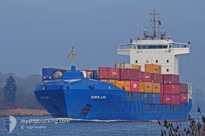
DREAM
Container Ship

Current Trip
| Time Travelled | 6 h, 57 mins |
|---|---|
| Remaining Time | --- |
| Distance Travelled | 82.96 nm |
| Remaining Distance | --- |
| AVG Speed | 13.9 Knop |
| MAX Speed | 15.5 Knop |
| AVG Wind | 15.7 knots |
| MAX Wind | 19 knots |
| MIN Temp | 16.5°C / 61.7°F |
| MAX Temp | 17.9°C / 64.22°F |
| Djupgående | 5.9 m |
| Position mottagen | 5 m sen |
Current Position
| Longitud | --- |
|---|---|
| Latitude | --- |
| Status | Under way using engine |
| Fart | 14.2 Knop |
| Kurs | 42° |
| Område | North Atlantic Ocean |
| Station | T-AIS |
| Position mottagen | 5 m sen |
Information
The current position of DREAM is in North Atlantic Ocean with coordinates 29.58395° / -14.92034° as reported on 2025-03-26 03:08 by AIS to our vessel tracker app. The vessel's current speed is 14.2 Knop
The vessel DREAM (IMO: 9322578, MMSI: 255805838) is a Container Ship that was built in 2006 ( 19 År gammal ). It's sailing under the flag of [PT] Portugal.
In this page you can find informations about the vessels current position, last detected port calls, and current voyage information. If the vessels is not in coverage by AIS you will find the latest position.
The current position of DREAM is detected by our AIS receivers and we are not responsible for the reliability of the data. The last position was recorded while the vessel was in Coverage by the Ais receivers of our vessel tracking app.
The current draught of DREAM as reported by AIS is 5.9 meters
Weather
| Temperature | 16.6°C / 61.88°F |
|---|---|
| Wind Speed | 16 knots |
| Direction | 35° NE |
| Pressure | 1022.2 hPa |
| Humidity | 70.4 % |
| Cloud Coverage | 100 % |


Featured Company
Last Port Calls
| Port | Arrival | Departure | Time In Port |
|---|---|---|---|
| 2025-03-25 08:47 | 2025-03-25 20:16 | 11 h | |
| 2025-03-25 01:11 | 2025-03-25 05:10 | 3 h | |
| 2025-03-22 19:01 | 2025-03-23 05:31 | 10 h | |
| 2025-03-21 19:50 | 2025-03-22 12:26 | 16 h | |
| 2025-03-18 12:36 | 2025-03-18 20:09 | 7 h | |
| 2025-03-18 03:30 | 2025-03-18 08:35 | 5 h | |
| 2025-03-15 15:37 | 2025-03-16 05:36 | 13 h | |
| 2025-03-14 16:55 | 2025-03-15 06:47 | 13 h | |
| 2025-03-11 15:21 | 2025-03-12 01:13 | 9 h | |
| 2025-03-11 08:07 | 2025-03-11 11:44 | 3 h |
Most Visited Ports (Last year)
| Port | Arrivals | |
|---|---|---|
| 51 | ||
| 51 | ||
| 51 | ||
| 49 | ||
| 1 | ||
| 1 |
Last Trips
| Origin | Departure | Destination | Arrival | Distance | |
|---|---|---|---|---|---|
| 2025-03-25 05:10 | 2025-03-25 08:47 | 54.18 nm | |||
| 2025-03-23 05:31 | 2025-03-25 01:11 | 688.95 nm | |||
| 2025-03-22 12:26 | 2025-03-22 19:01 | 68.50 nm | |||
| 2025-03-18 20:09 | 2025-03-21 19:50 | 841.03 nm | |||
| 2025-03-18 08:35 | 2025-03-18 12:36 | 54.61 nm | |||
| 2025-03-16 05:36 | 2025-03-18 03:30 | 725.12 nm | |||
| 2025-03-15 06:47 | 2025-03-15 15:37 | 68.73 nm | |||
| 2025-03-12 01:13 | 2025-03-14 16:55 | 876.29 nm | |||
| 2025-03-11 11:44 | 2025-03-11 15:21 | 54.32 nm | |||
| 2025-03-09 05:31 | 2025-03-11 08:07 | 690.23 nm |
Events
| Tid | Event | Detaljer | Position / Dest | Information |
|---|---|---|---|---|
| 2025-03-26 03:06 | Status ändrad | Under way using engine Default |
29.57997 / -14.92441
ESSVQ
|
Fart: 14.7 kn Kurs: 42° |
| 2025-03-26 02:23 | Status ändrad | Default Under way using engine |
29.44824 / -15.05823
ESSVQ
|
Fart: 14 kn Kurs: 42.4° |
| 2025-03-26 02:08 | Upptäckt i hav | Portuguese (Madeira) part of the North Atlantic Ocean |
29.40504 / -15.10561
North Atlantic Ocean
ESSVQ
|
Fart: 14 kn Kurs: 42.4° |
| 2025-03-26 02:08 | Status ändrad | Under way using engine Default |
29.40504 / -15.10561
ESSVQ
|
Fart: 13.8 kn Kurs: 45° |
| 2025-03-26 01:49 | I täckningsområde |
29.40504 / -15.10561
North Atlantic Ocean
ESSVQ
|
Fart: 14 kn Kurs: 42.4° |
|
| 2025-03-26 00:40 | Status ändrad | Default Under way using engine |
29.15953 / -15.37743
ESSVQ
|
Fart: 13.9 kn Kurs: 44.6° |
| 2025-03-26 00:34 | UTANFÖR täckningsområde |
29.14305 / -15.39555
North Atlantic Ocean
ESSVQ
|
Fart: 13.9 kn Kurs: 44.6° |
|
| 2025-03-25 20:16 | AVGÅTT HAMN |
|
28.47895 / -16.22998
ESSVQ
|
Fart: 7.7 kn Kurs: 142° |
| 2025-03-25 20:12 | STARTAR förflyttning |
28.48527 / -16.22818
[ES] TENERIFE
|
Fart: 6.3 kn Kurs: 211° |
|
| 2025-03-25 19:42 | Status ändrad | Under way using engine Moored |
28.48717 / -16.22874
[ES] TENERIFE
|
Fart: Kurs: 218° |