

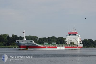
DONGEBORG
General Cargo

Current Trip
| Trip Time | 23 h, 40 mins |
|---|---|
| Trip Distance | 286.87 nm |
| AVG Speed | 12 Knop |
| MAX Speed | 15.5 Knop |
| Djupgående | 4.9 m |
| AVG Wind | 15.1 knots |
| MAX Wind | 24 knots |
| MIN Temp | 0.7°C / 33.26°F |
| MAX Temp | 6.8°C / 44.24°F |
| Position mottagen | 6 h, 7 m sen |
Current Position
| Longitud | --- |
|---|---|
| Latitude | --- |
| Status | Under way using engine |
| Fart | 11.2 Knop |
| Kurs | 207.7° |
| Område | Gulf of Bothnia |
| Station | T-AIS |
| Position mottagen | 6 h, 7 m sen |
Information
The current position of DONGEBORG is in Gulf of Bothnia with coordinates 61.41493° / 18.22261° as reported on 2025-03-28 00:24 by AIS to our vessel tracker app. The vessel's current speed is 11.2 Knop and is currently inside the port of GAVLE.
The vessel DONGEBORG (IMO: 9163697, MMSI: 245413000) is a General Cargo that was built in 1999 ( 26 År gammal ). It's sailing under the flag of [NL] Netherlands.
In this page you can find informations about the vessels current position, last detected port calls, and current voyage information. If the vessels is not in coverage by AIS you will find the latest position.
The current position of DONGEBORG is detected by our AIS receivers and we are not responsible for the reliability of the data. The last position was recorded while the vessel was in Coverage by the Ais receivers of our vessel tracking app.
The current draught of DONGEBORG as reported by AIS is 4.9 meters
Weather
| Temperature | 7.1°C / 44.78°F |
|---|---|
| Wind Speed | 14 knots |
| Direction | 214° SW |
| Pressure | 1001.6 hPa |
| Humidity | 90.7 % |
| Cloud Coverage | 100 % |


Featured Company
Last Port Calls
| Port | Arrival | Departure | Time In Port |
|---|---|---|---|
| 2025-03-28 06:42 | |||
| 2025-03-25 07:42 | 2025-03-27 07:02 | 1 d | |
| 2025-03-09 13:23 | 2025-03-12 17:30 | 3 d | |
| 2025-02-28 12:13 | 2025-03-01 15:41 | 1 d | |
| 2025-02-25 05:39 | 2025-02-25 14:28 | 8 h | |
| 2025-02-24 13:44 | 2025-02-24 17:25 | 3 h | |
| 2025-02-20 11:31 | 2025-02-21 19:43 | 1 d | |
| 2025-02-12 22:53 | 2025-02-13 20:13 | 21 h | |
| 2025-02-12 08:13 | 2025-02-12 22:17 | 14 h | |
| 2025-02-08 22:37 | 2025-02-11 03:17 | 2 d |
Most Visited Ports (Last year)
| Port | Arrivals | |
|---|---|---|
| 3 | ||
| 3 | ||
| 3 | ||
| 3 | ||
| 2 | ||
| 2 |
Last Trips
| Origin | Departure | Destination | Arrival | Distance | |
|---|---|---|---|---|---|
| 2025-03-27 07:02 | 2025-03-28 06:42 | 286.87 nm | |||
| 2025-03-12 17:30 | 2025-03-25 07:42 | 2583.52 nm | |||
| 2025-03-01 15:41 | 2025-03-09 13:23 | 1273.94 nm | |||
| 2025-02-25 14:28 | 2025-02-28 12:13 | 801.47 nm | |||
| 2025-02-24 17:25 | 2025-02-25 05:39 | 132.17 nm | |||
| 2025-02-21 19:43 | 2025-02-24 13:44 | 697.06 nm | |||
| 2025-02-13 20:13 | 2025-02-20 11:31 | 1902.13 nm | |||
| 2025-02-12 22:17 | 2025-02-12 22:53 | 1.71 nm | |||
| 2025-02-11 03:17 | 2025-02-12 08:13 | 290.09 nm | |||
| 2025-02-07 01:25 | 2025-02-08 22:37 | 124.74 nm |
Events
| Tid | Event | Detaljer | Position / Dest | Information |
|---|---|---|---|---|
| 2025-03-28 06:10 | STOPPAR förflyttning |
60.68984 / 17.21785
[SE] GAVLE
|
Fart: 0.1 kn Kurs: 243° |
|
| 2025-03-28 05:42 | ANLÄNDER HAMN |
|
60.69339 / 17.23776
[SE] GAVLE
|
Fart: 6.1 kn Kurs: 238° |
| 2025-03-28 00:30 | Status ändrad | Default Under way using engine |
61.39906 / 18.20485
SEGVX
|
Fart: 11.2 kn Kurs: 207.7° |
| 2025-03-28 00:24 | UTANFÖR täckningsområde |
61.41493 / 18.22261
Gulf of Bothnia
SEGVX
|
Fart: 11.2 kn Kurs: 207.7° |
|
| 2025-03-27 23:46 | Djupgående ändrat | 4.9 7.4 |
61.51998 / 18.34392
SEGVX
|
Fart: 11.3 kn Kurs: 208.5° |
| 2025-03-27 23:46 | Destination ändrad | SEGVX SEROR |
61.51998 / 18.34392
SEGVX
|
Fart: 11.3 kn Kurs: 208.5° |
| 2025-03-27 23:46 | ETA ändrat | 2025/03/28 05:00 2025/03/23 07:00 |
61.51998 / 18.34392
SEGVX
|
Fart: 11.3 kn Kurs: 208.5° |
| 2025-03-27 23:10 | Upptäckt i hav | Swedish part of the Gulf of Bothnia |
61.61763 / 18.45301
Gulf of Bothnia
|
Fart: 11.3 kn Kurs: 207.3° |
| 2025-03-27 23:09 | Status ändrad | Under way using engine Default |
61.62231 / 18.45812
SEROR
|
Fart: 11.4 kn Kurs: 208° |
| 2025-03-27 23:06 | I täckningsområde |
61.61763 / 18.45301
Gulf of Bothnia
|
Fart: 11.3 kn Kurs: 207.3° |