
DONG YAO HAI TAI
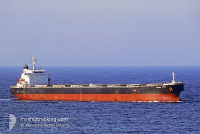
Bulk Carrier
Current Trip
CA0 FEI DIAN
| Time Travelled | 1 day |
|---|---|
| Remaining Time | --- |
| Distance Travelled | 509.40 nm |
| Remaining Distance | --- |
| AVG Speed | 11 Knop |
| MAX Speed | 13.6 Knop |
| AVG Wind | 13 knots |
| MAX Wind | 25.3 knots |
| MIN Temp | 18.4°C / 65.12°F |
| MAX Temp | 26.4°C / 79.52°F |
| Djupgående | 7 m |
| Position mottagen | 17 h, 45 m sen |
Current Position
| Longitud | 118.49978° |
|---|---|
| Latitude | 23.94057° |
| Status | Under way using engine |
| Fart | 10 Knop |
| Kurs | 52° |
| Område | South China Sea |
| Station | T-AIS |
| Position mottagen | 17 h, 45 m sen |
Info
Information
The current position of DONG YAO HAI TAI is in South China Sea with coordinates 23.94057° / 118.49978° as reported on 2024-05-01 14:17 by AIS to our vessel tracker app. The vessel's current speed is 10 Knop
The vessel DONG YAO HAI TAI (IMO: 9195327, MMSI: 413988000) is a Bulk Carrier that was built in 1999 ( 25 År gammal ). It's sailing under the flag of [CN] China.
In this page you can find informations about the vessels current position, last detected port calls, and current voyage information. If the vessels is not in coverage by AIS you will find the latest position.
The current position of DONG YAO HAI TAI is detected by our AIS receivers and we are not responsible for the reliability of the data. The last position was recorded while the vessel was in Coverage by the Ais receivers of our vessel tracking app.
The current draught of DONG YAO HAI TAI as reported by AIS is 7 meters
Weather
| Temperature | 18.4°C / 65.12°F |
|---|---|
| Wind Speed | 15 knots |
| Direction | 44° NE |
| Pressure | 1015.6 hPa |
| Humidity | 65.9 % |
| Cloud Coverage | 35 % |
Featured Company
Most Visited Ports (Last year)
| Port | Arrivals | |
|---|---|---|
| 5 | ||
| 5 | ||
| 4 | ||
| 4 | ||
| 1 | ||
| 1 |
Events
| Tid | Event | Detaljer | Position / Dest | Information |
|---|---|---|---|---|
| 2024-05-01 14:24 | Status ändrad | Default Under way using engine |
23.95215 / 118.51662
CA0 FEI DIAN
|
Fart: 10 kn Kurs: 52° |
| 2024-05-01 14:17 | UTANFÖR täckningsområde |
23.94057 / 118.49978
South China Sea
|
Fart: 10 kn Kurs: 52° |
|
| 2024-05-01 13:48 | Status ändrad | Under way using engine Default |
23.88760 / 118.42958
CA0 FEI DIAN
|
Fart: 10 kn Kurs: 47° |
| 2024-05-01 13:36 | I täckningsområde |
23.88760 / 118.42958
South China Sea
|
Fart: 10.2 kn Kurs: 48° |
|
| 2024-05-01 12:11 | Status ändrad | Default Under way using engine |
23.70470 / 118.21413
CA0 FEI DIAN
|
Fart: 10.1 kn Kurs: 47° |
| 2024-05-01 12:04 | UTANFÖR täckningsområde |
23.69182 / 118.19883
South China Sea
|
Fart: 10.1 kn Kurs: 47° |
|
| 2024-05-01 08:41 | Status ändrad | Under way using engine Default |
23.33528 / 117.66033
CA0 FEI DIAN
|
Fart: 12.4 kn Kurs: 60° |
| 2024-05-01 08:41 | I täckningsområde |
23.33875 / 117.66665
South China Sea
|
Fart: 12 kn Kurs: 59° |
|
| 2024-04-30 18:04 | Status ändrad | Default Under way using engine |
22.05612 / 114.79311
CA0 FEI DIAN
|
Fart: 10.8 kn Kurs: 62° |
| 2024-04-30 17:59 | UTANFÖR täckningsområde |
22.04928 / 114.77808
South China Sea
|
Fart: 10.8 kn Kurs: 62° |