

DISCOVERY BAY
Military ops

Current Trip
| Trip Time | 7 h, 30 mins |
|---|---|
| Trip Distance | 75.65 nm |
| AVG Speed | 11.3 Knop |
| MAX Speed | 13 Knop |
| Djupgående | 0 m |
| AVG Wind | 3.9 knots |
| MAX Wind | 7 knots |
| MIN Temp | 8.8°C / 47.84°F |
| MAX Temp | 12.4°C / 54.32°F |
| Position mottagen | 1 m sen |
Current Position
| Longitud | --- |
|---|---|
| Latitude | --- |
| Status | Moored |
| Fart | |
| Kurs | 296° |
| Område | The Coastal Waters of Southeast Alaska and British Columbia |
| Station | T-AIS |
| Position mottagen | 1 m sen |
Information
The current position of DISCOVERY BAY is in The Coastal Waters of Southeast Alaska and British Columbia with coordinates 47.70528° / -122.61713° as reported on 2025-03-26 07:08 by AIS to our vessel tracker app. The vessel's current speed is 0 Knop and is currently inside the port of KEYPORT.
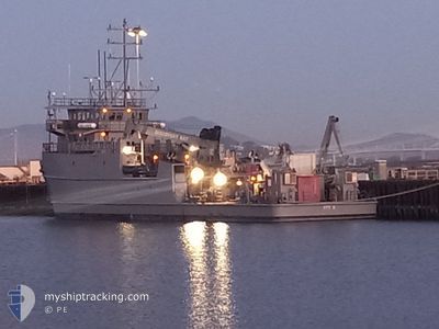
The vessel DISCOVERY BAY (IMO: 9100877, MMSI: 369970253) is a Military ops It's sailing under the flag of [US] USA.
In this page you can find informations about the vessels current position, last detected port calls, and current voyage information. If the vessels is not in coverage by AIS you will find the latest position.
The current position of DISCOVERY BAY is detected by our AIS receivers and we are not responsible for the reliability of the data. The last position was recorded while the vessel was in Coverage by the Ais receivers of our vessel tracking app.
Weather
| Temperature | 9.5°C / 49.1°F |
|---|---|
| Wind Speed | 4 knots |
| Direction | 3° N |
| Pressure | 1012.7 hPa |
| Humidity | 98.7 % |
| Cloud Coverage | 100 % |


Featured Company
Most Visited Ports (Last year)
| Port | Arrivals | |
|---|---|---|
| 6 | ||
| 3 | ||
| 1 |
Events
| Tid | Event | Detaljer | Position / Dest | Information |
|---|---|---|---|---|
| 2025-03-25 19:08 | ETA ändrat | 2025/03/24 18:00 |
47.70521 / -122.61716
[US] KEYPORT
|
Fart: Kurs: 296° |
| 2025-03-24 22:20 | Status ändrad | Moored Under way using engine |
47.70519 / -122.61719
[US] KEYPORT
|
Fart: Kurs: 296° |
| 2025-03-24 22:13 | STOPPAR förflyttning |
47.70535 / -122.61704
[US] KEYPORT
|
Fart: 0.2 kn Kurs: 289° |
|
| 2025-03-24 22:11 | ANLÄNDER HAMN |
|
47.70512 / -122.61618
[US] KEYPORT
|
Fart: 2.9 kn Kurs: 290° |
| 2025-03-24 21:14 | ETA ändrat | 2025/03/24 18:00 |
47.78019 / -122.46480
KEYPORT
|
Fart: 11.5 kn Kurs: 172° |
| 2025-03-24 20:50 | ETA ändrat | 2025/03/24 18:00 |
47.85387 / -122.48951
KEYPORT
|
Fart: 11.6 kn Kurs: 161.9° |
| 2025-03-24 19:02 | Destination ändrad | KEYPORT INDIAN-ISLAND |
48.08880 / -122.75123
KEYPORT
|
Fart: 12 kn Kurs: 32.4° |
| 2025-03-24 18:54 | STARTAR förflyttning | 2.24 nm, South of PORT TOWNSEND |
48.07306 / -122.75195
INDIAN-ISLAND
|
Fart: 6.4 kn Kurs: 251.6° |
| 2025-03-24 18:04 | STOPPAR förflyttning | 2.2 nm, South of PORT TOWNSEND |
48.07384 / -122.74934
INDIAN-ISLAND
|
Fart: 0.3 kn Kurs: 196° |
| 2025-03-24 14:41 | AVGÅTT HAMN |
|
47.70419 / -122.61332
INDIAN-ISLAND
|
Fart: 10.7 kn Kurs: 147° |