
DEVON
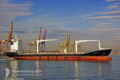
Cargo
Current Trip
| Time Travelled | 3 days |
|---|---|
| Remaining Time | --- |
| Distance Travelled | 725.45 nm |
| Remaining Distance | --- |
| AVG Speed | 10.8 Knop |
| MAX Speed | 18.6 Knop |
| AVG Wind | 16.3 knots |
| MAX Wind | 22.9 knots |
| MIN Temp | 21.2°C / 70.16°F |
| MAX Temp | 28.4°C / 83.12°F |
| Djupgående | 8 m |
| Position mottagen | 28 d sen |
Current Position
| Longitud | 95.10209° |
|---|---|
| Latitude | 6.02341° |
| Status | Under way using engine |
| Fart | 12.6 Knop |
| Kurs | 270° |
| Område | Andaman or Burma Sea |
| Station | T-AIS |
| Position mottagen | 28 d sen |
Info
Information
The current position of DEVON is in Andaman or Burma Sea with coordinates 6.02341° / 95.10209° as reported on 2024-04-21 10:01 by AIS to our vessel tracker app. The vessel's current speed is 12.6 Knop and is heading at the port of MAPUTO.
The vessel DEVON (MMSI: 255805599) is a Cargo It's sailing under the flag of [PT] Portugal.
In this page you can find informations about the vessels current position, last detected port calls, and current voyage information. If the vessels is not in coverage by AIS you will find the latest position.
The current position of DEVON is detected by our AIS receivers and we are not responsible for the reliability of the data. The last position was recorded while the vessel was in Coverage by the Ais receivers of our vessel tracking app.
The current draught of DEVON as reported by AIS is 8 meters
Weather
| Temperature | 27.4°C / 81.32°F |
|---|---|
| Wind Speed | 21 knots |
| Direction | 200° SSW |
| Pressure | 1008.3 hPa |
| Humidity | 85.6 % |
| Cloud Coverage | 17 % |
Featured Company
Last Port Calls
| Port | Arrival | Departure | Time In Port |
|---|---|---|---|
| 2024-05-15 16:01 | 2024-05-16 01:06 | 9 h | |
| 2024-05-11 18:29 | 2024-05-13 18:06 | 1 d | |
| 2024-05-07 14:11 | 2024-05-08 06:47 | 16 h | |
| 2024-04-19 00:50 | 2024-04-19 19:45 | 18 h | |
| 2024-04-18 13:29 | 2024-04-19 00:35 | 11 h | |
| 2024-04-04 00:15 | 2024-04-04 19:13 | 18 h | |
| 2024-03-29 06:33 | 2024-03-30 05:50 | 23 h | |
| 2024-03-26 04:04 | 2024-03-27 05:36 | 1 d | |
| 2024-03-12 17:47 | |||
| 2024-03-07 17:25 | 2024-03-09 02:09 | 1 d |
Last Trips
| Origin | Departure | Destination | Arrival | Distance | |
|---|---|---|---|---|---|
| 2024-05-13 18:06 | 2024-05-15 16:01 | 544.78 nm | |||
| 2024-05-08 06:47 | 2024-05-11 18:29 | 528.86 nm | |||
| 2024-04-19 19:45 | 2024-05-07 14:11 | 4897.82 nm | |||
| 2024-04-19 00:35 | 2024-04-19 00:50 | 0.65 nm | |||
| 2024-04-04 19:13 | 2024-04-18 13:29 | 4111.43 nm | |||
| 2024-03-30 05:50 | 2024-04-04 00:15 | 549.92 nm | |||
| 2024-03-27 05:36 | 2024-03-29 06:33 | 524.76 nm | |||
| 2024-03-09 02:09 | 2024-03-12 17:47 | 1150.35 nm | |||
| 2024-02-29 08:30 | 2024-03-07 17:25 | 1303.93 nm |
Events
| Tid | Event | Detaljer | Position / Dest | Information |
|---|---|---|---|---|
| 2024-05-19 09:13 | STOPPAR förflyttning |
-2.80966 / 40.44443
MAPUTO
|
Fart: 0.3 kn Kurs: 162° |
|
| 2024-05-16 14:10 | STARTAR förflyttning | 10.59 nm, North of NACALA PORTO |
-14.37142 / 40.71497
MAPUTO
|
Fart: 5.6 kn Kurs: 66° |
| 2024-05-16 00:29 | STOPPAR förflyttning | 10.81 nm, North of NACALA PORTO |
-14.36667 / 40.71167
MAPUTO
|
Fart: Kurs: -1° |
| 2024-05-15 23:09 | STARTAR förflyttning | 0.39 nm, North of NACALA PORTO |
-14.53533 / 40.66562
MAPUTO
|
Fart: 7.6 kn Kurs: 354° |
| 2024-05-15 23:06 | AVGÅTT HAMN |
|
-14.53533 / 40.66562
MAPUTO
|
Fart: Kurs: 48° |
| 2024-05-15 14:01 | STOPPAR förflyttning |
-14.54082 / 40.66475
[MZ] NACALA PORTO
|
Fart: 0.3 kn Kurs: 61° |
|
| 2024-05-15 14:01 | ANLÄNDER HAMN |
|
-14.54082 / 40.66475
[MZ] NACALA PORTO
|
Fart: 2 kn Kurs: 82° |
| 2024-05-15 12:31 | STARTAR förflyttning | 7.47 nm, North of NACALA PORTO |
-14.41668 / 40.66953
MAPUTO
|
Fart: 4.9 kn Kurs: 180° |
| 2024-05-15 11:59 | STOPPAR förflyttning | 7.48 nm, North of NACALA PORTO |
-14.41667 / 40.67166
MAPUTO
|
Fart: Kurs: -1° |
| 2024-05-13 16:06 | AVGÅTT HAMN |
|
-19.83711 / 34.82559
MAPUTO
|
Fart: 8.5 kn Kurs: 202° |