
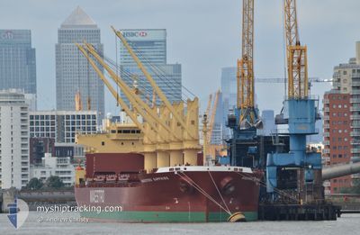
DEVBULK SERVET
Cargo
Current Trip
| Time Travelled | 7 days |
|---|---|
| Remaining Time | --- |
| Distance Travelled | 1950.57 nm |
| Remaining Distance | --- |
| AVG Speed | 11.4 Knop |
| MAX Speed | 13.5 Knop |
| AVG Wind | 7.9 knots |
| MAX Wind | 18.6 knots |
| MIN Temp | 17.9°C / 64.22°F |
| MAX Temp | 43.3°C / 109.94°F |
| Djupgående | 10.3 m |
| Position mottagen | 18 h, 38 m sen |
Current Position
| Longitud | --- |
|---|---|
| Latitude | --- |
| Status | Under way using engine |
| Fart | 11.2 Knop |
| Kurs | 293.5° |
| Område | North Pacific Ocean |
| Station | T-AIS |
| Position mottagen | 18 h, 38 m sen |
Info
Information
The current position of DEVBULK SERVET is in North Pacific Ocean with coordinates 34.52539° / -132.04056° as reported on 2024-10-04 04:50 by AIS to our vessel tracker app. The vessel's current speed is 11.2 Knop and is heading at the port of NAOSHIMA. The estimated time of arrival as calculated by MyShipTracking vessel tracking app is 2024-10-21 03:00 LT
The vessel DEVBULK SERVET (IMO: 9756250, MMSI: 538008971) is a Cargo It's sailing under the flag of [MH] Marshall Is.
In this page you can find informations about the vessels current position, last detected port calls, and current voyage information. If the vessels is not in coverage by AIS you will find the latest position.
The current position of DEVBULK SERVET is detected by our AIS receivers and we are not responsible for the reliability of the data. The last position was recorded while the vessel was in Coverage by the Ais receivers of our vessel tracking app.
The current draught of DEVBULK SERVET as reported by AIS is 10.3 meters
Weather
| Temperature | 19.7°C / 67.46°F |
|---|---|
| Wind Speed | 9 knots |
| Direction | 57° ENE |
| Pressure | 1018 hPa |
| Humidity | 78.2 % |
| Cloud Coverage | 74 % |
Featured Company
Last Port Calls
| Port | Arrival | Departure | Time In Port |
|---|---|---|---|
| 2024-09-23 16:12 | 2024-09-27 21:27 | 4 d | |
| 2024-09-17 05:07 | 2024-09-21 13:31 | 4 d | |
| 2024-08-30 22:29 | 2024-09-08 17:12 | 8 d |
Most Visited Ports (Last year)
| Port | Arrivals | |
|---|---|---|
| 2 | ||
| 2 | ||
| 2 | ||
| 1 | ||
| 1 | ||
| 1 |
Last Trips
| Origin | Departure | Destination | Arrival | Distance | |
|---|---|---|---|---|---|
| 2024-09-21 07:31 | 2024-09-23 09:12 | 200.29 nm | |||
| 2024-09-08 12:12 | 2024-09-16 23:07 | 508.86 nm | |||
| 2024-07-16 16:02 | 2024-08-30 17:29 | 9471.41 nm |
Events
| Tid | Event | Detaljer | Position / Dest | Information |
|---|---|---|---|---|
| 2024-10-04 04:54 | Status ändrad | Default Under way using engine |
34.53141 / -132.05405
JPNAS
|
Fart: 11.2 kn Kurs: 293.5° |
| 2024-10-04 04:50 | Status ändrad | Under way using engine Default |
34.52539 / -132.04056
JPNAS
|
Fart: 11.2 kn Kurs: 296° |
| 2024-10-04 04:50 | UTANFÖR täckningsområde |
34.52539 / -132.04056
North Pacific Ocean
JPNAS
|
Fart: 11.2 kn Kurs: 293.5° |
|
| 2024-10-04 04:41 | I täckningsområde |
34.52539 / -132.04056
North Pacific Ocean
JPNAS
|
Fart: 11.2 kn Kurs: 293.5° |
|
| 2024-10-04 03:49 | Status ändrad | Default Under way using engine |
34.44276 / -131.83536
JPNAS
|
Fart: 11.2 kn Kurs: 294.9° |
| 2024-10-04 03:43 | UTANFÖR täckningsområde |
34.43496 / -131.81440
North Pacific Ocean
JPNAS
|
Fart: 11.2 kn Kurs: 294.9° |
|
| 2024-10-04 03:32 | Status ändrad | Under way using engine Default |
34.42061 / -131.77559
JPNAS
|
Fart: 11 kn Kurs: 297° |
| 2024-10-04 03:28 | Status ändrad | Default Under way using engine |
34.41483 / -131.76158
JPNAS
|
Fart: 11.5 kn Kurs: 300.1° |
| 2024-10-04 02:43 | Status ändrad | Under way using engine Default |
34.34808 / -131.61788
JPNAS
|
Fart: 10.8 kn Kurs: 296° |
| 2024-10-04 02:35 | Status ändrad | Default Under way using engine |
34.33629 / -131.59119
JPNAS
|
Fart: 10.5 kn Kurs: 302.1° |