
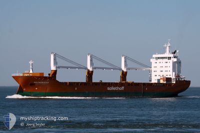
DELTAGRACHT
General Cargo
Current Trip
| Time Travelled | 13 h, 41 mins |
|---|---|
| Remaining Time | --- |
| Distance Travelled | 156.72 nm |
| Remaining Distance | --- |
| AVG Speed | 14 Knop |
| MAX Speed | 17.8 Knop |
| AVG Wind | 16.8 knots |
| MAX Wind | 22.9 knots |
| MIN Temp | 12.4°C / 54.32°F |
| MAX Temp | 13°C / 55.4°F |
| Djupgående | 6.5 m |
| Position mottagen | 3 h, 49 m sen |
Current Position
| Longitud | --- |
|---|---|
| Latitude | --- |
| Status | Under way using engine |
| Fart | 16.6 Knop |
| Kurs | 30.3° |
| Område | North Sea |
| Station | T-AIS |
| Position mottagen | 3 h, 49 m sen |
Info
Information
The current position of DELTAGRACHT is in North Sea with coordinates 52.72218° / 3.18527° as reported on 2024-12-02 05:05 by AIS to our vessel tracker app. The vessel's current speed is 16.6 Knop and is heading at the port of VAASA. The estimated time of arrival as calculated by MyShipTracking vessel tracking app is 2024-12-05 18:00 LT
The vessel DELTAGRACHT (IMO: 9420801, MMSI: 244155000) is a General Cargo that was built in 2009 ( 15 År gammal ). It's sailing under the flag of [NL] Netherlands.
In this page you can find informations about the vessels current position, last detected port calls, and current voyage information. If the vessels is not in coverage by AIS you will find the latest position.
The current position of DELTAGRACHT is detected by our AIS receivers and we are not responsible for the reliability of the data. The last position was recorded while the vessel was in Coverage by the Ais receivers of our vessel tracking app.
The current draught of DELTAGRACHT as reported by AIS is 6.5 meters
Weather
| Temperature | 10.5°C / 50.9°F |
|---|---|
| Wind Speed | 17 knots |
| Direction | 253° WSW |
| Pressure | 1008.1 hPa |
| Humidity | 90.4 % |
| Cloud Coverage | 46 % |
Featured Company
Last Port Calls
| Port | Arrival | Departure | Time In Port |
|---|---|---|---|
| 2024-11-28 22:00 | 2024-12-01 19:14 | 2 d | |
| 2024-11-21 09:46 | 2024-11-21 20:35 | 10 h | |
| 2024-10-13 23:29 | 2024-10-15 21:17 | 1 d | |
| 2024-10-03 05:31 |
Most Visited Ports (Last year)
| Port | Arrivals | |
|---|---|---|
| 6 | ||
| 2 | ||
| 1 | ||
| 1 | ||
| 1 |
Last Trips
| Origin | Departure | Destination | Arrival | Distance | |
|---|---|---|---|---|---|
| 2024-11-21 20:35 | 2024-11-28 22:00 | 1796.33 nm | |||
| 2024-10-16 07:17 | 2024-11-21 09:46 | 12040.68 nm | |||
| 2024-10-03 13:31 | 2024-10-14 09:29 | 3145.08 nm |
Events
| Tid | Event | Detaljer | Position / Dest | Information |
|---|---|---|---|---|
| 2024-12-02 05:13 | Status ändrad | Default Under way using engine |
52.75379 / 3.21563
FI VAA
|
Fart: 16.6 kn Kurs: 30.3° |
| 2024-12-02 05:05 | Status ändrad | Under way using engine Default |
52.72218 / 3.18527
FI VAA
|
Fart: 16.7 kn Kurs: 29° |
| 2024-12-02 05:05 | UTANFÖR täckningsområde |
52.72218 / 3.18527
North Sea
FI VAA
|
Fart: 16.6 kn Kurs: 30.3° |
|
| 2024-12-02 05:00 | I täckningsområde |
52.72218 / 3.18527
North Sea
FI VAA
|
Fart: 16.6 kn Kurs: 30.3° |
|
| 2024-12-02 02:45 | Status ändrad | Default Under way using engine |
52.14420 / 2.64215
FI VAA
|
Fart: 17.5 kn Kurs: 41.7° |
| 2024-12-02 02:37 | UTANFÖR täckningsområde |
52.11068 / 2.60204
North Sea
FI VAA
|
Fart: 17.5 kn Kurs: 41.7° |
|
| 2024-12-01 19:14 | AVGÅTT HAMN |
|
51.45243 / .33204
FI VAA
|
Fart: 4.7 kn Kurs: 118° |
| 2024-12-01 19:13 | STARTAR förflyttning |
51.45371 / .32897
[GB] NORTHFLEET
|
Fart: 5 kn Kurs: 119° |
|
| 2024-12-01 19:07 | Status ändrad | Under way using engine Moored |
51.45500 / .32581
[GB] NORTHFLEET
|
Fart: Kurs: 147° |
| 2024-12-01 18:31 | Djupgående ändrat | 6.5 6.3 |
51.45497 / .32585
[GB] NORTHFLEET
|
Fart: Kurs: 146° |