
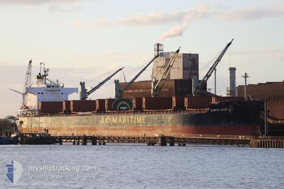
DARYA NOOR
Bulk Carrier
Current Trip
| Time Travelled | 9 days |
|---|---|
| Remaining Time | --- |
| Distance Travelled | 2306.41 nm |
| Remaining Distance | --- |
| AVG Speed | 9.7 Knop |
| MAX Speed | 12.9 Knop |
| AVG Wind | 10.8 knots |
| MAX Wind | 26.3 knots |
| MIN Temp | 9.8°C / 49.64°F |
| MAX Temp | 20°C / 68°F |
| Djupgående | 13.2 m |
| Position mottagen | 3 h, 14 m sen |
Current Position
| Longitud | -27.26212° |
|---|---|
| Latitude | 40.09683° |
| Status | Under way using engine |
| Fart | 10.6 Knop |
| Kurs | 101.9° |
| Område | North Atlantic Ocean |
| Station | T-AIS |
| Position mottagen | 3 h, 14 m sen |
Info
Information
The current position of DARYA NOOR is in North Atlantic Ocean with coordinates 40.09683° / -27.26212° as reported on 2024-04-28 18:20 by AIS to our vessel tracker app. The vessel's current speed is 10.6 Knop and is heading at the port of GIBRALTAR. The estimated time of arrival as calculated by MyShipTracking vessel tracking app is 2024-05-01 12:00 LT
The vessel DARYA NOOR (IMO: 9520912, MMSI: 477176300) is a Bulk Carrier that was built in 2011 ( 13 År gammal ). It's sailing under the flag of [HK] Hong Kong.
In this page you can find informations about the vessels current position, last detected port calls, and current voyage information. If the vessels is not in coverage by AIS you will find the latest position.
The current position of DARYA NOOR is detected by our AIS receivers and we are not responsible for the reliability of the data. The last position was recorded while the vessel was in Coverage by the Ais receivers of our vessel tracking app.
The current draught of DARYA NOOR as reported by AIS is 13.2 meters
Weather
| Temperature | 15.1°C / 59.18°F |
|---|---|
| Wind Speed | 8 knots |
| Direction | 315° NW |
| Pressure | 1029.4 hPa |
| Humidity | 70.9 % |
| Cloud Coverage | 51 % |
Featured Company
Most Visited Ports (Last year)
| Port | Arrivals | |
|---|---|---|
| 1 | ||
| 1 | ||
| 1 | ||
| 1 | ||
| 1 | ||
| 1 |
Events
| Tid | Event | Detaljer | Position / Dest | Information |
|---|---|---|---|---|
| 2024-04-28 18:24 | Status ändrad | Default Under way using engine |
40.09333 / -27.24833
GIBRALTAR
|
Fart: 10.6 kn Kurs: 101.9° |
| 2024-04-28 18:20 | Status ändrad | Under way using engine Default |
40.09683 / -27.26212
GIBRALTAR
|
Fart: 10 kn Kurs: 101° |
| 2024-04-28 18:20 | UTANFÖR täckningsområde |
40.09683 / -27.26212
North Atlantic Ocean
GIBRALTAR
|
Fart: 10.6 kn Kurs: 101.9° |
|
| 2024-04-28 18:09 | I täckningsområde |
40.09683 / -27.26212
North Atlantic Ocean
GIBRALTAR
|
Fart: 10.6 kn Kurs: 101.9° |
|
| 2024-04-28 16:06 | Status ändrad | Default Under way using engine |
40.16218 / -27.77137
GIBRALTAR
|
Fart: 10.5 kn Kurs: 100.4° |
| 2024-04-28 16:00 | UTANFÖR täckningsområde |
40.16499 / -27.79278
North Atlantic Ocean
GIBRALTAR
|
Fart: 10.5 kn Kurs: 100.4° |
|
| 2024-04-28 15:59 | Status ändrad | Under way using engine Default |
40.16547 / -27.79658
GIBRALTAR
|
Fart: 10 kn Kurs: 99° |
| 2024-04-28 15:12 | Status ändrad | Default Under way using engine |
40.18500 / -27.97833
GIBRALTAR
|
Fart: 10.8 kn Kurs: 94.6° |
| 2024-04-28 15:06 | Status ändrad | Under way using engine Default |
40.18668 / -28.00251
GIBRALTAR
|
Fart: 10 kn Kurs: 98° |
| 2024-04-28 15:00 | Status ändrad | Default Under way using engine |
40.18833 / -28.02500
GIBRALTAR
|
Fart: 10.4 kn Kurs: 98.1° |