
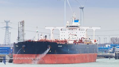
DALMA
Crude Oil Tanker
Current Trip
SNSIN
| Time Travelled | --- |
|---|---|
| Remaining Time | --- |
| Distance Travelled | 7403.81 nm |
| Remaining Distance | --- |
| AVG Speed | 11.8 Knop |
| MAX Speed | 11.8 Knop |
| AVG Wind | 6.9 knots |
| MAX Wind | 21.9 knots |
| MIN Temp | 10.7°C / 51.26°F |
| MAX Temp | 30.4°C / 86.72°F |
| Djupgående | 11 m |
| Position mottagen | 1 d sen |
Current Position
| Longitud | 125.21727° |
|---|---|
| Latitude | 36.07247° |
| Status | Under way using engine |
| Fart | 12.7 Knop |
| Kurs | 246° |
| Område | Yellow Sea |
| Station | T-AIS |
| Position mottagen | 1 d sen |
Info
Information
The current position of DALMA is in Yellow Sea with coordinates 36.07247° / 125.21727° as reported on 2024-04-30 16:26 by AIS to our vessel tracker app. The vessel's current speed is 12.7 Knop
The vessel DALMA (IMO: 9322279, MMSI: 636018893) is a Crude Oil Tanker that was built in 2007 ( 17 År gammal ). It's sailing under the flag of [LR] Liberia.
In this page you can find informations about the vessels current position, last detected port calls, and current voyage information. If the vessels is not in coverage by AIS you will find the latest position.
The current position of DALMA is detected by our AIS receivers and we are not responsible for the reliability of the data. The last position was recorded while the vessel was in Coverage by the Ais receivers of our vessel tracking app.
The current draught of DALMA as reported by AIS is 11 meters
Weather
| Temperature | 21.3°C / 70.34°F |
|---|---|
| Wind Speed | 15 knots |
| Direction | 23° NNE |
| Pressure | 1016.2 hPa |
| Humidity | 80.4 % |
| Cloud Coverage | 100 % |
Featured Company
Last Port Calls
Most Visited Ports (Last year)
| Port | Arrivals | |
|---|---|---|
| 1 | ||
| 1 | ||
| 1 |
Last Trips
| Origin | Departure | Destination | Arrival | Distance |
|---|
Events
| Tid | Event | Detaljer | Position / Dest | Information |
|---|---|---|---|---|
| 2024-04-30 16:32 | Status ändrad | Default Under way using engine |
36.06392 / 125.19172
SNSIN
|
Fart: 12.7 kn Kurs: 246° |
| 2024-04-30 16:26 | Status ändrad | Under way using engine Default |
36.07247 / 125.21727
SNSIN
|
Fart: 12.8 kn Kurs: 247° |
| 2024-04-30 16:26 | UTANFÖR täckningsområde |
36.07247 / 125.21727
Yellow Sea
SNSIN
|
Fart: 12.7 kn Kurs: 246° |
|
| 2024-04-30 16:24 | Status ändrad | Default Under way using engine |
36.07525 / 125.22540
SNSIN
|
Fart: 12.7 kn Kurs: 246° |
| 2024-04-30 16:10 | Status ändrad | Under way using engine Default |
36.09390 / 125.27988
SNSIN
|
Fart: 13 kn Kurs: 240° |
| 2024-04-30 16:04 | Status ändrad | Default Under way using engine |
36.10415 / 125.30357
SNSIN
|
Fart: 12.9 kn Kurs: 248° |
| 2024-04-30 14:58 | Status ändrad | Under way using engine Default |
36.19528 / 125.57728
SNSIN
|
Fart: 12.9 kn Kurs: 242° |
| 2024-04-30 14:48 | Status ändrad | Default Under way using engine |
36.21172 / 125.61603
SNSIN
|
Fart: 13 kn Kurs: 230° |
| 2024-04-30 09:16 | STARTAR förflyttning | 1.71 nm, West of DAESAN |
37.03708 / 126.34593
SNSIN
|
Fart: 3.1 kn Kurs: 235° |
| 2024-04-30 09:12 | Djupgående ändrat | 11 19.9 |
37.03768 / 126.34927
SNSIN
|
Fart: 1.6 kn Kurs: 255° |