
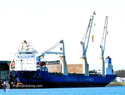
DA XIANG
Cargo
Current Trip
| Time Travelled | 22 days |
|---|---|
| Remaining Time | --- |
| Distance Travelled | 6454.37 nm |
| Remaining Distance | --- |
| AVG Speed | 12.6 Knop |
| MAX Speed | 15.5 Knop |
| AVG Wind | 11.3 knots |
| MAX Wind | 29 knots |
| MIN Temp | 26.2°C / 79.16°F |
| MAX Temp | 34.3°C / 93.74°F |
| Djupgående | 10.3 m |
| Position mottagen | 6 h, 51 m sen |
Current Position
| Longitud | 122.39849° |
|---|---|
| Latitude | 25.12436° |
| Status | Under way using engine |
| Fart | 14.9 Knop |
| Kurs | 13.7° |
| Område | Eastern China Sea |
| Station | T-AIS |
| Position mottagen | 6 h, 51 m sen |
Info
Information
The current position of DA XIANG is in Eastern China Sea with coordinates 25.12436° / 122.39849° as reported on 2024-06-09 04:51 by AIS to our vessel tracker app. The vessel's current speed is 14.9 Knop and is heading at the port of TAICANG. The estimated time of arrival as calculated by MyShipTracking vessel tracking app is 2024-06-11 02:00 LT
The vessel DA XIANG (IMO: 9768552, MMSI: 413491830) is a Cargo It's sailing under the flag of [CN] China.
In this page you can find informations about the vessels current position, last detected port calls, and current voyage information. If the vessels is not in coverage by AIS you will find the latest position.
The current position of DA XIANG is detected by our AIS receivers and we are not responsible for the reliability of the data. The last position was recorded while the vessel was in Coverage by the Ais receivers of our vessel tracking app.
The current draught of DA XIANG as reported by AIS is 10.3 meters
Weather
| Temperature | 25.8°C / 78.44°F |
|---|---|
| Wind Speed | 10 knots |
| Direction | 94° E |
| Pressure | 1009.6 hPa |
| Humidity | 78.5 % |
| Cloud Coverage | 35 % |
Featured Company
Last Port Calls
| Port | Arrival | Departure | Time In Port |
|---|---|---|---|
| 2024-05-12 07:48 | 2024-05-18 11:31 | 6 d | |
| 2024-05-01 11:17 | 2024-05-09 16:44 | 8 d |
Last Trips
| Origin | Departure | Destination | Arrival | Distance | |
|---|---|---|---|---|---|
| 2024-05-09 16:44 | 2024-05-12 07:48 | 499.31 nm | |||
| 2024-03-07 00:58 | 2024-05-01 11:17 | 7338.73 nm |
Events
| Tid | Event | Detaljer | Position / Dest | Information |
|---|---|---|---|---|
| 2024-06-09 04:55 | Status ändrad | Default Under way using engine |
25.13971 / 122.40230
CJK
|
Fart: 14.9 kn Kurs: 13.7° |
| 2024-06-09 04:51 | Upptäckt i hav | Taiwanese part of the Eastern China Sea |
25.12436 / 122.39849
Eastern China Sea
CJK
|
Fart: 14.9 kn Kurs: 13.7° |
| 2024-06-09 04:51 | Status ändrad | Under way using engine Default |
25.12436 / 122.39849
CJK
|
Fart: 14.8 kn Kurs: 14° |
| 2024-06-09 04:51 | I täckningsområde |
25.12436 / 122.39849
Eastern China Sea
CJK
|
Fart: 14.9 kn Kurs: 13.7° |
|
| 2024-06-09 04:51 | UTANFÖR täckningsområde |
25.12436 / 122.39849
Eastern China Sea
CJK
|
Fart: 14.9 kn Kurs: 13.7° |
|
| 2024-06-03 10:07 | Status ändrad | Default Under way using engine |
1.27188 / 104.23190
CJK
|
Fart: 11.7 kn Kurs: 83° |
| 2024-06-03 10:03 | UTANFÖR täckningsområde |
1.27027 / 104.21860
Singapore Strait
CJK
|
Fart: 11.7 kn Kurs: 83° |
|
| 2024-06-03 09:39 | Upptäckt i hav | Malaysian part of the Singapore Strait |
1.26041 / 104.14179
Singapore Strait
CJK
|
Fart: 11.9 kn Kurs: 82.2° |
| 2024-06-03 06:13 | Djupgående ändrat | 10.3 10.1 |
1.11295 / 103.53319
CJK
|
Fart: 11.5 kn Kurs: 122.7° |
| 2024-06-03 06:13 | Destination ändrad | CJK PORT KLANNG |
1.11295 / 103.53319
CJK
|
Fart: 11.5 kn Kurs: 122.7° |