
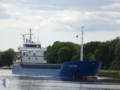
COSTAMAR
General Cargo
Current Trip
| Trip Time | 3 days |
|---|---|
| Trip Distance | 933.26 nm |
| AVG Speed | 9.5 Knop |
| MAX Speed | 11 Knop |
| Djupgående | 5.7 m |
| AVG Wind | 13.2 knots |
| MAX Wind | 21.5 knots |
| MIN Temp | 0.2°C / 32.36°F |
| MAX Temp | 9.9°C / 49.82°F |
| Position mottagen | 1 m sen |
Current Position
| Longitud | --- |
|---|---|
| Latitude | --- |
| Status | Moored |
| Fart | |
| Kurs | 285° |
| Område | Kattegat |
| Station | T-AIS |
| Position mottagen | 1 m sen |
Information
The current position of COSTAMAR is in Kattegat with coordinates 55.70409° / 9.55900° as reported on 2025-03-27 21:18 by AIS to our vessel tracker app. The vessel's current speed is 0 Knop and is currently inside the port of VEJLE.
The vessel COSTAMAR (IMO: 9552020, MMSI: 255805989) is a General Cargo that was built in 2010 ( 15 År gammal ). It's sailing under the flag of [PT] Portugal.
In this page you can find informations about the vessels current position, last detected port calls, and current voyage information. If the vessels is not in coverage by AIS you will find the latest position.
The current position of COSTAMAR is detected by our AIS receivers and we are not responsible for the reliability of the data. The last position was recorded while the vessel was in Coverage by the Ais receivers of our vessel tracking app.
The current draught of COSTAMAR as reported by AIS is 4.6 meters
Weather
| Temperature | 5.2°C / 41.36°F |
|---|---|
| Wind Speed | 10 knots |
| Direction | 226° SW |
| Pressure | 1014.3 hPa |
| Humidity | 94.9 % |
| Cloud Coverage | 100 % |
Featured Company
Last Port Calls
| Port | Arrival | Departure | Time In Port |
|---|---|---|---|
| 2025-03-27 09:57 | |||
| 2025-03-20 08:59 | 2025-03-23 11:46 | 3 d | |
| 2025-03-16 13:54 | 2025-03-18 08:14 | 1 d | |
| 2025-03-13 09:22 | 2025-03-14 16:01 | 1 d | |
| 2025-03-12 05:20 | 2025-03-13 03:33 | 22 h | |
| 2025-03-08 08:01 | 2025-03-10 22:12 | 2 d | |
| 2025-03-05 22:45 | 2025-03-06 17:42 | 18 h | |
| 2025-02-27 12:48 | 2025-03-01 09:38 | 1 d | |
| 2025-02-23 19:33 | 2025-02-24 17:16 | 21 h | |
| 2025-02-21 16:20 | 2025-02-22 14:07 | 21 h |
Last Trips
| Origin | Departure | Destination | Arrival | Distance | |
|---|---|---|---|---|---|
| 2025-03-23 13:46 | 2025-03-27 10:57 | 933.26 nm | |||
| 2025-03-18 09:14 | 2025-03-20 10:59 | 184.75 nm | |||
| 2025-03-14 18:01 | 2025-03-16 14:54 | 431.19 nm | |||
| 2025-03-13 05:33 | 2025-03-13 11:22 | 59.58 nm | |||
| 2025-03-10 23:12 | 2025-03-12 07:20 | 299.39 nm | |||
| 2025-03-06 18:42 | 2025-03-08 09:01 | 313.60 nm | |||
| 2025-03-01 11:38 | 2025-03-05 23:45 | 966.85 nm | |||
| 2025-02-24 18:16 | 2025-02-27 14:48 | 703.17 nm | |||
| 2025-02-22 15:07 | 2025-02-23 20:33 | 250.26 nm | |||
| 2025-02-20 11:10 | 2025-02-21 17:20 | 239.30 nm |
Events
| Tid | Event | Detaljer | Position / Dest | Information |
|---|---|---|---|---|
| 2025-03-27 17:25 | Djupgående ändrat | 4.6 5.7 |
55.70408 / 9.55901
[DK] VEJLE
|
Fart: Kurs: 285° |
| 2025-03-27 17:25 | Destination ändrad | LTKLJ DKVEJ |
55.70408 / 9.55901
[DK] VEJLE
|
Fart: Kurs: 285° |
| 2025-03-27 17:25 | ETA ändrat | 2025/03/30 16:00 2025/03/27 10:00 |
55.70408 / 9.55901
[DK] VEJLE
|
Fart: Kurs: 285° |
| 2025-03-27 10:24 | Status ändrad | Moored Under way using engine |
55.70409 / 9.55898
[DK] VEJLE
|
Fart: Kurs: 285° |
| 2025-03-27 10:06 | STOPPAR förflyttning |
55.70423 / 9.55926
[DK] VEJLE
|
Fart: 0.2 kn Kurs: 275° |
|
| 2025-03-27 09:57 | ANLÄNDER HAMN |
|
55.70300 / 9.56617
[DK] VEJLE
|
Fart: 3.2 kn Kurs: 287° |
| 2025-03-26 22:29 | Byter havsområde | Danish part of the Kattegat Swedish part of the Kattegat |
56.18937 / 12.39958
Kattegat
DKVEJ
|
Fart: 9.7 kn Kurs: 268.4° |
| 2025-03-26 22:22 | Byter havsområde | Swedish part of the Kattegat Danish part of the Kattegat |
56.18135 / 12.42782
Kattegat
DKVEJ
|
Fart: 10.1 kn Kurs: 317.2° |
| 2025-03-26 21:38 | Upptäckt i hav | Danish part of the Kattegat |
56.09444 / 12.58237
Kattegat
DKVEJ
|
Fart: 9.5 kn Kurs: 315.2° |
| 2025-03-26 19:32 | Byter havsområde | Swedish part of the Kattegat Danish part of the Kattegat |
55.81681 / 12.72301
Kattegat
DKVEJ
|
Fart: 10.3 kn Kurs: 9° |