
OCEAN ULTRA
Cargo
Current Trip
| Time Travelled | 24 days |
|---|---|
| Remaining Time | --- |
| Distance Travelled | 5242.32 nm |
| Remaining Distance | --- |
| AVG Speed | 11.3 Knop |
| MAX Speed | 14.9 Knop |
| AVG Wind | 8.9 knots |
| MAX Wind | 28 knots |
| MIN Temp | -1.2°C / 29.84°F |
| MAX Temp | 28.7°C / 83.66°F |
| Djupgående | 9.3 m |
| Position mottagen | 5 d sen |
Current Position
| Longitud | --- |
|---|---|
| Latitude | --- |
| Status | Under way using engine |
| Fart | 11.8 Knop |
| Kurs | 302.4° |
| Område | North Pacific Ocean |
| Station | T-AIS |
| Position mottagen | 5 d sen |
Info
Information
The current position of OCEAN ULTRA is in North Pacific Ocean with coordinates 22.54410° / -110.51400° as reported on 2025-12-31 06:10 by AIS to our vessel tracker app. The vessel's current speed is 11.8 Knop and is heading at the port of KITIMAT.
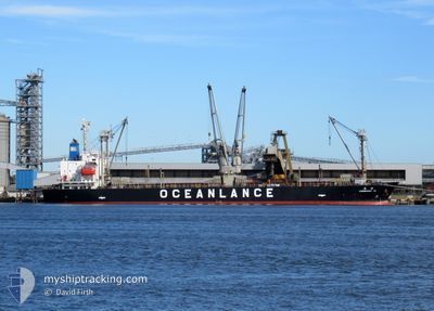
The vessel OCEAN ULTRA (MMSI: 373875000) is a Cargo It's sailing under the flag of [PA] Panama.
In this page you can find informations about the vessels current position, last detected port calls, and current voyage information. If the vessels is not in coverage by AIS you will find the latest position.
The current position of OCEAN ULTRA is detected by our AIS receivers and we are not responsible for the reliability of the data. The last position was recorded while the vessel was in Coverage by the Ais receivers of our vessel tracking app.
The current draught of OCEAN ULTRA as reported by AIS is 9.3 meters
Weather
| Temperature | 10.8°C / 51.44°F |
|---|---|
| Wind Speed | 17 knots |
| Direction | 4° N |
| Pressure | 1016.8 hPa |
| Humidity | 63.9 % |
| Cloud Coverage | 14 % |
Featured Company
Last Port Calls
| Port | Arrival | Departure | Time In Port |
|---|---|---|---|
| 2025-12-10 20:06 | 2025-12-11 22:07 | 1 d | |
| 2025-11-10 11:28 | 2025-11-11 21:11 | 1 d | |
| 2025-11-01 16:34 | 2025-11-04 20:26 | 3 d |
Events
| Tid | Event | Detaljer | Position / Dest | Information |
|---|---|---|---|---|
| 2025-12-31 06:28 | Status ändrad | Default Under way using engine |
22.59850 / -110.60827
CAKTMAL TOWING
|
Fart: 11.8 kn Kurs: 302.4° |
| 2025-12-31 06:10 | UTANFÖR täckningsområde |
22.54410 / -110.51400
North Pacific Ocean
|
Fart: 11.8 kn Kurs: 302.4° |
|
| 2025-12-31 02:05 | Status ändrad | Under way using engine Default |
22.09310 / -109.76100
CAKTMAL TOWING
|
Fart: 12.9 kn Kurs: 303° |
| 2025-12-31 01:55 | Status ändrad | Default Under way using engine |
22.07797 / -109.73468
CAKTMAL TOWING
|
Fart: 12.9 kn Kurs: 302.3° |
| 2025-12-31 01:53 | Destination ändrad | CAKTMAL TOWING LAST UNTE |
22.03000 / -109.65400
CAKTMAL TOWING
|
Fart: 12.9 kn Kurs: 302.3° |
| 2025-12-31 01:37 | Status ändrad | Under way using engine Default |
22.03000 / -109.65400
LAST UNTE
|
Fart: 12.9 kn Kurs: 302° |
| 2025-12-31 01:37 | I täckningsområde |
22.03000 / -109.65400
North Pacific Ocean
|
Fart: 12.9 kn Kurs: 302.3° |
|
| 2025-12-31 00:50 | Status ändrad | Default Under way using engine |
21.94973 / -109.52563
LAST UNTE
|
Fart: 12.6 kn Kurs: 304.1° |
| 2025-12-31 00:32 | Status ändrad | Under way using engine Default |
21.90540 / -109.45500
LAST UNTE
|
Fart: 12.6 kn Kurs: 304° |
| 2025-12-31 00:32 | UTANFÖR täckningsområde |
21.90540 / -109.45500
North Pacific Ocean
|
Fart: 12.6 kn Kurs: 304.1° |