

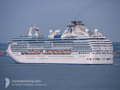
CORAL PRINCESS
Passengers Ship

Current Trip
| Time Travelled | 1 day |
|---|---|
| Remaining Time | 1 day |
| Distance Travelled | 647.42 nm |
| Remaining Distance | 505.62 nm |
| AVG Speed | 17.8 Knop |
| MAX Speed | 20.1 Knop |
| AVG Wind | 10.8 knots |
| MAX Wind | 22 knots |
| MIN Temp | 13.6°C / 56.48°F |
| MAX Temp | 17.1°C / 62.78°F |
| Djupgående | 8.4 m |
| Position mottagen | 1 d sen |
Current Position
| Longitud | --- |
|---|---|
| Latitude | --- |
| Status | Under way using engine |
| Fart | 19.4 Knop |
| Kurs | 159.6° |
| Område | North Pacific Ocean |
| Station | T-AIS |
| Position mottagen | 1 d sen |
Information
The current position of CORAL PRINCESS is in North Pacific Ocean with coordinates 31.65230° / -117.37177° as reported on 2025-03-26 07:03 by AIS to our vessel tracker app. The vessel's current speed is 19.4 Knop and is heading at the port of PUERTO VALLARTA. The estimated time of arrival as calculated by MyShipTracking vessel tracking app is 2025-03-28 06:39 LT
The vessel CORAL PRINCESS (IMO: 9229659, MMSI: 310376000) is a Passengers Ship that was built in 2002 ( 23 År gammal ). It's sailing under the flag of [BM] Bermuda.
In this page you can find informations about the vessels current position, last detected port calls, and current voyage information. If the vessels is not in coverage by AIS you will find the latest position.
The current position of CORAL PRINCESS is detected by our AIS receivers and we are not responsible for the reliability of the data. The last position was recorded while the vessel was in Coverage by the Ais receivers of our vessel tracking app.
The current draught of CORAL PRINCESS as reported by AIS is 8.4 meters
Weather
| Temperature | 16.3°C / 61.34°F |
|---|---|
| Wind Speed | 19 knots |
| Direction | 329° NNW |
| Pressure | 1014.8 hPa |
| Humidity | 86.5 % |
| Cloud Coverage | 7 % |


Featured Company
Last Port Calls
| Port | Arrival | Departure | Time In Port |
|---|---|---|---|
| 2025-03-25 05:42 | 2025-03-25 16:17 | 10 h | |
| 2025-03-22 07:24 | 2025-03-22 17:02 | 9 h | |
| 2025-03-20 07:11 | 2025-03-20 17:01 | 9 h | |
| 2025-03-19 07:22 | 2025-03-19 16:36 | 9 h | |
| 2025-03-17 05:01 | 2025-03-17 19:11 | 14 h | |
| 2025-03-09 06:15 | 2025-03-09 16:11 | 9 h | |
| 2025-03-01 08:02 | 2025-03-01 19:24 | 11 h | |
| 2025-02-27 06:53 | 2025-02-27 22:26 | 15 h | |
| 2025-02-26 07:39 | 2025-02-26 17:07 | 9 h | |
| 2025-02-24 07:26 | 2025-02-24 17:19 | 9 h |
Most Visited Ports (Last year)
| Port | Arrivals | |
|---|---|---|
| 8 | ||
| 7 | ||
| 6 | ||
| 6 | ||
| 4 | ||
| 4 |
Last Trips
| Origin | Departure | Destination | Arrival | Distance | |
|---|---|---|---|---|---|
| 2025-03-22 17:02 | 2025-03-25 05:42 | 1114.29 nm | |||
| 2025-03-20 17:01 | 2025-03-22 07:24 | 696.99 nm | |||
| 2025-03-19 16:36 | 2025-03-20 07:11 | 237.25 nm | |||
| 2025-03-17 19:11 | 2025-03-19 07:22 | 589.63 nm | |||
| 2025-03-09 16:11 | 2025-03-17 05:01 | 2288.71 nm | |||
| 2025-03-01 19:24 | 2025-03-09 06:15 | 2294.46 nm | |||
| 2025-02-27 22:26 | 2025-03-01 08:02 | 594.23 nm | |||
| 2025-02-26 17:07 | 2025-02-27 06:53 | 230.72 nm | |||
| 2025-02-24 17:19 | 2025-02-26 07:39 | 697.56 nm | |||
| 2025-02-21 17:32 | 2025-02-24 07:26 | 1113.91 nm |
Events
| Tid | Event | Detaljer | Position / Dest | Information |
|---|---|---|---|---|
| 2025-03-26 07:06 | Status ändrad | Default Under way using engine |
31.63573 / -117.36466
MX PVR
|
Fart: 19.4 kn Kurs: 159.6° |
| 2025-03-26 07:03 | UTANFÖR täckningsområde |
31.65230 / -117.37177
North Pacific Ocean
MX PVR
|
Fart: 19.4 kn Kurs: 159.6° |
|
| 2025-03-26 06:20 | Status ändrad | Under way using engine Default |
31.87056 / -117.46456
MX PVR
|
Fart: 19.2 kn Kurs: 161° |
| 2025-03-26 06:06 | Status ändrad | Default Under way using engine |
31.94137 / -117.49487
MX PVR
|
Fart: 19 kn Kurs: 161° |
| 2025-03-26 03:49 | Byter havsområde | Mexican part of the North Pacific Ocean United States part of the North Pacific Ocean |
32.61639 / -117.77893
North Pacific Ocean
MX PVR
|
Fart: 18.7 kn Kurs: 172.5° |
| 2025-03-25 23:17 | AVGÅTT HAMN |
|
33.70443 / -118.24728
MX PVR
|
Fart: 7.5 kn Kurs: 180° |
| 2025-03-25 22:51 | STARTAR förflyttning |
33.74603 / -118.27398
[US] LOS ANGELES
|
Fart: 3.2 kn Kurs: 206° |
|
| 2025-03-25 22:43 | Status ändrad | Under way using engine Moored |
33.74797 / -118.27622
[US] LOS ANGELES
|
Fart: 0.8 kn Kurs: 299° |
| 2025-03-25 22:16 | Status ändrad | Moored Default |
33.74839 / -118.27751
[US] LOS ANGELES
|
Fart: Kurs: 301° |
| 2025-03-25 22:13 | Status ändrad | Default Moored |
33.74839 / -118.27750
[US] LOS ANGELES
|
Fart: Kurs: 301° |