

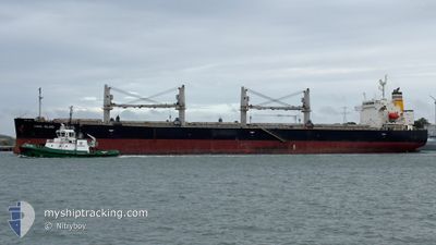
CORAL ISLAND
Bulk Carrier

Current Trip
| Time Travelled | 3 days |
|---|---|
| Remaining Time | --- |
| Distance Travelled | 958.81 nm |
| Remaining Distance | --- |
| AVG Speed | 10.3 Knop |
| MAX Speed | 11.9 Knop |
| AVG Wind | 15.2 knots |
| MAX Wind | 27.5 knots |
| MIN Temp | 9.8°C / 49.64°F |
| MAX Temp | 20.5°C / 68.9°F |
| Djupgående | 11.9 m |
| Position mottagen | 13 h, 30 m sen |
Current Position
| Longitud | --- |
|---|---|
| Latitude | --- |
| Status | Under way using engine |
| Fart | 10.4 Knop |
| Kurs | 295° |
| Område | Mediterranean Sea - Eastern Basin |
| Station | T-AIS |
| Position mottagen | 13 h, 30 m sen |
Information
The current position of CORAL ISLAND is in Mediterranean Sea - Eastern Basin with coordinates 36.56125° / 14.05787° as reported on 2025-03-27 10:33 by AIS to our vessel tracker app. The vessel's current speed is 10.4 Knop and is heading at the port of ABIDJAN. The estimated time of arrival as calculated by MyShipTracking vessel tracking app is 2025-04-08 09:00 LT
The vessel CORAL ISLAND (IMO: 9304112, MMSI: 249397000) is a Bulk Carrier that was built in 2006 ( 19 År gammal ). It's sailing under the flag of [MT] Malta.
In this page you can find informations about the vessels current position, last detected port calls, and current voyage information. If the vessels is not in coverage by AIS you will find the latest position.
The current position of CORAL ISLAND is detected by our AIS receivers and we are not responsible for the reliability of the data. The last position was recorded while the vessel was in Coverage by the Ais receivers of our vessel tracking app.
The current draught of CORAL ISLAND as reported by AIS is 11.9 meters
Weather
| Temperature | 14.7°C / 58.46°F |
|---|---|
| Wind Speed | 23 knots |
| Direction | 296° WNW |
| Pressure | 1009.8 hPa |
| Humidity | 77.8 % |
| Cloud Coverage | 8 % |


Featured Company
Events
| Tid | Event | Detaljer | Position / Dest | Information |
|---|---|---|---|---|
| 2025-03-27 10:41 | Status ändrad | Default Under way using engine |
36.57050 / 14.03207
CIABJ
|
Fart: 10.4 kn Kurs: 295° |
| 2025-03-27 10:33 | Status ändrad | Under way using engine Default |
36.56125 / 14.05787
CIABJ
|
Fart: 10.3 kn Kurs: 292° |
| 2025-03-27 10:33 | UTANFÖR täckningsområde |
36.56125 / 14.05787
Mediterranean Sea - Eastern Basin
CIABJ
|
Fart: 10.4 kn Kurs: 295° |
|
| 2025-03-27 10:23 | I täckningsområde |
36.56125 / 14.05787
Mediterranean Sea - Eastern Basin
CIABJ
|
Fart: 10.4 kn Kurs: 295° |
|
| 2025-03-27 09:34 | Status ändrad | Default Under way using engine |
36.49330 / 14.25493
CIABJ
|
Fart: 10.5 kn Kurs: 295° |
| 2025-03-27 09:29 | UTANFÖR täckningsområde |
36.48802 / 14.26848
Mediterranean Sea - Eastern Basin
CIABJ
|
Fart: 10.5 kn Kurs: 295° |
|
| 2025-03-27 08:04 | Status ändrad | Under way using engine Default |
36.39548 / 14.55662
CIABJ
|
Fart: 10.5 kn Kurs: 277° |
| 2025-03-27 08:02 | Status ändrad | Default Under way using engine |
36.39457 / 14.56552
CIABJ
|
Fart: 10.5 kn Kurs: 277° |
| 2025-03-27 08:01 | Status ändrad | Under way using engine Default |
36.39425 / 14.56860
CIABJ
|
Fart: 10.5 kn Kurs: 276° |
| 2025-03-27 07:53 | Status ändrad | Default Under way using engine |
36.39140 / 14.59742
CIABJ
|
Fart: 10.4 kn Kurs: 276° |