
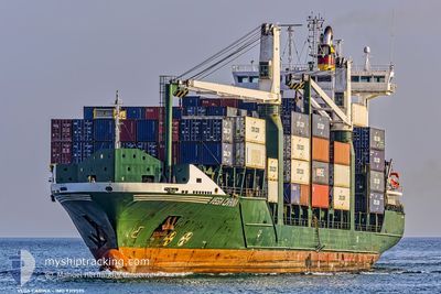
CONTSHIP PEP
Container Ship
Current Trip
| Time Travelled | 2 days |
|---|---|
| Remaining Time | 21 h, 45 mins |
| Distance Travelled | 818.18 nm |
| Remaining Distance | 242.97 nm |
| AVG Speed | 12.2 Knop |
| MAX Speed | 14 Knop |
| AVG Wind | 10.8 knots |
| MAX Wind | 20 knots |
| MIN Temp | 20.3°C / 68.54°F |
| MAX Temp | 28.4°C / 83.12°F |
| Djupgående | 8.5 m |
| Position mottagen | 52 m sen |
Current Position
| Longitud | -74.07959° |
|---|---|
| Latitude | 20.51619° |
| Status | Under way using engine |
| Fart | 11.1 Knop |
| Kurs | 157.2° |
| Område | North Atlantic Ocean |
| Station | T-AIS |
| Position mottagen | 52 m sen |
Info
Information
The current position of CONTSHIP PEP is in North Atlantic Ocean with coordinates 20.51619° / -74.07959° as reported on 2024-05-18 00:26 by AIS to our vessel tracker app. The vessel's current speed is 11.1 Knop and is heading at the port of KINGSTON (JM). The estimated time of arrival as calculated by MyShipTracking vessel tracking app is 2024-05-18 23:03 LT
The vessel CONTSHIP PEP (IMO: 9319595, MMSI: 210367000) is a Container Ship that was built in 2006 ( 18 År gammal ). It's sailing under the flag of [CY] Cyprus.
In this page you can find informations about the vessels current position, last detected port calls, and current voyage information. If the vessels is not in coverage by AIS you will find the latest position.
The current position of CONTSHIP PEP is detected by our AIS receivers and we are not responsible for the reliability of the data. The last position was recorded while the vessel was in Coverage by the Ais receivers of our vessel tracking app.
The current draught of CONTSHIP PEP as reported by AIS is 8.5 meters
Weather
| Temperature | 28°C / 82.4°F |
|---|---|
| Wind Speed | 7 knots |
| Direction | 71° ENE |
| Pressure | 1014.3 hPa |
| Humidity | 76.6 % |
| Cloud Coverage | 79 % |
Featured Company
Last Port Calls
| Port | Arrival | Departure | Time In Port |
|---|---|---|---|
| 2024-05-13 20:59 | 2024-05-15 08:06 | 1 d | |
| 2024-05-09 17:25 | 2024-05-10 21:32 | 1 d | |
| 2024-05-07 12:22 | 2024-05-08 13:44 | 1 d | |
| 2024-05-04 10:42 | 2024-05-04 21:11 | 10 h | |
| 2024-05-03 10:13 | 2024-05-03 20:47 | 10 h | |
| 2024-05-01 13:33 | 2024-05-02 01:28 | 11 h | |
| 2024-04-27 23:26 | 2024-04-28 21:03 | 21 h | |
| 2024-04-25 22:58 | 2024-04-25 23:10 | 11 m | |
| 2024-04-20 15:09 | 2024-04-21 10:22 | 19 h | |
| 2024-04-15 18:41 | 2024-04-16 18:21 | 23 h |
Most Visited Ports (Last year)
| Port | Arrivals | |
|---|---|---|
| 26 | ||
| 10 | ||
| 8 | ||
| 8 | ||
| 5 | ||
| 4 |
Last Trips
| Origin | Departure | Destination | Arrival | Distance | |
|---|---|---|---|---|---|
| 2024-05-10 17:32 | 2024-05-13 16:59 | 959.71 nm | |||
| 2024-05-08 08:44 | 2024-05-09 13:25 | 287.20 nm | |||
| 2024-05-04 17:11 | 2024-05-07 07:22 | 949.49 nm | |||
| 2024-05-03 16:47 | 2024-05-04 06:42 | 122.96 nm | |||
| 2024-05-01 21:28 | 2024-05-03 06:13 | 380.54 nm | |||
| 2024-04-28 16:03 | 2024-05-01 09:33 | 811.60 nm | |||
| 2024-04-25 18:10 | 2024-04-27 18:26 | 30.13 nm | |||
| 2024-04-21 06:22 | 2024-04-25 17:58 | 1068.38 nm | |||
| 2024-04-16 13:21 | 2024-04-20 11:09 | 1065.55 nm | |||
| 2024-04-11 06:24 | 2024-04-15 13:41 | 1080.81 nm |
Events
| Tid | Event | Detaljer | Position / Dest | Information |
|---|---|---|---|---|
| 2024-05-18 00:29 | Status ändrad | Default Under way using engine |
20.50500 / -74.07500
JMKIN
|
Fart: 11.1 kn Kurs: 157.2° |
| 2024-05-18 00:25 | Status ändrad | Under way using engine Default |
20.51666 / -74.07980
JMKIN
|
Fart: 11 kn Kurs: 159° |
| 2024-05-18 00:25 | I täckningsområde |
20.51619 / -74.07959
North Atlantic Ocean
JMKIN
|
Fart: 11.1 kn Kurs: 157.2° |
|
| 2024-05-17 23:29 | Status ändrad | Default Under way using engine |
20.67833 / -74.14500
JMKIN
|
Fart: 10.9 kn Kurs: 161.3° |
| 2024-05-17 23:24 | UTANFÖR täckningsområde |
20.69546 / -74.15152
North Atlantic Ocean
JMKIN
|
Fart: 10.9 kn Kurs: 161.3° |
|
| 2024-05-17 23:10 | Upptäckt i hav | Cuban part of the North Atlantic Ocean |
20.73386 / -74.16579
North Atlantic Ocean
JMKIN
|
Fart: 10.9 kn Kurs: 162.2° |
| 2024-05-17 23:10 | Status ändrad | Under way using engine Default |
20.73492 / -74.16614
JMKIN
|
Fart: 10 kn Kurs: 162° |
| 2024-05-17 23:02 | I täckningsområde |
20.73386 / -74.16579
North Atlantic Ocean
JMKIN
|
Fart: 10.9 kn Kurs: 162.2° |
|
| 2024-05-17 22:05 | Status ändrad | Default Under way using engine |
20.91837 / -74.22891
JMKIN
|
Fart: 10.3 kn Kurs: 164° |
| 2024-05-17 22:03 | UTANFÖR täckningsområde |
20.92531 / -74.23121
North Atlantic Ocean
JMKIN
|
Fart: 10.3 kn Kurs: 164° |