
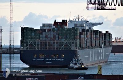
CMA CGM VON HUMBOLDT
Container Ship
Current Trip
| Trip Time | 1 day |
|---|---|
| Trip Distance | 523.83 nm |
| AVG Speed | 16.2 Knop |
| MAX Speed | 19.5 Knop |
| Djupgående | 11.7 m |
| AVG Wind | 15.7 knots |
| MAX Wind | 20 knots |
| MIN Temp | 9.4°C / 48.92°F |
| MAX Temp | 15.3°C / 59.54°F |
| Position mottagen | 1 d sen |
Current Position
| Longitud | --- |
|---|---|
| Latitude | --- |
| Status | Under way using engine |
| Fart | 11.2 Knop |
| Kurs | 301.3° |
| Område | Japan Sea |
| Station | T-AIS |
| Position mottagen | 1 d sen |
Info
Information
The current position of CMA CGM VON HUMBOLDT is in Japan Sea with coordinates 34.79710° / 128.97190° as reported on 2024-11-22 18:34 by AIS to our vessel tracker app. The vessel's current speed is 11.2 Knop and is currently inside the port of BUSAN NEW PORT.
The vessel CMA CGM VON HUMBOLDT (IMO: 9454448, MMSI: 215219000) is a Container Ship that was built in 2013 ( 11 År gammal ). It's sailing under the flag of [MT] Malta.
In this page you can find informations about the vessels current position, last detected port calls, and current voyage information. If the vessels is not in coverage by AIS you will find the latest position.
The current position of CMA CGM VON HUMBOLDT is detected by our AIS receivers and we are not responsible for the reliability of the data. The last position was recorded while the vessel was in Coverage by the Ais receivers of our vessel tracking app.
The current draught of CMA CGM VON HUMBOLDT as reported by AIS is 11.7 meters
Weather
| Temperature | 13.6°C / 56.48°F |
|---|---|
| Wind Speed | 2 knots |
| Direction | 7° N |
| Pressure | 1027.6 hPa |
| Humidity | 47.3 % |
| Cloud Coverage | 48 % |
Featured Company
Last Port Calls
| Port | Arrival | Departure | Time In Port |
|---|---|---|---|
| 2024-11-22 21:00 | |||
| 2024-11-20 23:40 | 2024-11-21 13:32 | 13 h | |
| 2024-11-18 06:32 | 2024-11-19 19:04 | 1 d | |
| 2024-11-13 07:17 | 2024-11-13 15:02 | 7 h | |
| 2024-11-11 17:18 | 2024-11-13 05:12 | 1 d | |
| 2024-11-04 21:20 | 2024-11-07 12:16 | 2 d | |
| 2024-10-07 15:43 | 2024-10-08 22:43 | 1 d | |
| 2024-10-01 23:08 | 2024-10-04 01:23 | 2 d | |
| 2024-09-23 06:46 | 2024-09-24 12:33 | 1 d | |
| 2024-09-17 15:33 | 2024-09-20 17:10 | 3 d |
Most Visited Ports (Last year)
| Port | Arrivals | |
|---|---|---|
| 4 | ||
| 4 | ||
| 3 | ||
| 3 | ||
| 3 | ||
| 3 |
Last Trips
| Origin | Departure | Destination | Arrival | Distance | |
|---|---|---|---|---|---|
| 2024-11-21 21:32 | 2024-11-23 06:00 | 523.83 nm | |||
| 2024-11-20 03:04 | 2024-11-21 07:40 | 475.01 nm | |||
| 2024-11-13 23:02 | 2024-11-18 14:32 | 939.20 nm | |||
| 2024-11-13 13:12 | 2024-11-13 15:17 | 21.67 nm | |||
| 2024-11-07 20:16 | 2024-11-12 01:18 | 1687.89 nm | |||
| 2024-10-09 00:43 | 2024-11-05 05:20 | 10840.96 nm | |||
| 2024-10-04 03:23 | 2024-10-07 17:43 | 1447.72 nm | |||
| 2024-09-24 14:33 | 2024-10-02 01:08 | 1409.34 nm | |||
| 2024-09-20 19:10 | 2024-09-23 08:46 | 996.23 nm | |||
| 2024-09-15 06:50 | 2024-09-17 17:33 | 590.82 nm |
Events
| Tid | Event | Detaljer | Position / Dest | Information |
|---|---|---|---|---|
| 2024-11-22 21:00 | STOPPAR förflyttning |
35.06811 / 128.80824
[KR] BUSAN NEW PORT
|
Fart: 0.2 kn Kurs: 81° |
|
| 2024-11-22 21:00 | ANLÄNDER HAMN |
|
35.06811 / 128.80824
[KR] BUSAN NEW PORT
|
Fart: 1.6 kn Kurs: 87° |
| 2024-11-22 18:40 | Status ändrad | Default Under way using engine |
34.81112 / 128.95605
CNNGB
|
Fart: 11.2 kn Kurs: 301.3° |
| 2024-11-22 18:34 | UTANFÖR täckningsområde |
34.79710 / 128.97190
Japan Sea
|
Fart: 11.2 kn Kurs: 301.3° |
|
| 2024-11-22 18:30 | Status ändrad | Under way using engine Default |
34.79010 / 128.98650
CNNGB
|
Fart: 9.6 kn Kurs: 300° |
| 2024-11-22 18:12 | Status ändrad | Default Under way using engine |
34.75260 / 129.01495
CNNGB
|
Fart: 12.3 kn Kurs: 344.1° |
| 2024-11-22 18:03 | Byter havsområde | South Korean part of the Japan Sea Chinese part of the South China Sea |
34.72580 / 129.02375
Japan Sea
|
Fart: 12.6 kn Kurs: 343.4° |
| 2024-11-22 18:02 | Status ändrad | Under way using engine Default |
34.72237 / 129.02493
CNNGB
|
Fart: 13.8 kn Kurs: 344° |
| 2024-11-22 17:48 | I täckningsområde |
34.72580 / 129.02375
Japan Sea
|
Fart: 12.6 kn Kurs: 343.4° |
|
| 2024-11-21 13:32 | AVGÅTT HAMN |
|
36.01407 / 120.35731
CNNGB
|
Fart: 10.1 kn Kurs: 103° |