
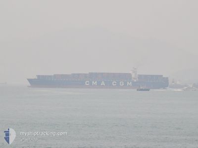
CMA CGM NORMA
Container Ship
Current Trip
PAPCN
| Time Travelled | 5 days |
|---|---|
| Remaining Time | --- |
| Distance Travelled | 2756.11 nm |
| Remaining Distance | --- |
| AVG Speed | 19.4 Knop |
| MAX Speed | 22 Knop |
| AVG Wind | 8.9 knots |
| MAX Wind | 15.4 knots |
| MIN Temp | 10.7°C / 51.26°F |
| MAX Temp | 23.7°C / 74.66°F |
| Djupgående | 13.3 m |
| Position mottagen | 5 d sen |
Current Position
| Longitud | 141.96937° |
|---|---|
| Latitude | 35.75180° |
| Status | Under way using engine |
| Fart | 20.8 Knop |
| Kurs | 60.3° |
| Område | North Pacific Ocean |
| Station | T-AIS |
| Position mottagen | 5 d sen |
Info
Information
The current position of CMA CGM NORMA is in North Pacific Ocean with coordinates 35.75180° / 141.96937° as reported on 2024-06-11 15:15 by AIS to our vessel tracker app. The vessel's current speed is 20.8 Knop
The vessel CMA CGM NORMA (IMO: 9299812, MMSI: 215879000) is a Container Ship that was built in 2006 ( 18 År gammal ). It's sailing under the flag of [MT] Malta.
In this page you can find informations about the vessels current position, last detected port calls, and current voyage information. If the vessels is not in coverage by AIS you will find the latest position.
The current position of CMA CGM NORMA is detected by our AIS receivers and we are not responsible for the reliability of the data. The last position was recorded while the vessel was in Coverage by the Ais receivers of our vessel tracking app.
The current draught of CMA CGM NORMA as reported by AIS is 13.3 meters
Weather
| Temperature | 13.2°C / 55.76°F |
|---|---|
| Wind Speed | 15 knots |
| Direction | 159° SSE |
| Pressure | 1007.9 hPa |
| Humidity | 99 % |
| Cloud Coverage | 100 % |
Featured Company
Last Port Calls
| Port | Arrival | Departure | Time In Port |
|---|---|---|---|
| 2024-06-10 11:31 | 2024-06-11 06:39 | 19 h | |
| 2024-06-07 03:37 | 2024-06-08 08:37 | 1 d | |
| 2024-06-04 09:39 | 2024-06-05 10:07 | 1 d | |
| 2024-05-26 14:04 | 2024-05-27 17:41 | 1 d | |
| 2024-05-19 22:00 | 2024-05-20 19:00 | 20 h | |
| 2024-04-15 13:04 | 2024-04-17 01:21 | 1 d | |
| 2024-04-11 16:44 | 2024-04-13 04:37 | 1 d | |
| 2024-04-09 20:03 | 2024-04-10 12:01 | 15 h | |
| 2024-04-06 21:33 | 2024-04-08 00:49 | 1 d | |
| 2024-04-04 01:32 | 2024-04-05 06:46 | 1 d |
Most Visited Ports (Last year)
| Port | Arrivals | |
|---|---|---|
| 4 | ||
| 4 | ||
| 4 | ||
| 3 | ||
| 3 | ||
| 3 |
Last Trips
| Origin | Departure | Destination | Arrival | Distance | |
|---|---|---|---|---|---|
| 2024-06-08 17:37 | 2024-06-10 20:31 | 891.27 nm | |||
| 2024-06-05 18:07 | 2024-06-07 12:37 | 496.19 nm | |||
| 2024-05-28 01:41 | 2024-06-04 17:39 | 932.17 nm | |||
| 2024-05-21 03:00 | 2024-05-26 22:04 | 2053.43 nm | |||
| 2024-04-16 20:21 | 2024-05-20 06:00 | 11874.99 nm | |||
| 2024-04-13 00:37 | 2024-04-15 08:04 | 760.03 nm | |||
| 2024-04-10 08:01 | 2024-04-11 12:44 | 441.43 nm | |||
| 2024-04-07 20:49 | 2024-04-09 16:03 | 165.48 nm | |||
| 2024-04-05 02:46 | 2024-04-06 17:33 | 545.37 nm | |||
| 2024-03-10 05:33 | 2024-04-03 21:32 | 9651.18 nm |
Events
| Tid | Event | Detaljer | Position / Dest | Information |
|---|---|---|---|---|
| 2024-06-11 15:21 | Status ändrad | Default Under way using engine |
35.76607 / 142.00938
PAPCN
|
Fart: 20.8 kn Kurs: 60.3° |
| 2024-06-11 15:15 | UTANFÖR täckningsområde |
35.75180 / 141.96937
North Pacific Ocean
PAPCN
|
Fart: 20.8 kn Kurs: 60.3° |
|
| 2024-06-11 15:12 | Status ändrad | Under way using engine Default |
35.74355 / 141.95298
PAPCN
|
Fart: 20.8 kn Kurs: 58° |
| 2024-06-11 14:57 | I täckningsområde |
35.74883 / 141.96328
North Pacific Ocean
PAPCN
|
Fart: 20.8 kn Kurs: 58.2° |
|
| 2024-06-11 14:13 | Status ändrad | Default Under way using engine |
35.56731 / 141.60295
PAPCN
|
Fart: 21 kn Kurs: 58.7° |
| 2024-06-11 14:02 | UTANFÖR täckningsområde |
35.53490 / 141.53617
North Pacific Ocean
PAPCN
|
Fart: 21 kn Kurs: 58.7° |
|
| 2024-06-11 13:55 | Status ändrad | Under way using engine Default |
35.51415 / 141.49348
PAPCN
|
Fart: 21.2 kn Kurs: 58° |
| 2024-06-11 13:49 | Status ändrad | Default Under way using engine |
35.49615 / 141.45706
PAPCN
|
Fart: 21.5 kn Kurs: 58.3° |
| 2024-06-11 09:05 | Status ändrad | Under way using engine Default |
34.86100 / 139.77162
PAPCN
|
Fart: 20.8 kn Kurs: 140° |
| 2024-06-11 08:57 | Status ändrad | Default Under way using engine |
34.89455 / 139.73700
PAPCN
|
Fart: 20.7 kn Kurs: 139.9° |