
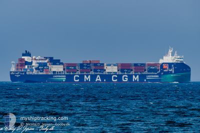
CMA CGM ERMITAGE
Cargo A
Current Trip
DEHAM>EETLL VIA KIEL
| Time Travelled | 1 day |
|---|---|
| Remaining Time | --- |
| Distance Travelled | 599.74 nm |
| Remaining Distance | --- |
| AVG Speed | 15.1 Knop |
| MAX Speed | 16.8 Knop |
| AVG Wind | 7.9 knots |
| MAX Wind | 11 knots |
| MIN Temp | 15.1°C / 59.18°F |
| MAX Temp | 18.8°C / 65.84°F |
| Djupgående | 7.4 m |
| Position mottagen | Nu |
Current Position
| Longitud | 24.32791° |
|---|---|
| Latitude | 59.70663° |
| Status | Under way using engine |
| Fart | 16.4 Knop |
| Kurs | 77.3° |
| Område | Gulf of Finland |
| Station | T-AIS |
| Position mottagen | Nu |
Info
Information
The current position of CMA CGM ERMITAGE is in Gulf of Finland with coordinates 59.70663° / 24.32791° as reported on 2024-06-27 15:06 by AIS to our vessel tracker app. The vessel's current speed is 16.4 Knop
The vessel CMA CGM ERMITAGE (IMO: 9961295, MMSI: 256800000) is a Cargo A It's sailing under the flag of [MT] Malta.
In this page you can find informations about the vessels current position, last detected port calls, and current voyage information. If the vessels is not in coverage by AIS you will find the latest position.
The current position of CMA CGM ERMITAGE is detected by our AIS receivers and we are not responsible for the reliability of the data. The last position was recorded while the vessel was in Coverage by the Ais receivers of our vessel tracking app.
The current draught of CMA CGM ERMITAGE as reported by AIS is 7.4 meters
Weather
| Temperature | 17.2°C / 62.96°F |
|---|---|
| Wind Speed | 8 knots |
| Direction | 265° W |
| Pressure | 1016.5 hPa |
| Humidity | 79.9 % |
| Cloud Coverage | --- |
Featured Company
Last Port Calls
| Port | Arrival | Departure | Time In Port |
|---|---|---|---|
| 2024-06-26 00:57 | 2024-06-26 01:02 | 4 m | |
| 2024-06-23 08:39 | 2024-06-25 08:26 | 1 d | |
| 2024-06-22 09:05 | 2024-06-22 22:32 | 13 h | |
| 2024-06-18 06:59 | 2024-06-18 21:29 | 14 h | |
| 2024-06-15 15:27 | 2024-06-17 02:09 | 1 d | |
| 2024-06-06 08:01 | 2024-06-10 04:32 | 3 d | |
| 2024-06-05 08:10 | 2024-06-05 22:06 | 13 h | |
| 2024-05-31 17:30 | 2024-06-01 08:08 | 14 h | |
| 2024-05-30 03:25 | 2024-05-30 15:17 | 11 h | |
| 2024-05-28 11:26 | 2024-05-29 23:27 | 1 d |
Last Trips
| Origin | Departure | Destination | Arrival | Distance | |
|---|---|---|---|---|---|
| 2024-06-25 10:26 | 2024-06-26 02:57 | 91.45 nm | |||
| 2024-06-23 00:32 | 2024-06-23 10:39 | 116.31 nm | |||
| 2024-06-18 23:29 | 2024-06-22 11:05 | 898.36 nm | |||
| 2024-06-17 05:09 | 2024-06-18 08:59 | 446.22 nm | |||
| 2024-06-10 06:32 | 2024-06-15 18:27 | 870.92 nm | |||
| 2024-06-06 00:06 | 2024-06-06 10:01 | 116.55 nm | |||
| 2024-06-01 10:08 | 2024-06-05 10:10 | 898.43 nm | |||
| 2024-05-30 18:17 | 2024-05-31 19:30 | 429.78 nm | |||
| 2024-05-30 02:27 | 2024-05-30 06:25 | 47.59 nm | |||
| 2024-05-23 11:26 | 2024-05-28 14:26 | 864.97 nm |
Events
| Tid | Event | Detaljer | Position / Dest | Information |
|---|---|---|---|---|
| 2024-06-27 14:52 | Byter havsområde | Estonian part of the Gulf of Finland Finnish part of the Gulf of Finland |
59.68949 / 24.20738
Gulf of Finland
DEHAM>EETLL VIA KIEL
|
Fart: 16.3 kn Kurs: 73.1° |
| 2024-06-27 12:53 | Byter havsområde | Finnish part of the Gulf of Finland Estonian part of the Gulf of Finland |
59.53044 / 23.19240
Gulf of Finland
DEHAM>EETLL VIA KIEL
|
Fart: 16.3 kn Kurs: 73° |
| 2024-06-27 12:49 | Byter havsområde | Estonian part of the Gulf of Finland Estonian part of the Baltic Sea |
59.52600 / 23.16629
Gulf of Finland
DEHAM>EETLL VIA KIEL
|
Fart: 16.3 kn Kurs: 70.9° |
| 2024-06-27 12:46 | Byter havsområde | Estonian part of the Baltic Sea Finnish part of the Baltic Sea |
59.52147 / 23.14025
Baltic Sea
DEHAM>EETLL VIA KIEL
|
Fart: 16.3 kn Kurs: 71.2° |
| 2024-06-27 11:42 | Byter havsområde | Finnish part of the Baltic Sea Estonian part of the Baltic Sea |
59.41070 / 22.61641
Baltic Sea
DEHAM>EETLL VIA KIEL
|
Fart: 16.3 kn Kurs: 62.5° |
| 2024-06-27 08:08 | Byter havsområde | Estonian part of the Baltic Sea Swedish part of the Baltic Sea |
58.73422 / 21.31715
Baltic Sea
DEHAM>EETLL VIA KIEL
|
Fart: 16.3 kn Kurs: 34.8° |
| 2024-06-27 08:08 | I täckningsområde |
58.73422 / 21.31715
Baltic Sea
DEHAM>EETLL VIA KIEL
|
Fart: 16.3 kn Kurs: 34.8° |
|
| 2024-06-26 20:42 | UTANFÖR täckningsområde |
56.43235 / 17.64838
Baltic Sea
DEHAM>EETLL VIA KIEL
|
Fart: 15.9 kn Kurs: 52.4° |
|
| 2024-06-26 14:59 | Byter havsområde | Swedish part of the Baltic Sea Danish part of the Kattegat |
55.61976 / 15.39045
Baltic Sea
DEHAM>EETLL VIA KIEL
|
Fart: 16.7 kn Kurs: 63.6° |
| 2024-06-26 11:23 | Byter havsområde | Danish part of the Kattegat Swedish part of the Baltic Sea |
55.00923 / 14.07573
Kattegat
DEHAM>EETLL VIA KIEL
|
Fart: 16.1 kn Kurs: 72.3° |