
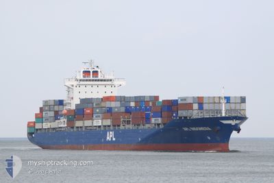
CMA CGM CAIMEP
Container Ship
Current Trip
| Time Travelled | 1 day |
|---|---|
| Remaining Time | --- |
| Distance Travelled | 174.51 nm |
| Remaining Distance | 340.44 nm |
| AVG Speed | 9.4 Knop |
| MAX Speed | 12.9 Knop |
| AVG Wind | 4.2 knots |
| MAX Wind | 6.9 knots |
| MIN Temp | 27.5°C / 81.5°F |
| MAX Temp | 30.8°C / 87.44°F |
| Djupgående | 8.9 m |
| Position mottagen | 2 d sen |
Current Position
| Longitud | 100.26232° |
|---|---|
| Latitude | 4.08224° |
| Status | Under way using engine |
| Fart | 10.9 Knop |
| Kurs | 168° |
| Område | Malacca Strait |
| Station | T-AIS |
| Position mottagen | 2 d sen |
Info
Information
The current position of CMA CGM CAIMEP is in Malacca Strait with coordinates 4.08224° / 100.26232° as reported on 2024-04-24 02:51 by AIS to our vessel tracker app. The vessel's current speed is 10.9 Knop and is heading at the port of PENANG. The estimated time of arrival as calculated by MyShipTracking vessel tracking app is 2024-04-21 17:00 LT
The vessel CMA CGM CAIMEP (IMO: 9431757, MMSI: 229075000) is a Container Ship that was built in 2010 ( 14 År gammal ). It's sailing under the flag of [MT] Malta.
In this page you can find informations about the vessels current position, last detected port calls, and current voyage information. If the vessels is not in coverage by AIS you will find the latest position.
The current position of CMA CGM CAIMEP is detected by our AIS receivers and we are not responsible for the reliability of the data. The last position was recorded while the vessel was in Coverage by the Ais receivers of our vessel tracking app.
The current draught of CMA CGM CAIMEP as reported by AIS is 8.9 meters
Weather
| Temperature | 29.8°C / 85.64°F |
|---|---|
| Wind Speed | 4 knots |
| Direction | 149° SSE |
| Pressure | 1004.2 hPa |
| Humidity | 69.6 % |
| Cloud Coverage | 27 % |
Featured Company
Last Port Calls
| Port | Arrival | Departure | Time In Port |
|---|---|---|---|
| 2024-04-24 14:28 | 2024-04-25 02:28 | 12 h | |
| 2024-04-22 12:56 | 2024-04-23 17:08 | 1 d | |
| 2024-04-20 08:20 | 2024-04-20 23:37 | 15 h | |
| 2024-04-15 16:23 | 2024-04-16 02:03 | 9 h | |
| 2024-04-13 22:34 | 2024-04-14 07:09 | 8 h | |
| 2024-04-11 05:53 | 2024-04-11 16:34 | 10 h | |
| 2024-04-10 02:53 | 2024-04-10 12:54 | 10 h | |
| 2024-04-08 08:33 | 2024-04-08 21:37 | 13 h | |
| 2024-04-06 09:02 | 2024-04-06 20:35 | 11 h | |
| 2024-03-31 22:23 | 2024-04-02 04:01 | 1 d |
Most Visited Ports (Last year)
| Port | Arrivals | |
|---|---|---|
| 18 | ||
| 12 | ||
| 11 | ||
| 10 | ||
| 8 | ||
| 7 |
Last Trips
| Origin | Departure | Destination | Arrival | Distance | |
|---|---|---|---|---|---|
| 2024-04-24 01:08 | 2024-04-24 22:28 | 228.16 nm | |||
| 2024-04-21 07:37 | 2024-04-22 20:56 | 219.93 nm | |||
| 2024-04-16 10:03 | 2024-04-20 16:20 | 1650.50 nm | |||
| 2024-04-14 15:09 | 2024-04-16 00:23 | 226.41 nm | |||
| 2024-04-12 00:34 | 2024-04-14 06:34 | 726.65 nm | |||
| 2024-04-10 20:54 | 2024-04-11 13:53 | 180.64 nm | |||
| 2024-04-09 05:37 | 2024-04-10 10:53 | 447.41 nm | |||
| 2024-04-07 05:35 | 2024-04-08 16:33 | 481.69 nm | |||
| 2024-04-02 12:01 | 2024-04-06 18:02 | 822.21 nm | |||
| 2024-03-27 21:24 | 2024-04-01 06:23 | 464.92 nm |
Events
| Tid | Event | Detaljer | Position / Dest | Information |
|---|---|---|---|---|
| 2024-04-25 15:25 | STARTAR förflyttning | 13.87 nm, South of PORT KLANG |
2.77163 / 101.29926
PENANG
|
Fart: 3.1 kn Kurs: 188° |
| 2024-04-25 03:36 | STOPPAR förflyttning | 13.82 nm, South of PORT KLANG |
2.77306 / 101.29671
PENANG
|
Fart: 0.1 kn Kurs: 127° |
| 2024-04-25 02:28 | AVGÅTT HAMN |
|
2.90696 / 101.26974
PENANG
|
Fart: 9.9 kn Kurs: 225° |
| 2024-04-25 02:20 | STARTAR förflyttning |
2.92140 / 101.28451
[MY] PORT KLANG
|
Fart: 5.7 kn Kurs: 225° |
|
| 2024-04-24 14:28 | STOPPAR förflyttning |
2.92424 / 101.28803
[MY] PORT KLANG
|
Fart: 0.3 kn Kurs: 209° |
|
| 2024-04-24 14:28 | ANLÄNDER HAMN |
|
2.92424 / 101.28803
[MY] PORT KLANG
|
Fart: 0.9 kn Kurs: 212° |
| 2024-04-24 13:20 | STARTAR förflyttning | 11.6 nm, South West of PORT KLANG |
2.82714 / 101.25629
PENANG
|
Fart: 3.7 kn Kurs: 356° |
| 2024-04-24 13:04 | STOPPAR förflyttning | 11.87 nm, South West of PORT KLANG |
2.82336 / 101.25378
PENANG
|
Fart: 0.2 kn Kurs: 19° |
| 2024-04-24 02:53 | Status ändrad | Default Under way using engine |
4.07469 / 100.26397
PENANG
|
Fart: 10.9 kn Kurs: 168° |
| 2024-04-24 02:51 | UTANFÖR täckningsområde |
4.08224 / 100.26232
Malacca Strait
|
Fart: 10.9 kn Kurs: 168° |