
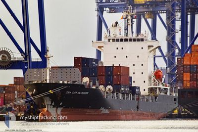
CMA CGM BLOSSOM
Cargo
Current Trip
| Time Travelled | 2 days |
|---|---|
| Remaining Time | --- |
| Distance Travelled | 713.04 nm |
| Remaining Distance | 19.06 nm |
| AVG Speed | 12.5 Knop |
| MAX Speed | 15.8 Knop |
| AVG Wind | 7.3 knots |
| MAX Wind | 18.8 knots |
| MIN Temp | 18.2°C / 64.76°F |
| MAX Temp | 25.4°C / 77.72°F |
| Djupgående | 7.4 m |
| Position mottagen | 1 m sen |
Current Position
| Longitud | 26.59584° |
|---|---|
| Latitude | 38.85929° |
| Status | Under way using engine |
| Fart | 0.2 Knop |
| Kurs | 22° |
| Område | Aegean Sea |
| Station | T-AIS |
| Position mottagen | 1 m sen |
Info
Information
The current position of CMA CGM BLOSSOM is in Aegean Sea with coordinates 38.85929° / 26.59584° as reported on 2024-05-20 13:15 by AIS to our vessel tracker app. The vessel's current speed is 0.2 Knop and is heading at the port of ALIAGA. The estimated time of arrival as calculated by MyShipTracking vessel tracking app is 2024-05-20 06:00 LT
The vessel CMA CGM BLOSSOM (IMO: 9962524, MMSI: 352001685) is a Cargo It's sailing under the flag of [PA] Panama.
In this page you can find informations about the vessels current position, last detected port calls, and current voyage information. If the vessels is not in coverage by AIS you will find the latest position.
The current position of CMA CGM BLOSSOM is detected by our AIS receivers and we are not responsible for the reliability of the data. The last position was recorded while the vessel was in Coverage by the Ais receivers of our vessel tracking app.
The current draught of CMA CGM BLOSSOM as reported by AIS is 7.4 meters
Weather
| Temperature | 22.7°C / 72.86°F |
|---|---|
| Wind Speed | 9 knots |
| Direction | 290° WNW |
| Pressure | 1011.2 hPa |
| Humidity | 65.5 % |
| Cloud Coverage | 100 % |
Featured Company
Last Port Calls
| Port | Arrival | Departure | Time In Port |
|---|---|---|---|
| 2024-05-16 12:43 | 2024-05-17 22:29 | 1 d | |
| 2024-05-13 15:52 | 2024-05-14 03:18 | 11 h | |
| 2024-05-09 08:27 | 2024-05-09 15:17 | 6 h | |
| 2024-05-08 06:22 | 2024-05-09 03:20 | 20 h | |
| 2024-05-06 14:36 | 2024-05-07 06:46 | 16 h | |
| 2024-05-03 06:22 | 2024-05-03 12:47 | 6 h | |
| 2024-05-02 16:12 | 2024-05-03 03:32 | 11 h | |
| 2024-04-29 16:52 | 2024-04-30 03:18 | 10 h | |
| 2024-04-23 01:10 | 2024-04-27 20:10 | 4 d | |
| 2024-04-20 06:18 | 2024-04-20 20:54 | 14 h |
Most Visited Ports (Last year)
| Port | Arrivals | |
|---|---|---|
| 11 | ||
| 8 | ||
| 7 | ||
| 7 | ||
| 5 | ||
| 5 |
Last Trips
| Origin | Departure | Destination | Arrival | Distance | |
|---|---|---|---|---|---|
| 2024-05-14 03:18 | 2024-05-16 12:43 | 769.41 nm | |||
| 2024-05-09 15:17 | 2024-05-13 15:52 | 773.67 nm | |||
| 2024-05-09 03:20 | 2024-05-09 08:27 | 47.57 nm | |||
| 2024-05-07 06:46 | 2024-05-08 06:22 | 261.21 nm | |||
| 2024-05-03 12:47 | 2024-05-06 14:36 | 241.96 nm | |||
| 2024-05-03 03:32 | 2024-05-03 06:22 | 0.46 nm | |||
| 2024-04-30 03:18 | 2024-05-02 16:12 | 677.73 nm | |||
| 2024-04-27 20:10 | 2024-04-29 16:52 | 677.03 nm | |||
| 2024-04-20 20:54 | 2024-04-23 01:10 | 793.41 nm | |||
| 2024-04-16 13:14 | 2024-04-18 12:50 | 525.74 nm |
Events
| Tid | Event | Detaljer | Position / Dest | Information |
|---|---|---|---|---|
| 2024-05-20 12:42 | STOPPAR förflyttning | 11.65 nm, South of PERAMA MYT |
38.85837 / 26.59213
ALIAGA
|
Fart: 0.3 kn Kurs: 4° |
| 2024-05-20 11:01 | STARTAR förflyttning | 5.85 nm, South of PERAMA MYT |
38.94373 / 26.50462
ALIAGA
|
Fart: 3.2 kn Kurs: 182° |
| 2024-05-20 08:18 | Status ändrad | Under way using engine Default |
38.93229 / 26.51061
ALIAGA
|
Fart: 0.9 kn Kurs: 157° |
| 2024-05-20 08:05 | Status ändrad | Default Under way using engine |
38.93115 / 26.51475
ALIAGA
|
Fart: 0.7 kn Kurs: 167° |
| 2024-05-20 00:40 | STOPPAR förflyttning | 8.39 nm, South of PERAMA MYT |
38.91021 / 26.57124
ALIAGA
|
Fart: 0.3 kn Kurs: 317° |
| 2024-05-19 07:30 | Status ändrad | Under way using engine Default |
36.55444 / 23.53157
ALIAGA
|
Fart: 13.8 kn Kurs: 32° |
| 2024-05-19 07:30 | I täckningsområde |
36.55444 / 23.53157
Aegean Sea
ALIAGA
|
Fart: 13.9 kn Kurs: 31° |
|
| 2024-05-19 06:26 | Status ändrad | Default Under way using engine |
36.34576 / 23.37178
ALIAGA
|
Fart: 13.8 kn Kurs: 31.8° |
| 2024-05-19 06:17 | UTANFÖR täckningsområde |
36.31636 / 23.34946
Aegean Sea
ALIAGA
|
Fart: 13.8 kn Kurs: 31.8° |
|
| 2024-05-19 06:16 | Status ändrad | Under way using engine Default |
36.31256 / 23.34655
ALIAGA
|
Fart: 13 kn Kurs: 32° |