

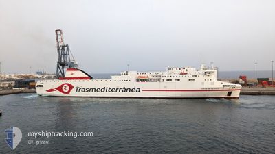
CIUDAD DE VALENCIA
Passenger

Current Trip
| Trip Time | 5 h, 1 mins |
|---|---|
| Trip Distance | 104.68 nm |
| AVG Speed | 21.2 Knop |
| MAX Speed | 22.3 Knop |
| Djupgående | 6 m |
| AVG Wind | 9.2 knots |
| MAX Wind | 11.4 knots |
| MIN Temp | 14.6°C / 58.28°F |
| MAX Temp | 18.4°C / 65.12°F |
| Position mottagen | 16 h, 52 m sen |
Current Position
| Longitud | --- |
|---|---|
| Latitude | --- |
| Status | Under way using engine |
| Fart | 20.1 Knop |
| Kurs | 299.9° |
| Område | North Atlantic Ocean |
| Station | T-AIS |
| Position mottagen | 16 h, 52 m sen |
Information
The current position of CIUDAD DE VALENCIA is in North Atlantic Ocean with coordinates 28.66043° / -16.14726° as reported on 2025-02-20 18:25 by AIS to our vessel tracker app. The vessel's current speed is 20.1 Knop and is currently inside the port of LA PALMA.
The vessel CIUDAD DE VALENCIA (IMO: 9869722, MMSI: 247432300) is a Passenger It's sailing under the flag of [IT] Italy.
In this page you can find informations about the vessels current position, last detected port calls, and current voyage information. If the vessels is not in coverage by AIS you will find the latest position.
The current position of CIUDAD DE VALENCIA is detected by our AIS receivers and we are not responsible for the reliability of the data. The last position was recorded while the vessel was in Coverage by the Ais receivers of our vessel tracking app.
The current draught of CIUDAD DE VALENCIA as reported by AIS is 6 meters
Weather
| Temperature | 14.6°C / 58.28°F |
|---|---|
| Wind Speed | 3 knots |
| Direction | 38° NE |
| Pressure | 1025.2 hPa |
| Humidity | 83.1 % |
| Cloud Coverage | 79 % |


Featured Company
Last Port Calls
| Port | Arrival | Departure | Time In Port |
|---|---|---|---|
| 2025-02-20 22:31 | |||
| 2025-02-20 10:52 | 2025-02-20 17:30 | 6 h | |
| 2025-02-20 03:55 | 2025-02-20 08:19 | 4 h | |
| 2025-02-19 20:12 | 2025-02-19 21:36 | 1 h | |
| 2025-02-17 07:25 | 2025-02-18 13:37 | 1 d | |
| 2025-02-15 21:27 | 2025-02-15 23:54 | 2 h | |
| 2025-02-15 17:40 | 2025-02-15 19:22 | 1 h | |
| 2025-02-15 08:49 | 2025-02-15 12:21 | 3 h | |
| 2025-02-14 21:35 | 2025-02-15 02:33 | 4 h | |
| 2025-02-13 21:37 | 2025-02-14 16:20 | 18 h |
Most Visited Ports (Last year)
| Port | Arrivals | |
|---|---|---|
| 105 | ||
| 105 | ||
| 105 | ||
| 61 | ||
| 54 | ||
| 52 |
Last Trips
| Origin | Departure | Destination | Arrival | Distance | |
|---|---|---|---|---|---|
| 2025-02-20 17:30 | 2025-02-20 22:31 | 104.68 nm | |||
| 2025-02-20 08:19 | 2025-02-20 10:52 | 52.36 nm | |||
| 2025-02-19 21:36 | 2025-02-20 03:55 | 101.26 nm | |||
| 2025-02-18 14:37 | 2025-02-19 20:12 | 632.16 nm | |||
| 2025-02-15 23:54 | 2025-02-17 08:25 | 593.44 nm | |||
| 2025-02-15 19:22 | 2025-02-15 21:27 | 32.83 nm | |||
| 2025-02-15 12:21 | 2025-02-15 17:40 | 101.51 nm | |||
| 2025-02-15 02:33 | 2025-02-15 08:49 | 53.27 nm | |||
| 2025-02-14 16:20 | 2025-02-14 21:35 | 102.78 nm | |||
| 2025-02-13 16:29 | 2025-02-13 21:37 | 104.77 nm |
Events
| Tid | Event | Detaljer | Position / Dest | Information |
|---|---|---|---|---|
| 2025-02-20 22:31 | ANLÄNDER HAMN |
|
28.66993 / -17.76357
[ES] LA PALMA
|
Fart: 22.3 kn Kurs: 271° |
| 2025-02-20 18:40 | Status ändrad | Default Under way using engine |
28.68732 / -16.23215
ESSPC
|
Fart: 20.1 kn Kurs: 299.9° |
| 2025-02-20 18:25 | Status ändrad | Under way using engine Default |
28.66043 / -16.14726
ESSPC
|
Fart: 20.6 kn Kurs: 300° |
| 2025-02-20 18:25 | UTANFÖR täckningsområde |
28.66043 / -16.14726
North Atlantic Ocean
ESSPC
|
Fart: 20.1 kn Kurs: 299.9° |
|
| 2025-02-20 18:22 | Status ändrad | Default Under way using engine |
28.65110 / -16.12872
ESSPC
|
Fart: 21.4 kn Kurs: 326.2° |
| 2025-02-20 17:30 | AVGÅTT HAMN |
|
28.47867 / -16.22842
ESSPC
|
Fart: 12.2 kn Kurs: 106° |
| 2025-02-20 17:24 | STARTAR förflyttning |
28.47608 / -16.24069
[ES] TENERIFE
|
Fart: 3.9 kn Kurs: 63° |
|
| 2025-02-20 17:21 | Djupgående ändrat | 6 6.4 |
28.47593 / -16.24289
[ES] TENERIFE
|
Fart: 1 kn Kurs: 44° |
| 2025-02-20 17:21 | ETA ändrat | 2025/02/20 22:30 2025/02/20 11:00 |
28.47593 / -16.24289
[ES] TENERIFE
|
Fart: 1 kn Kurs: 44° |
| 2025-02-20 17:19 | Status ändrad | Under way using engine Moored |
28.47614 / -16.24318
[ES] TENERIFE
|
Fart: Kurs: 38° |